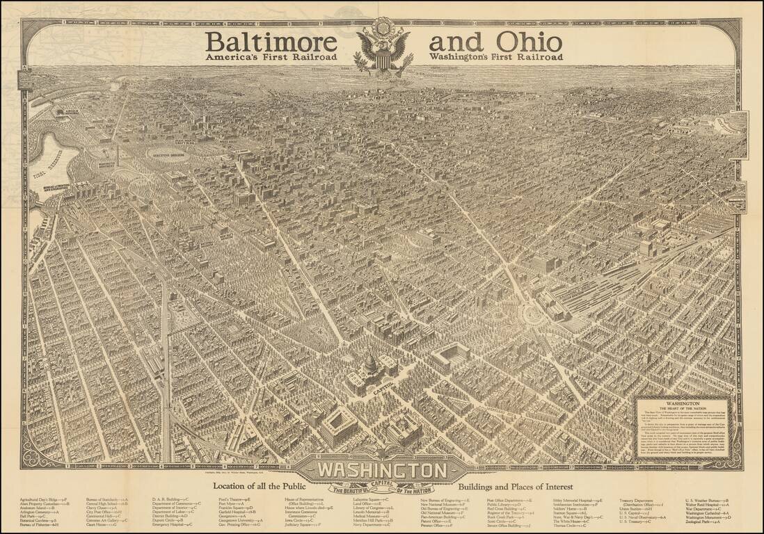
This is a great vintage tourist advertisement by the Baltimore and Ohio Railroad showing a birdseye view of Washington, D.C. The expansive view of Washington, supposedly the result of two years of ground surveys and sketches, shows many features of the...
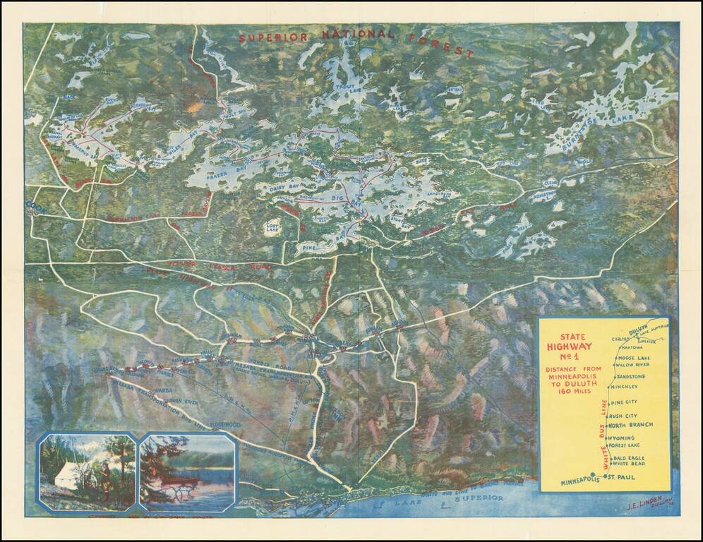
Rare color bird's-eye view of northern Minnesota, produced in Duluth by J.E. Linden. The map was produced to entice vacationers from the Twin Cities to travel to Lake Vermilion in the summer. Lake Superior and Duluth occupy the bottom of the map, and...
![Guide To the Blazed Trails of Montana and Wyoming . . . [Montana, Wyoming, NW Colorado, Eastern Idaho, Northern Utah, NE Nevada] Rand McNally Offical 1923 Auto Trails Map [Yellowstone National Park and Glacier National Park on verso]](/map/small/66099.jpg)
Early Automobile Road Map Detailed map of [Montana, Wyoming, NW Colorado, Eastern Idaho, Northern Utah, NE Nevada, published by the Automobile Club and prepared fkr Kilmer & Sons of Spokane, Washington, The map is scarce -- this is the first...
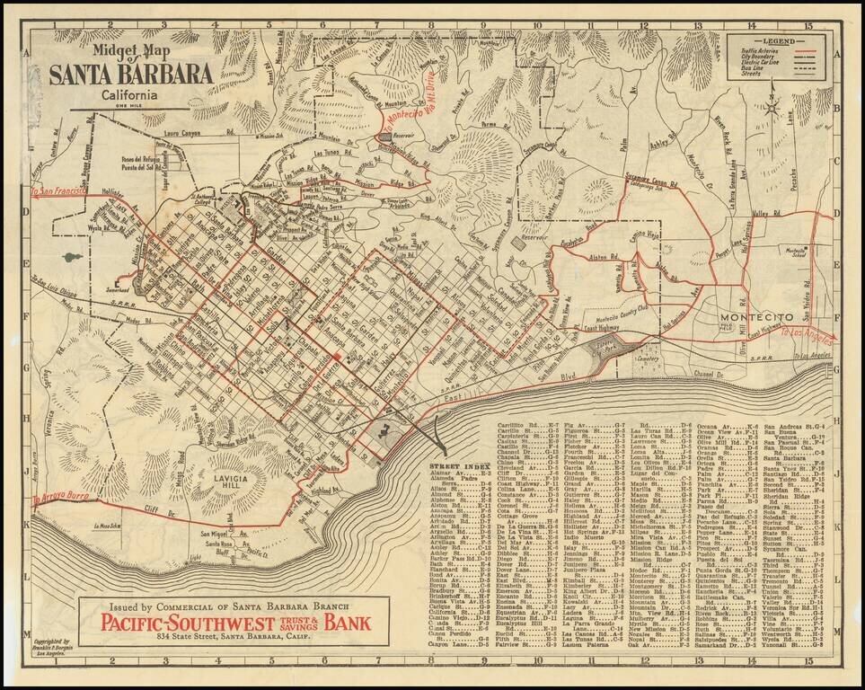
Rare early "midget" series map of Santa Barbara, published as a promotional map for Pacific-Southwest Trust & Savings Bank. Includes a birdseye view style "Motor and Relief Map" of Southern and Central California (extending to San Francisco) on...
![[Pictorial Road Maps] Motoring to Yosemite and the Mariposa Big Trees](/map/small/70985.jpg)
Finely illustrated promotional booklet, consisting of 16 pages and 7 color maps, published by the Yosemite Park and Curry Co., Yosemite National Park, California, and printed by H. S. Crocker Co., San Francisco. While the maps and pamphlet are...
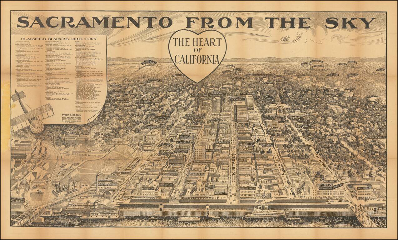
Rare Sacramento Birds-Eye View Rare aerial view of Sacramento, published in Sacramento, with a detailed map of the city on the verso. The view shows Sacramento from the west, looking toward the Sierra Nevada Mountains, with downtown Sacramento and...
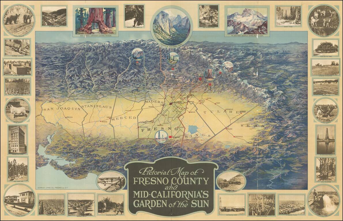
One of the great California pictorial maps from the Golden Age of American Pictorial mapmaking. The map stretches from San Francisco in the lower-left corner to San Emigdio Mountains at the right and the Sierra Nevadas in the background. The map thus...
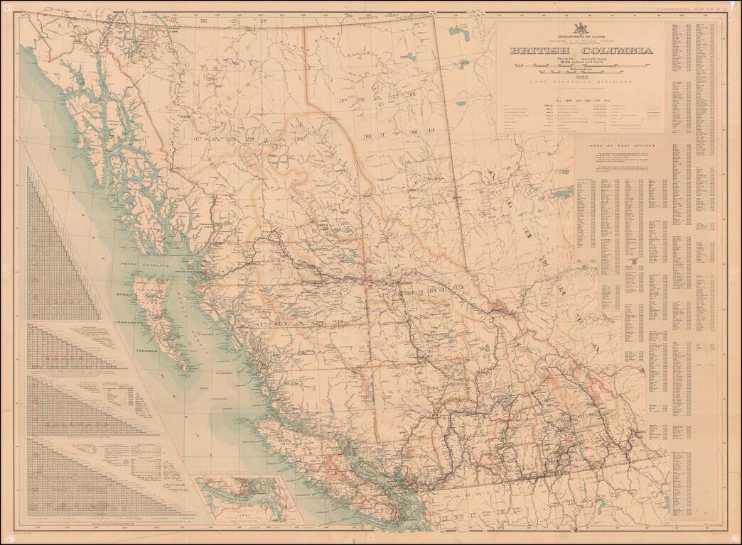
With an Index of Post Offices for British Columbia Highly detailed map of British Columbia, published by the Department of Lands, Land Records Division. An elaborate set of distance tables are shown at the left, noting distances along the coast,...