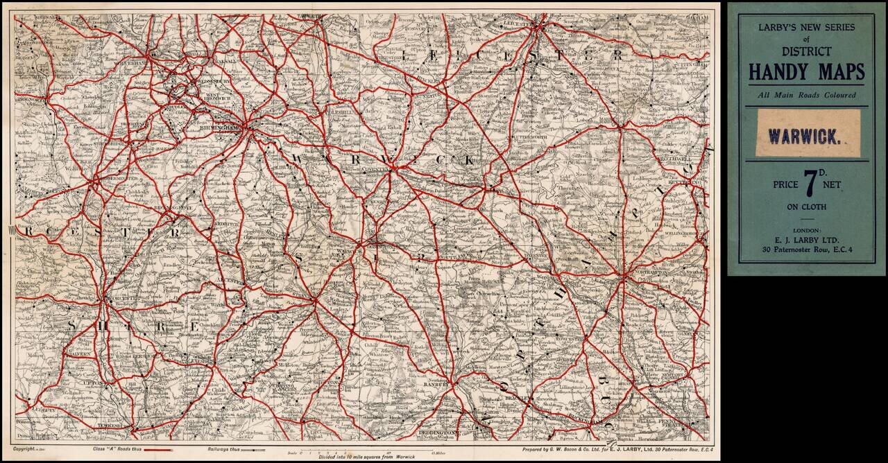
Includes the areas areund Wolverhampton, Birmingham, West Bromwich, Coventry, Leicester, Warwick, Leamington, Stratford, Upton, Worcester, Buckingam, Northampton, Rugby, etc.
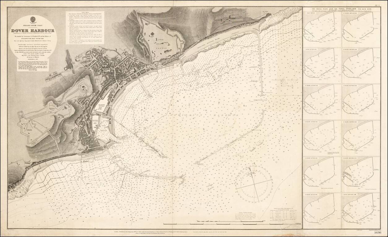
Highly detailed map of the Port of Dover, published in 1910. The finely detailed chart reflects the revisions of the Admiralty over a number of years. The Military Prison, Castle, Harbor Works, Citadel and docks are plainly illustrated, along with a...
![[Illustrated Plan of Moscow & its Environs] Illustrirovannyi Plan
Moskovi i yeye Okrestnostmy.](/map/small/37725.jpg)
A highly decorative and large-scale plan of Moscow, depicting the city not long before the Revolution of 1917. This magnificent map depicts all of Moscow and its environs as it appeared in 1910, during the twilight of the Czarist period. In large...
![[Bukovina] Harta Etnografica a Bucovinei Intocmita Pe TEmeiul Recenzamantului Oficial Din 1910 De I. Nistor](/map/small/53990.jpg)
Detailed Ethnographic map of Bucovina, identifying the ethnic make up of the cities and towns in the region. An explanation of the color coding is shown at the left, including 8 different ethnic groups, including: Roma Ruthenians (Eastern Slavic...
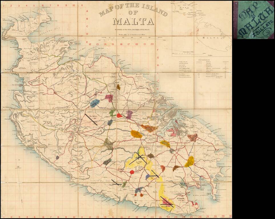
Fascinating map of Malta, pubished by the War Office in London. This example includes some interesting manuscript additions. Detailed map of Malta on a scale of two inches to a mile, with a key detailing roads, railways, churches, police stations,...
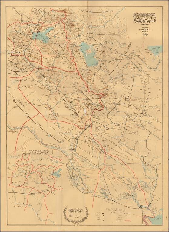
The Berlin-Baghdad Railway Detailed map of Eastern Iraq and Western Iran, published to illustrate the progress of the Baghdad Railway. The map extends from Basra in the South, along the border between Iran and Iraq, up to Lake Urmia and Southeastern...