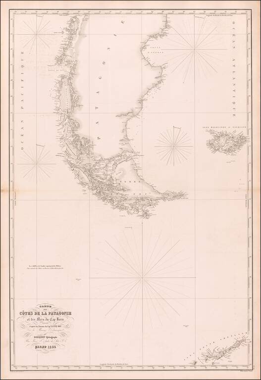
Rare separately published sea chart of the southern tip of South America, the Falkland Islands and the South Shetland Islands, published in Paris by Aime Robiquet. The chart lists Captain R. Fitz Roy of the British Admiralty as the source for the map...
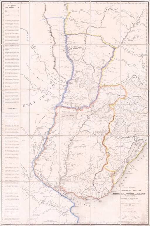
A Colonial Rarity Created By Spain's Most Important Boundary Commissioner and Surveyor -- Crucial to Early Argentinian History The earliest surviving example of Don Jose Maria Cabrer's finely executed map of the Argentine Confederation and the...
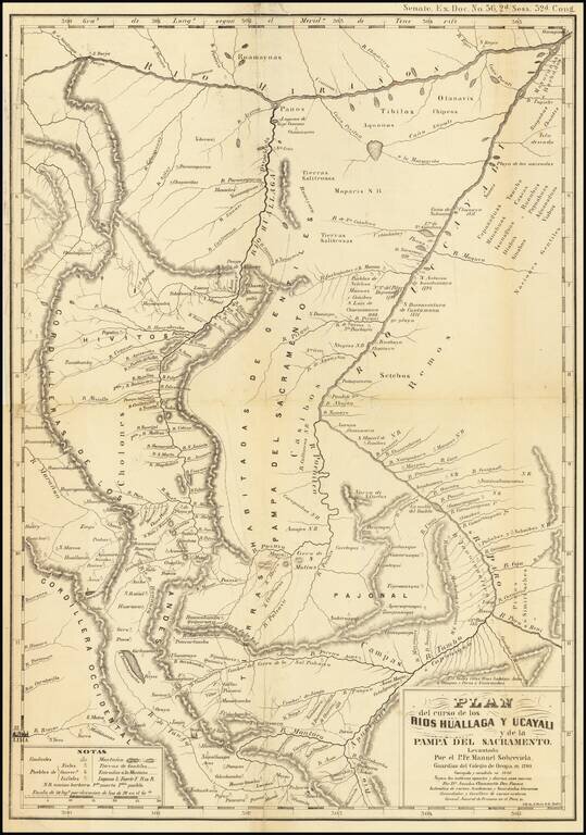
Antique lithographed map, issued in 1853 a Hoen of Baltimore, reproducing this original. Between 1789 and 1790 Father Manuel Sobreviela travelled along the Huallaga River and created a map of the area around the Huallaga and Ucayali Rivers. Sobreviela...
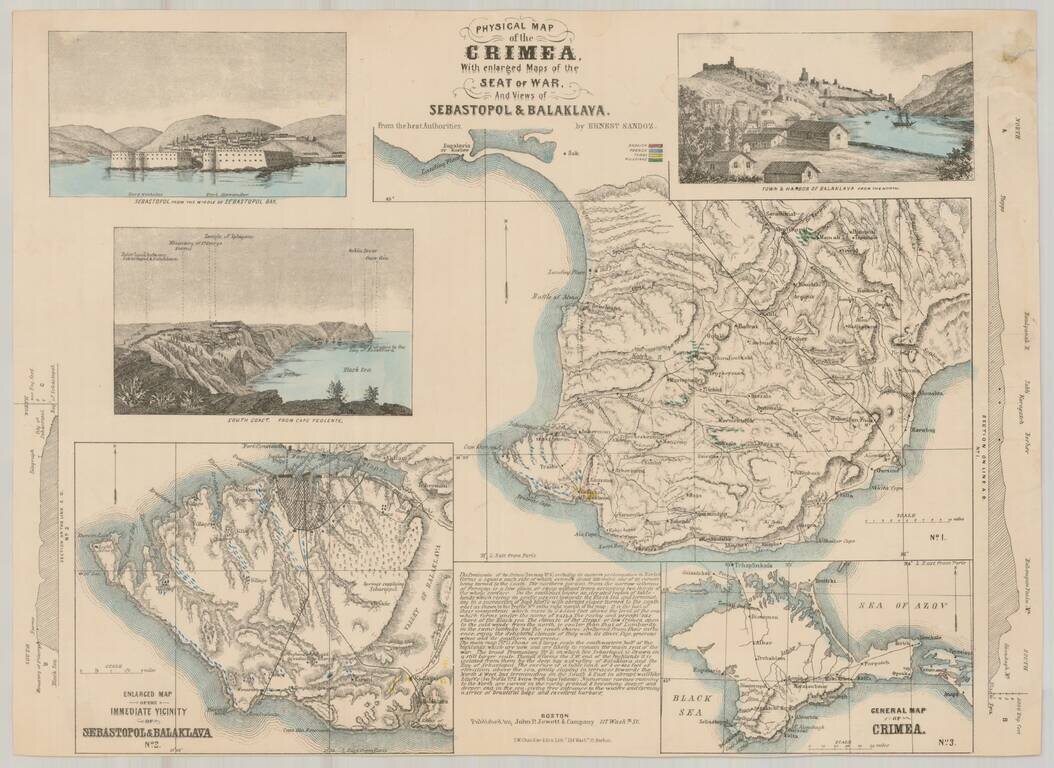
Rare separately issued map of showing the status of the War in the Crimea, published by John P. Jewett & Co. in Boston and Lithographed by S.W. Chandler & Bro. in Boston. The map includes inset maps entitled "General Map of Crimea" and...
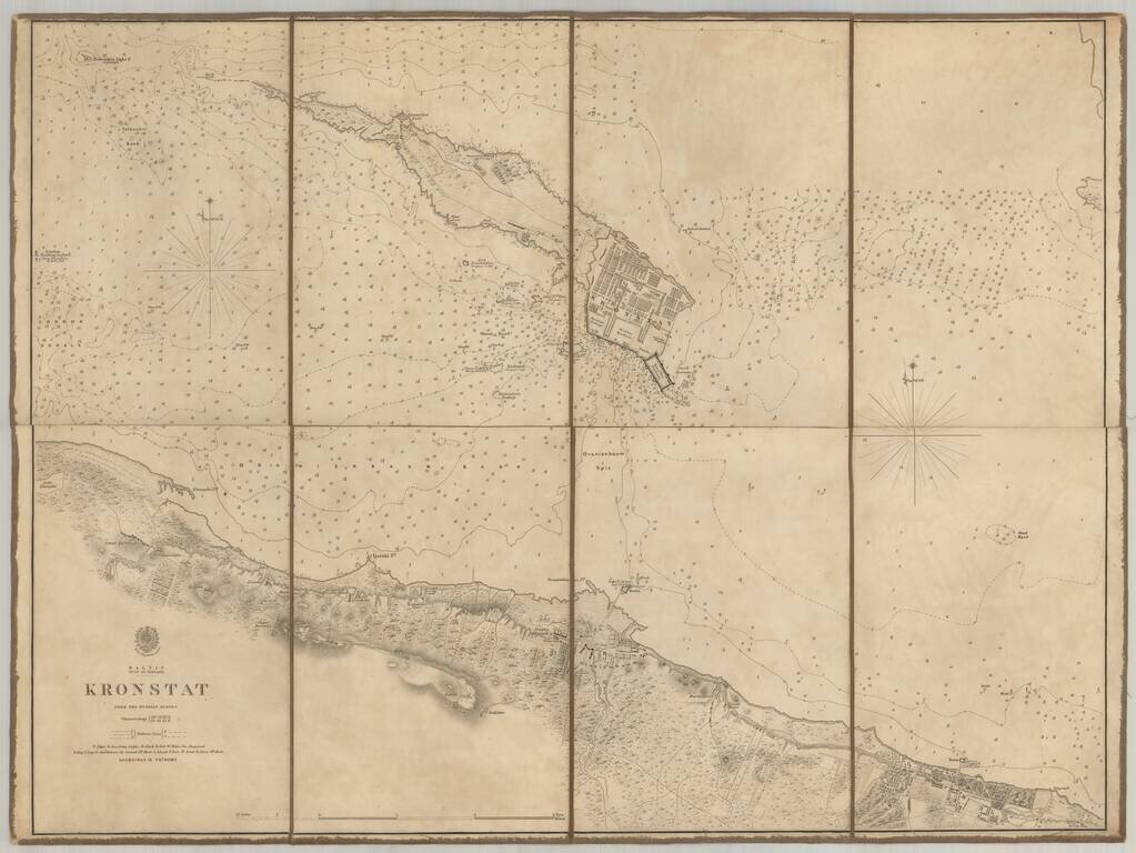
Scarce chart of the Island of Kronstat, the primary defensive position for the Russian Navy in defense of Russia's Czarist Capital of St. Petersburg. Published on the eve of the Crimean war in anticipation of the conflict with Russia, the Allied Navy...
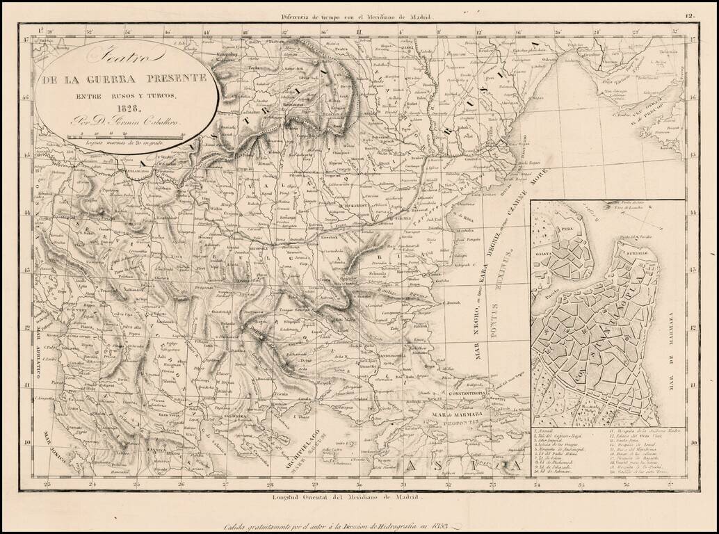
Rare separately issued map illustrating the Theater of War between the Russians and the Ottoman Empire, dated 1828 and issued by the Fermin, with a later imprint for the Direccion Hidrographia. Includes a large inset plan of Istanbul.
![(Commodore Perry's Arrival in Edo Bay.) [Foreign Ship | Defence on Land and Sea] [lkokusen | Kairiku okatame]](/map/small/55558.jpg)
Commodore Perry's Fleet Arrives in Edo Bay. A large double-page two-sheet kawaraban with a fold along the left edge. The upper section of this image is a list of the officials responsible for coastal defense. The lower right side shows an American...
![[Concerning the Revised Locations of the Officials Assigned to Coastal Defence] [Kaisei kairiku okatame basho ni tsuki]](/map/small/55559.jpg)
Large double-page two-sheet kawaraban illustrating coastal defense against foreign navies. Published in the wake of Commodore Perry's arrival in Japan. The upper section of the kawaraban lists the officials assigned to coastal defense duty. The...
![(Commodore Perry) [Clans Assigned to Defence Duty on Land and Sea for Maintaining Peace] [Kairiku okatame taihei kagami]](/map/small/55561.jpg)
Japanese Coastal Defense Against Foreign Navies. With a Depiction of Commodore Perry's Fleet and Flagship. This double page kawaraban map shows the officials responsible for coastal defense in lzu, Saga mi, Musashi, Kazusa, Shimofusa, and Awa...
![[Clans Assigned to Defence Duty on Land and Sea in lzu, Sagami, Musashi, Kazusa, Shimofusa, and Boshu] (same as Awa) [Provinces for Maintaining Peace] [lzu, Sagami, Musashi, Kazusa, Shimofusa, Boshu Kairiku okatame taihei kagami]](/map/small/55560.jpg)
Large double-page kawaraban showing coastal defense against foreign navies, in the wake of Commodore Perry's arrival in Japan. A large map shows the coastal area in lzu, Sagami, Musashi, Kazusa, Shimofusa, and Awa Provinces with the names of the...
![[Clans Assigned to Defence Duty on Land and Sea in lzu, Sagami, Musashi, Kazusa, Shimofusa, and Awa Provinces] [lzu, Sagami, Musashi, Kazusa, Shimofusa, Awa kairiku okatame]](/map/small/55562.jpg)
Woodcut kawaraban showing the officials responsible for coastal defense in lzu, Sagami, Musashi, Kazusa, Shimofusa, and Awa Provinces.
![(Commodore Perry) [Illustration of the Steam Locomotive.] [Jokisha no zu]](/map/small/55566.jpg)
The Miniature Steam Locomotive Commodore Perry Brought to Japan. Woodblock kawaraban print showing the miniature steam locomotive, which is one of the gifts to the Edo government Commodore Perry brought to Japan. The caption says "Gifts from Emperor...
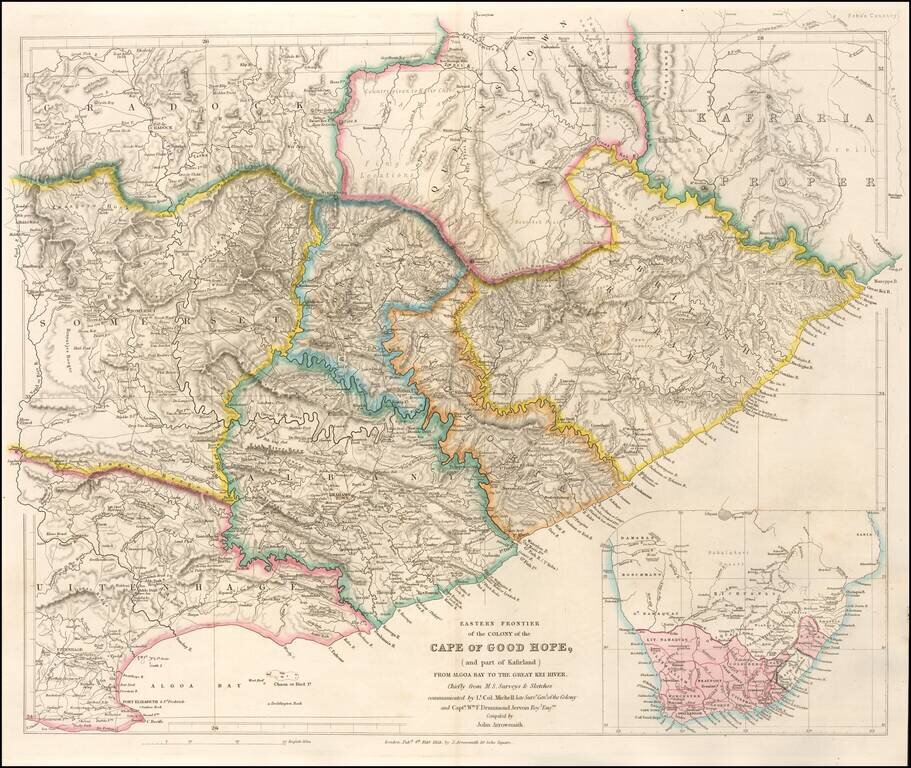
Highly detailed map of the Eastern Frontier of the Colony of the Cape of Good Hope, published by John Arrowmsith in London. Fine example of John Arrowsmith's meticulous style and remains one of the finest nineteenth century maps of the area. The map...