![[St. Lawrence Island, Alaska] Карта Острова св: Лаврентия исправленная колониальными мореходами [Map of the Island of St. Lawrence corrected by the colonial sailors.]](/map/small/59917.jpg)
The George Davidson Copy of Tebenkov's Map of St. Lawrence Island, Alaska Rare and remarkable map of St. Lawrence Island Alaska, compiled by Mikhail Dmitrievich Tebenkov, who in 1849 was serving as the Governor of American Russia. Mikhail Dmitrievich...
![[3 Part Map of the Philippines]: Islas Filipinas Primera Hoja Central [and] Islas Filipinas Segunda Hoja Central [and] Islas Filipinas Posesiones de Oceania. Media Hoja Superior. Media Hoya Inferior](/map/small/61939.jpg)
Good example of Francisco Coello's Islas Filipinas, the most important general map of the Philippines of the 19th-century and the first modern topographical map of the Philippines based on Scientific Surveys. The present map is the most important...
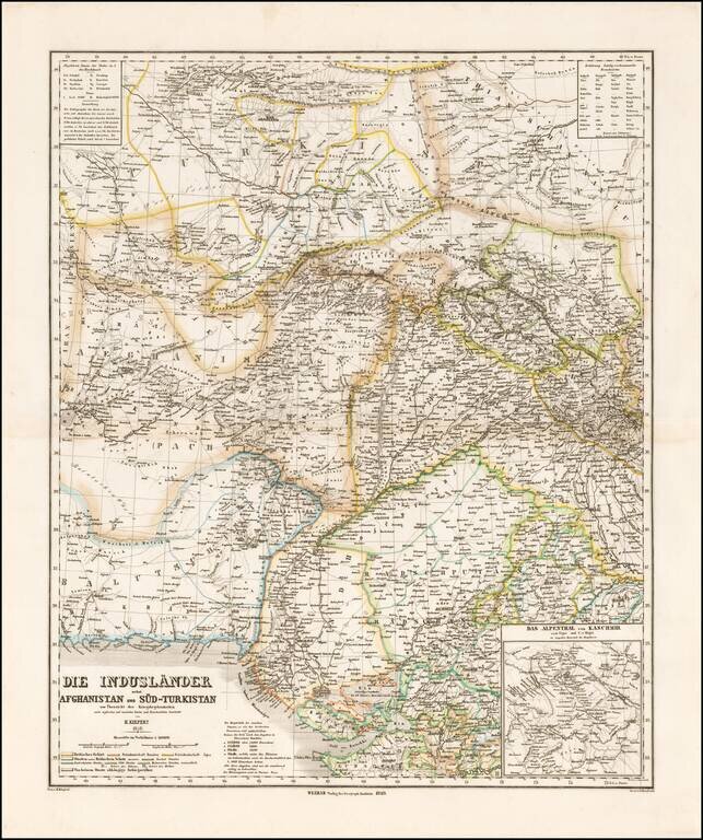
Striking map of Central Asia, published in Weimar by Heinrich Kiepert. The map extends from Afghanistan and Balutschistan in the west to Kaxgar, Jarkand, Delhi and Northwestern India. The map encompasses much of the modern day Pakistan, Afghanistan,...
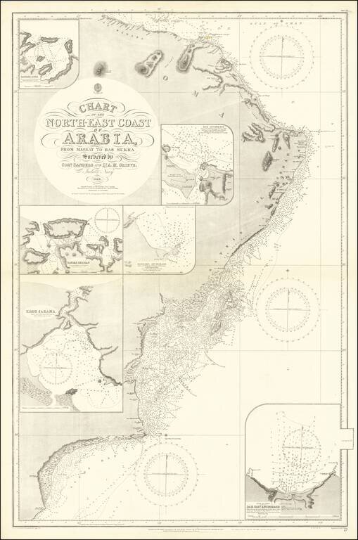
Detailed sea chart of the easternmost tip of the Arabian Peninsula in present-day Oman. Interestingly, the map was made from surveys of the Indian Navy in 1849. Muscat is shown towards the top of the map. Hundreds, if not thousands, of soundings dot...
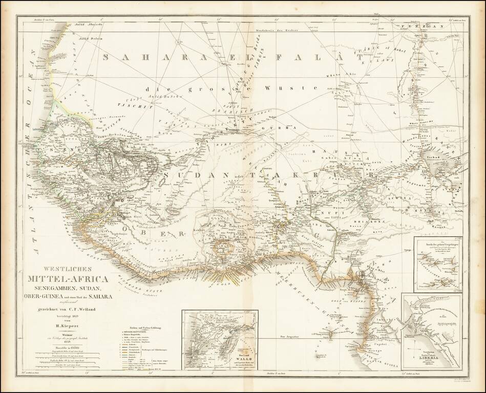
Fine large map of West Africa, published by German mapmaker Heinrich Kiepert in Weimar. Includes several insets, including an inset of the Free Colony of Liberia. Many early trade routes are located in the Sahara.
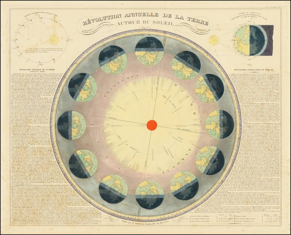
Nice example of Andriveau Goujon's spectacular chart tracking the 12 monthly phases of the earth's orbit around the sun and showing the relative projections of sunlight, with two smaller diagrams. A wonderful decorative large celestial diagram, unique...