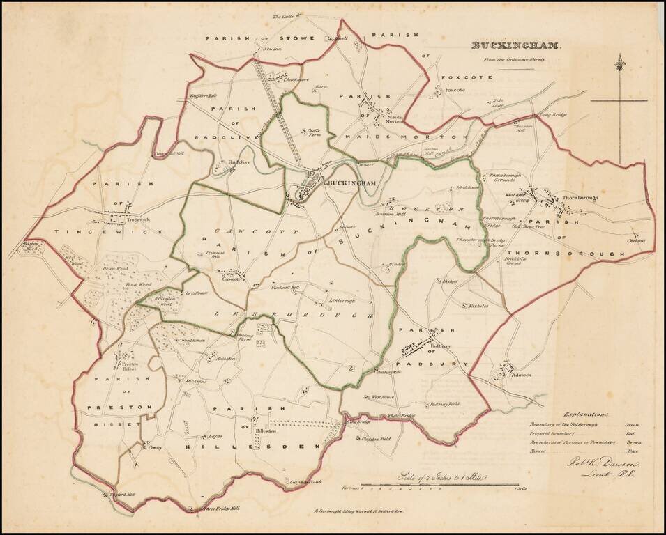
Detailed map of Buckingham County, with roads, towns, rivers and other details.
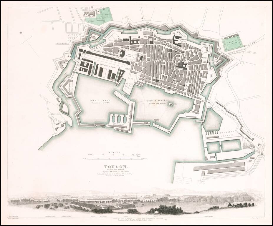
Fabulous town plan of Toulon, with a large panorama view of the City. One of the best 19th Century English towns plans to appear in a commercial atlas.
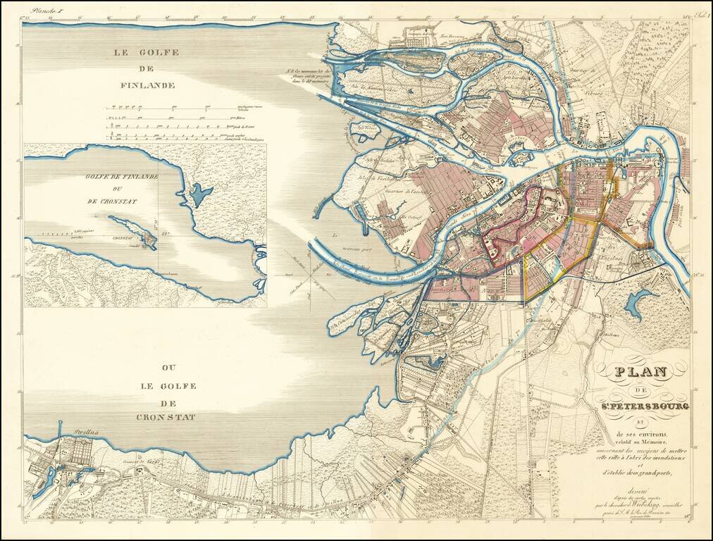
Rare Plan of St. Petersburg Proposing An Early Solution to St. Petersburg's Perennial Flooding Issues Von Wiebeking's plan for St. Petersburg was one of several competing plans proposed for the purpose of addressing the chonic flooding issues in St....
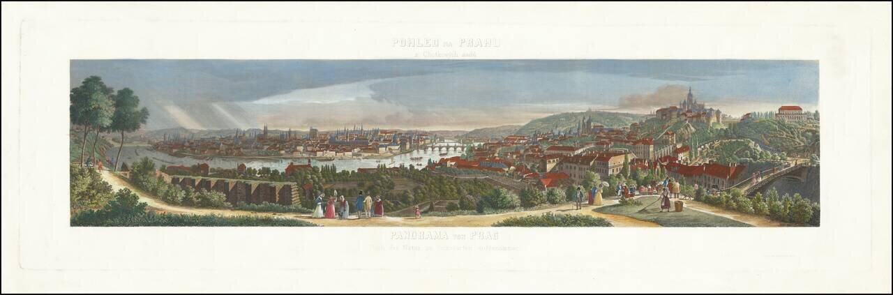
Rare panoramic view of Prague, showing the town from the Chotkovy hillside. The view is based upon a drawing by Morstat and engraved by F. Geissler.
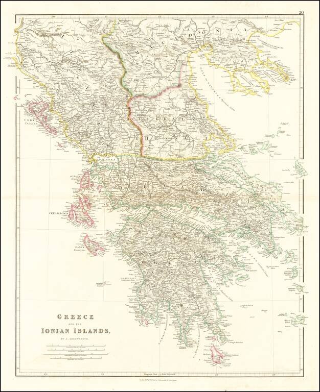
Attractive map of Greece and the Ionian Islands, prior to the consolidation of the Island into the Greek nation. The map appeared in John Arrowsmith's London Atlas.
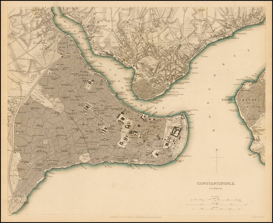
Highly detailed plan of Constantinople (Istanbul) and neighboring areas. Shows buildings, streets, ports of entry, Mosques, gates and a host of other details. One of the best plans of the city to appear in a 19th Century Commercial Atlas.

Attractive map of Cyprus, Asia Minor, the Holy Land and Egypt. The map appeared in Arrowsmith's London Atlas.
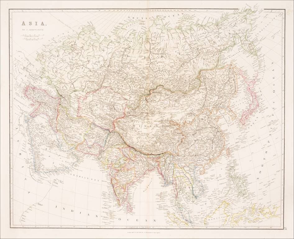
Striking example of Arrowsmith's map of Asia. The map appeared in Arrowsmith's London Atlas, one of the most popular English atlases of the mid-19th Century.
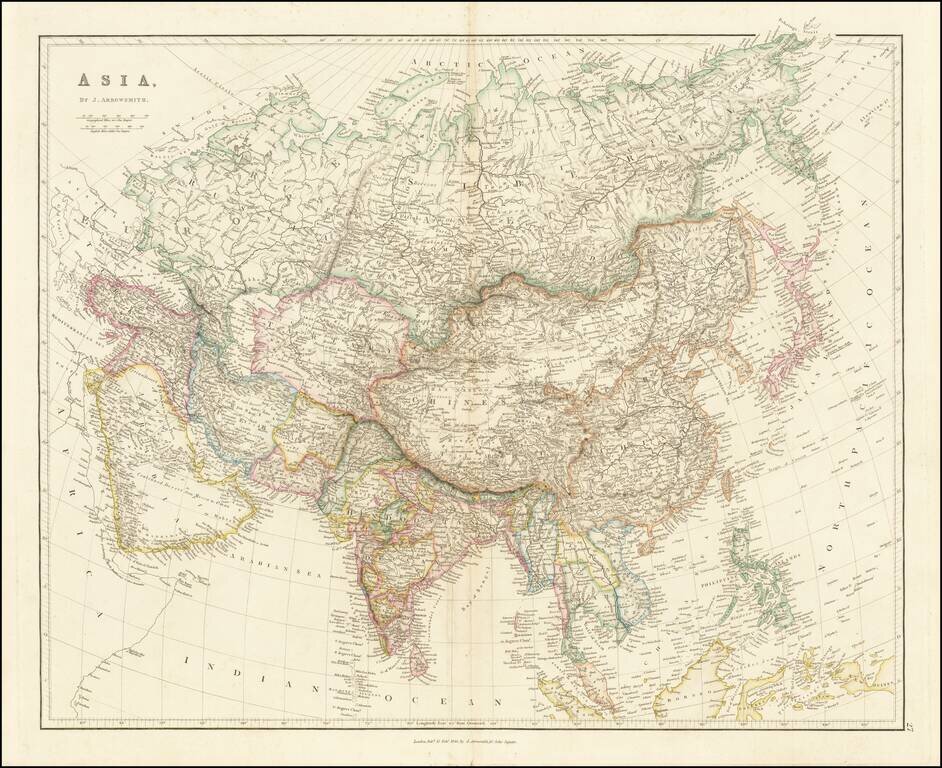
Striking example of Arrowsmith's map of Asia. The map appeared in Arrowsmith's London Atlas, one of the most popular English atlases of the mid-19th Century.
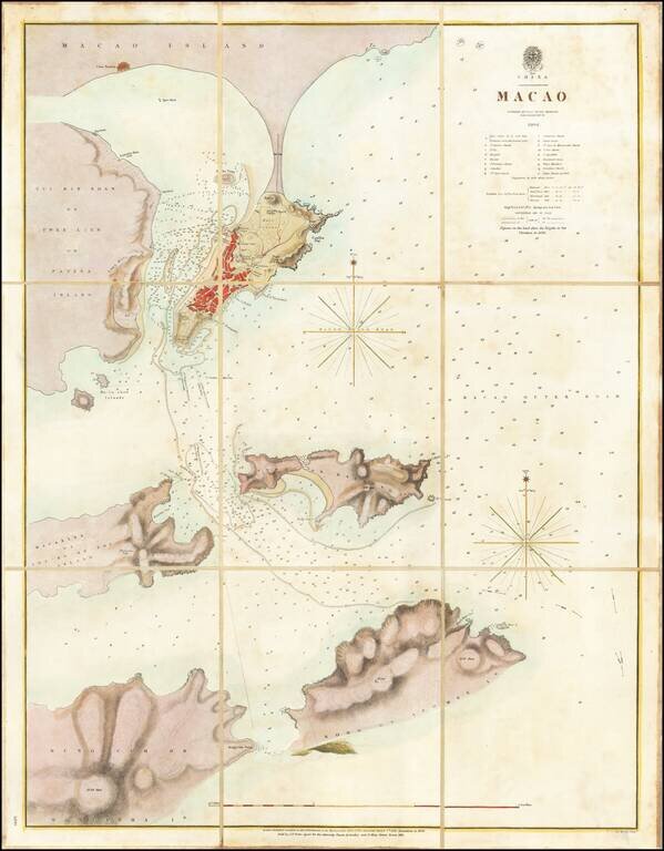
A Surreptitious Survey of Macau By A Famed British Officer Rare separately published sea chart of Macau, published by the British Admiralty, based upon the work of Peter Heywood, of Mutiny on the Bounty fame. The chart shows the town of Macau,...
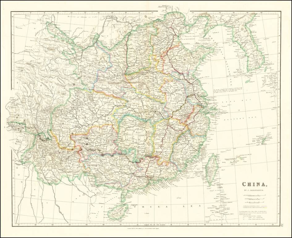
With Lord Macartney's Route and Lord Amherst's Route Illustrated Striking example of Arrowsmith's map of China and Korea. The map names Hong-Kong I. & Victoria City. The map appeared in Arrowsmith's London Atlas, one of the most popular English...
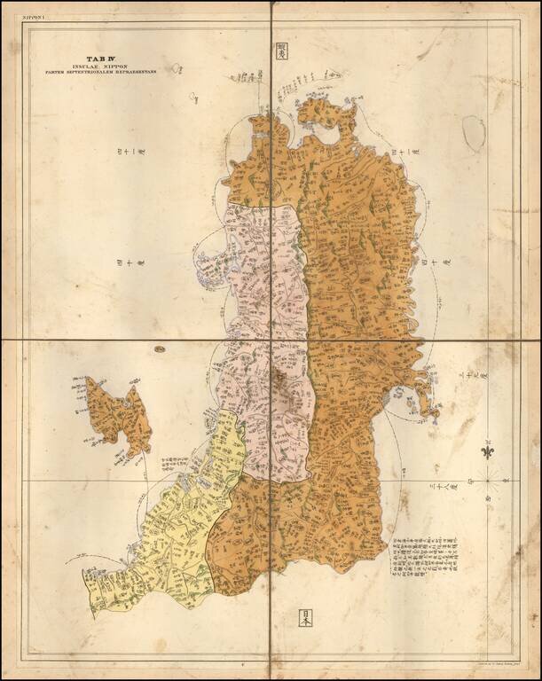
Rare Separately Published Example of the Map of Part of Honshu, by German physician and traveler Philipp Franz von Siebold. Fine map of the most northern part of Honshu, including Fukushima, the island of Sado island. One of the few large scale maps,...
![[Northern India] (hand drawn map of Northern India)](/map/small/64513.jpg)
Finely executed manuscript map of the northern part of India, drawn by an anonymous French hand. The map's primary feature is the illustration of the primary topography of the region, including mountain, valleys, rivers, lakes and towns, with some...
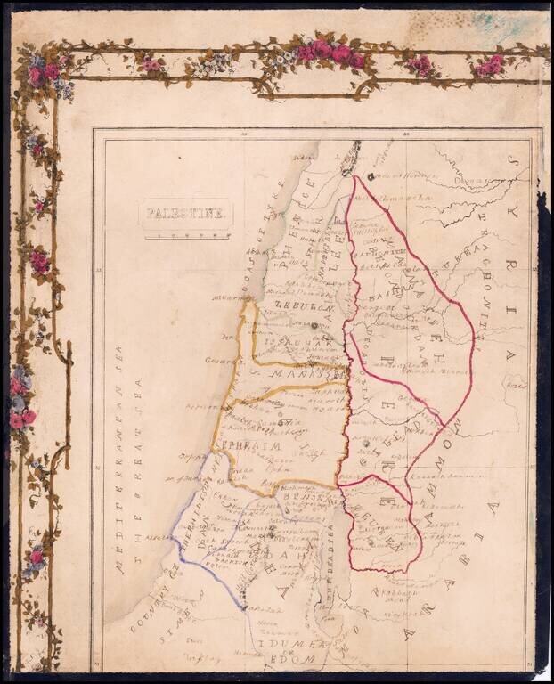
Hand Drawn Antique Map of Palestine / Holy Land Detailed map of Palestine, divided by the Tribes of Israel, with a partial decorative border.
![[Arabia] Skizze einer Karte von Asyr und einem Theile von Kedjas und Nedjd, nach Chedufeaus Materialien, entworen von den Capt. Ing. Galinier und Ferret . . . .](/map/small/62167.jpg)
Detailed map of the Southwestern part of Saudi Arabia, extending from Djidda (Jedda) and Mekka to Ras Torfa and Djisan (Jezan). One area noted is the Nordlichster Kaffeedistrict (Northernmost Coffee District), in the area that is now the Al Baha...
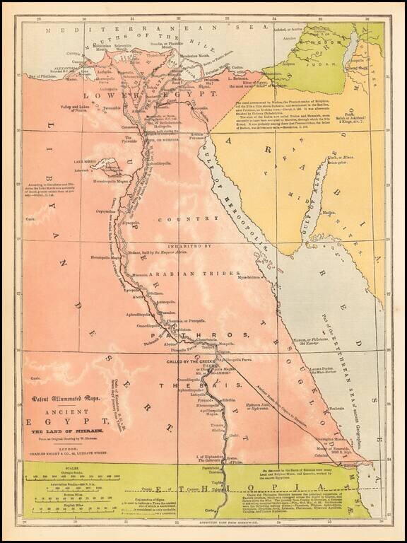
Fine example of Charles Knight's rare "Patent Illuminated Map" of Egypt. As noted by Jerem Norman, "In 1838, English printer and publisher Charles Knight received British patent No. 7673 for "Improvements in the Process and in the Apparatus used in...