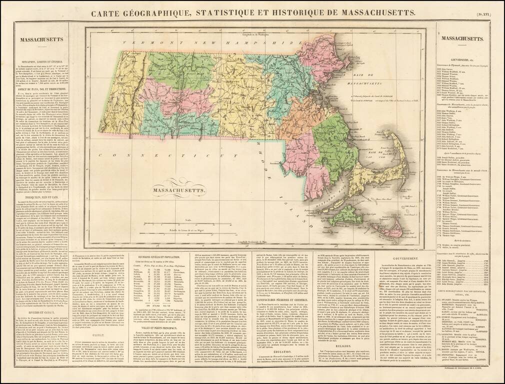
Fine early map of Massachusetts, colored by county and showing the various towns, roads, rivers, bridges, and a host of other details. One of the earliest obtainable maps of Massachusetts printed in Europe. Surrounded by text describing the state,...
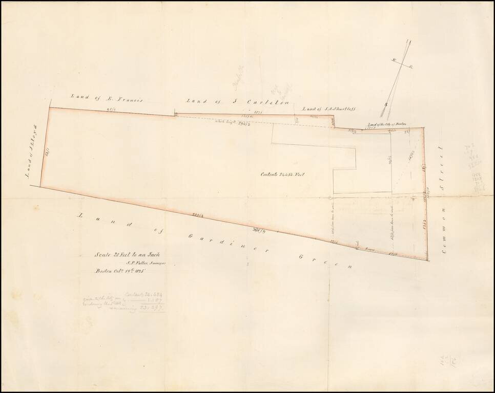
Detailed map of the area west of Common Street, which is now Winthrop Square and the location of the Freedom Trail, Training Field and Soldier's Monument. The lands owned by Gardiner Green are shown. The map is described on the verso as The map was...
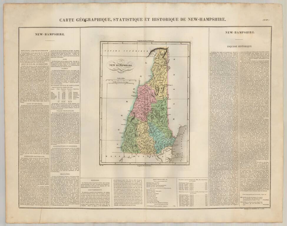
Excellent wide margined example of the French edition of this map of New Hampshire from Buchon's fine atlas of America. One of the first maps of the state of New Hampshire published outside of America. Size includes text surrounding map, which...
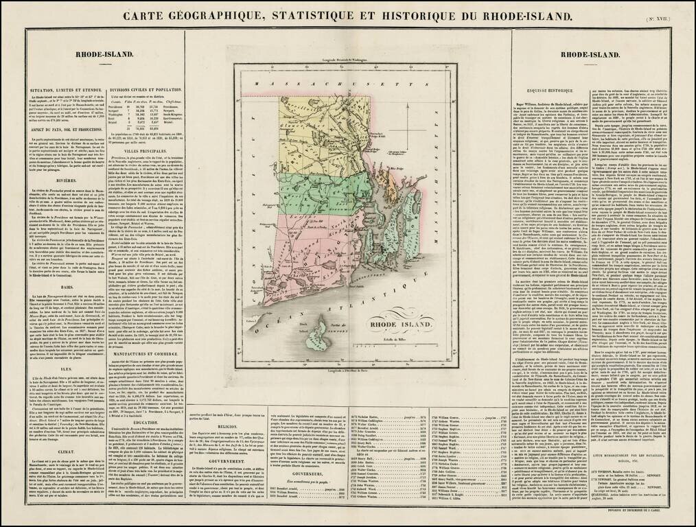
Nice example of the French edition of this early map of Rhode Island from Carey & Lea's Atlas. Includes wonderful contemporary details concerning the topography, indigenous lands, rivers, climate, towns, manufacturing, commerce, education,...
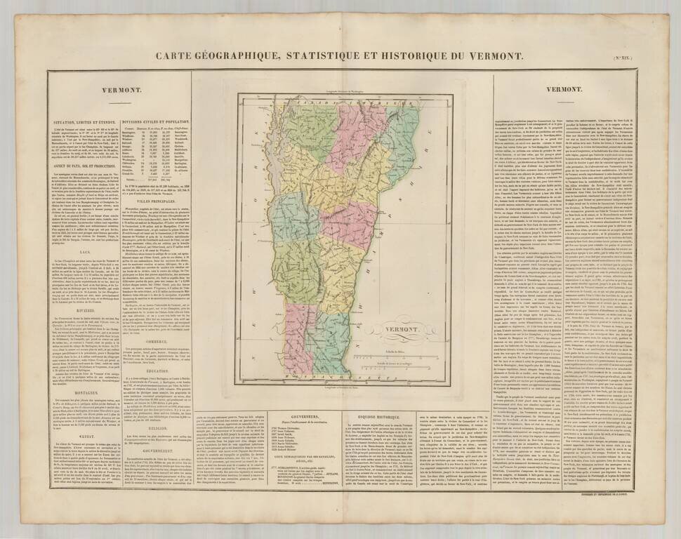
Excellent wide margined example of the French edition of this map of Vermont from Carey & Lea's Atlas. One of the first maps of the state of Vermont published outside of America. Size includes text surrounding map, which includes wonderful...
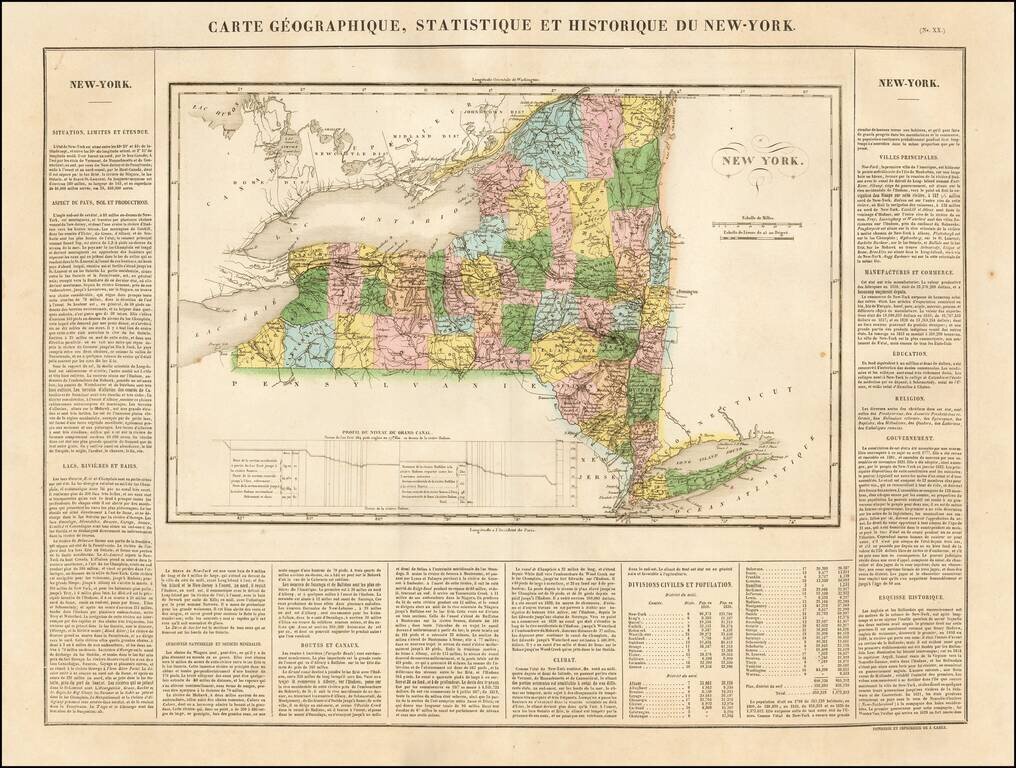
One of the Earliest Maps of New York State Published in Europe. Excellent wide margined example of the Buchon's map of New York. Buchon's work is prized for the fine engraving quality. The text includes wonderful contemporary details concerning the...
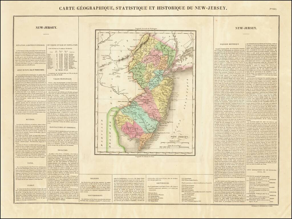
First Map of New Jersey Printed in France One of the earliest obtainable maps of the State of New Jersey published outside of the United States. The map appeared in Buchon's edition of Carey & Lea's Atlas, which was highly prized not only for its...
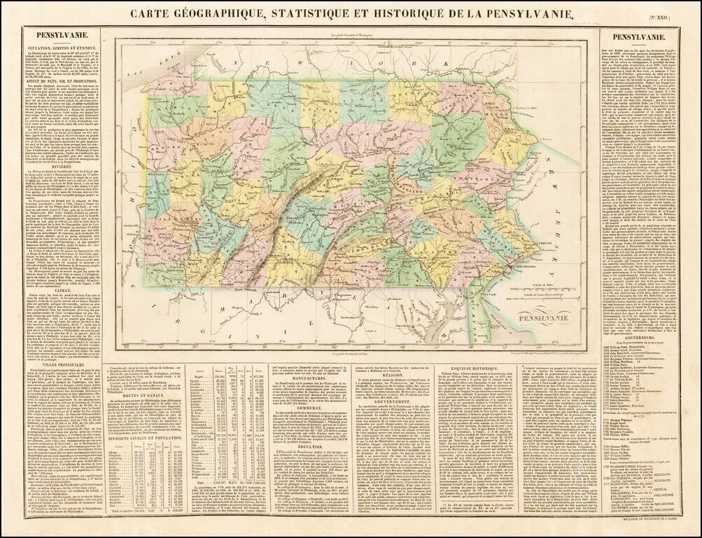
Attractive map of Pennsylanvia, colored by county and showing the various towns, roads, rivers, bridges, and a host of other details. The map is surrounded by text describing the state, its population, governors, religion, education, commerce, climate...
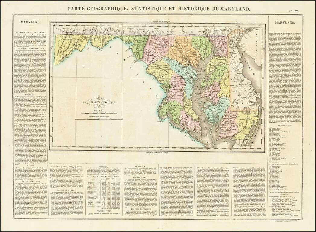
Finely engraved hand colored map of Maryland, colored by county and showing the various towns, roads, rivers, bridges, and a host of other details. This is one of the earliest maps of Maryland published outside of the United States. Overall plate...
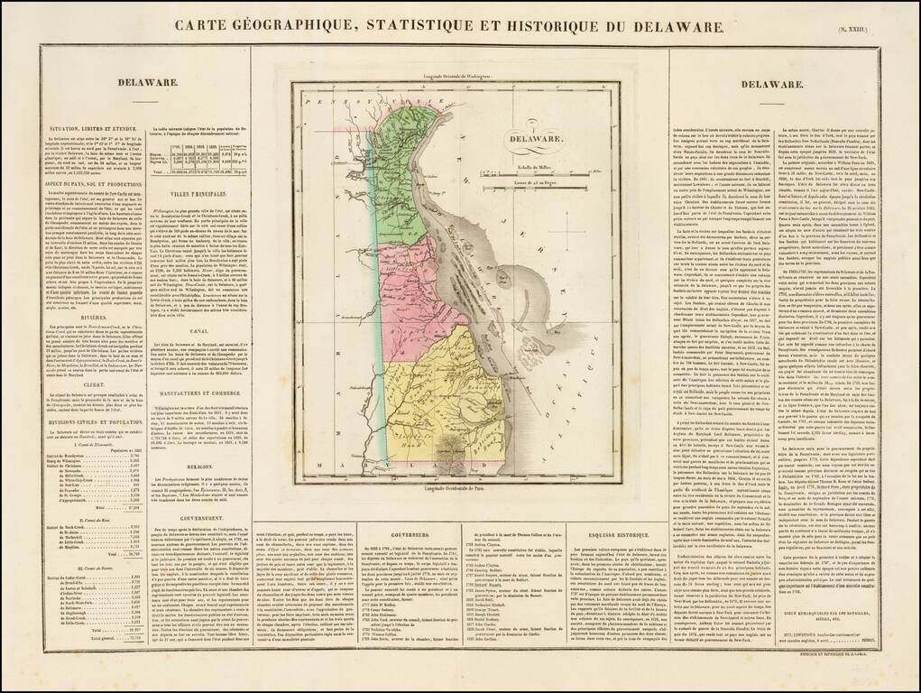
Nice example of the French edition of this early map of Delaware from Carey & Lea's Atlas. Includes wonderful contemporary details concerning the topography, indigenous lands, rivers, climate, towns, manufacturing, commerce, education, history,...
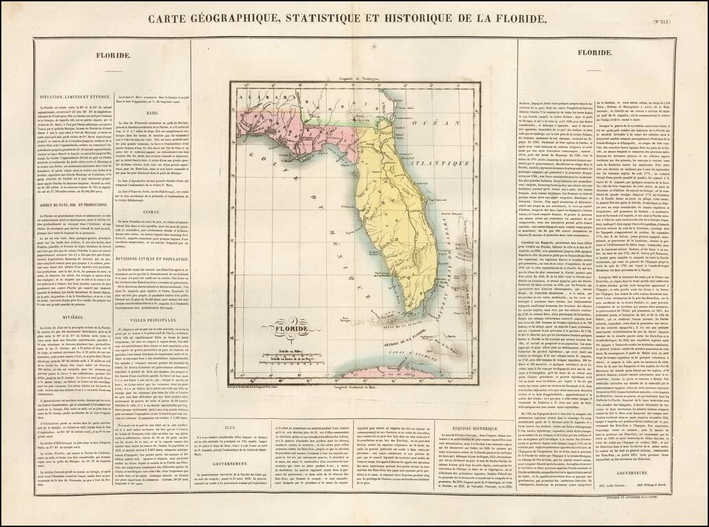
The Earliest Map of Florida Territory Published in France Very early territorial map of Florida, from the French edition of Carey & Lea's Atlas. Divided into East & West Florida. St. John River still shown in early mythical fashion. Shows...
![[Alabama, Mississippi, Arkansas, Louisiana and part of Tennessee and Western Florida] Amer. Sep. No. 56 Partie des États Unis](/map/small/54672.jpg)
Fine Map of Mississippi and Alabama from the Distinctive Atlas Universel Highly-detailed regional map focusing on Mississippi and Alabama published in Vandermalean’s important Atlas Universel shortly after they were split into separate territories...
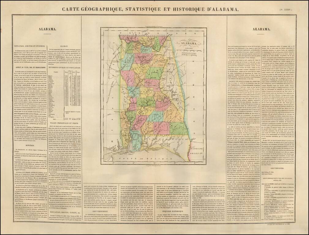
Nice example of the French edition of Carey & Lea's sought after map of Alabama. Hand colored by counties. Shows early roads, rivers, towns, bays, court houses, and other early details. General Jackson's route to New Orleans and the Government...
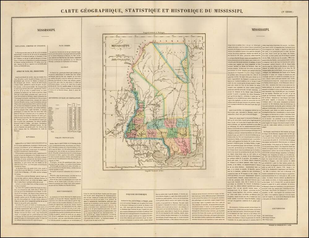
The first French Map of the State of Mississippi. Detailed map of Mississippi, published by Buchon in Paris in 1825, the earliest map of the newly formed state published outside the United States. Very few counties are shown in the north part of the...
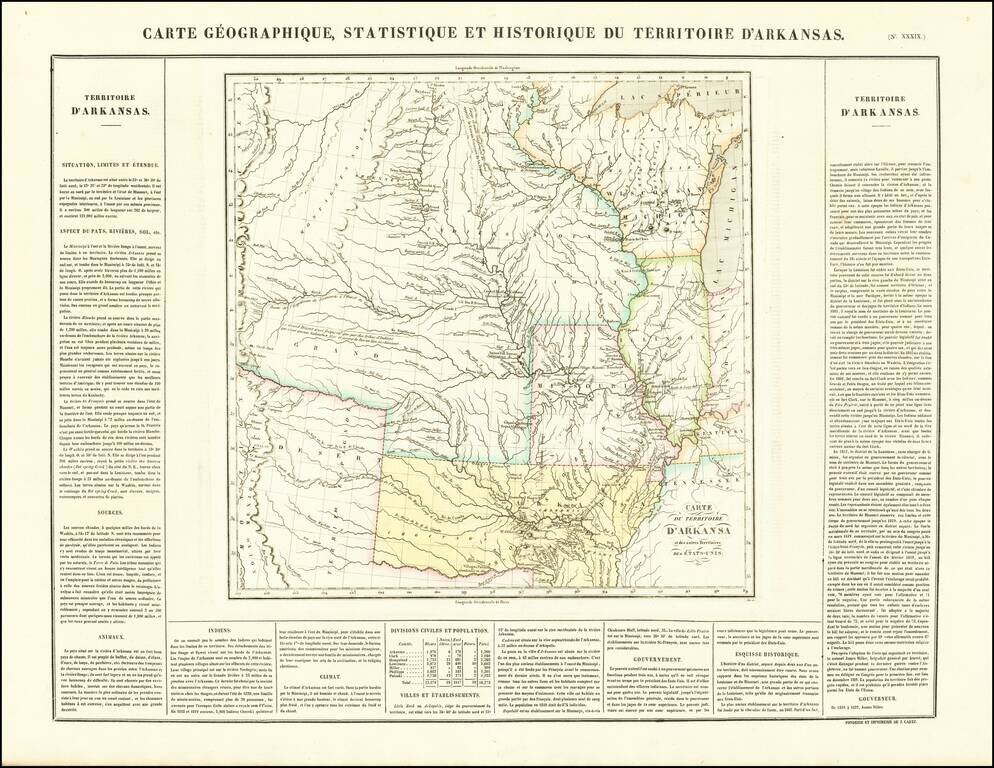
French edition of Stephen Long's seminal map of the region drained by the Arkansas, Kansas, Missouri and Mississippi Rivers, one of the most important maps of the American West. Stephen H. Long led a government expedition to the Rocky Mountains in...
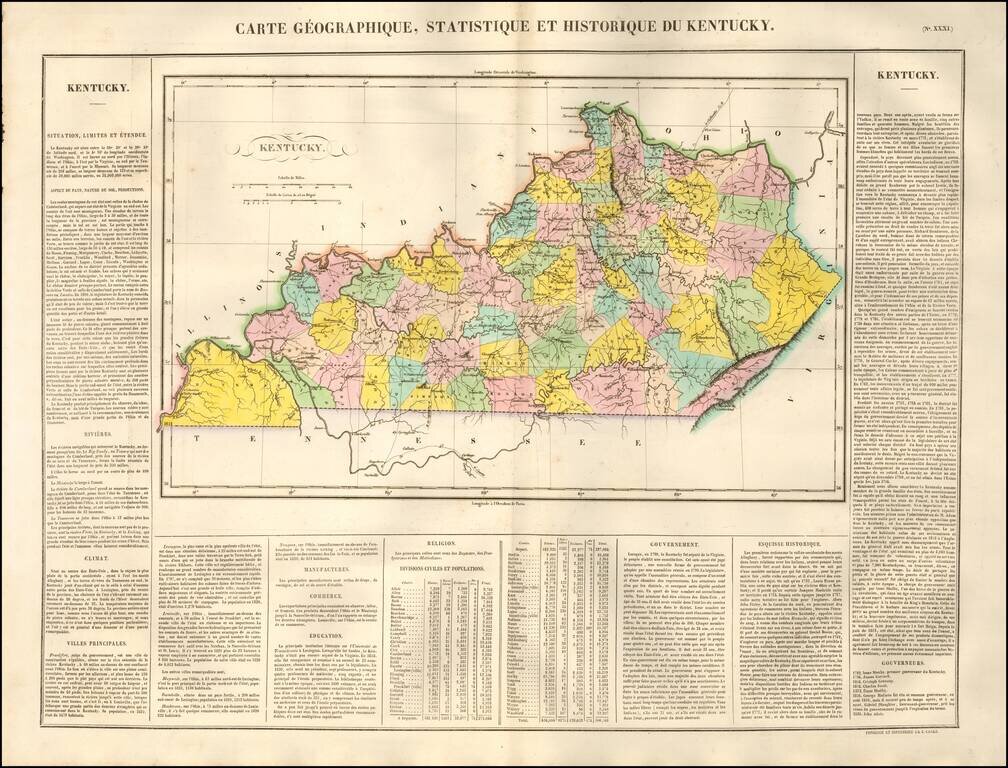
One of the Earliest Maps of the State of Kentucky Published in France Finely engraved map of Kentucky, hand colored by counties, published by Jean Alexandre Buchon, in Paris, in 1825. Buchon's work is colored by county and shows the various towns,...