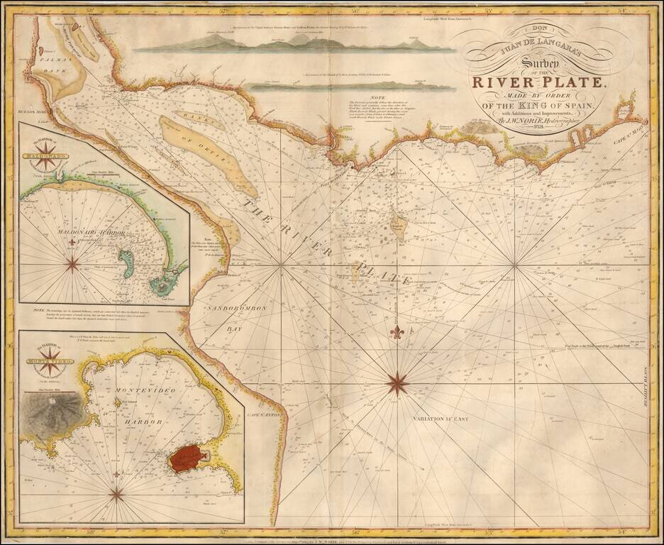
English Edition of The First Scientific Mapping of the Rio de la Plata Unrecorded 1824 edition of Norie's English Sea chart of the mouth of the River Plate, based upon Spanish surveys undertaken by the Malapsina expedition, under the direction of Juan...
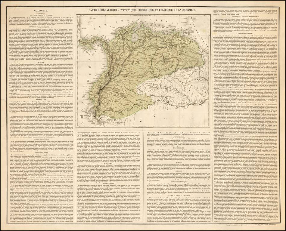
The Rare Precursor -- First Sheet -- For The French Edition of Carey & Lea's American Atlas map of Colombia. "France also seeks to spread the Carey-Lea Atlas . . . This is the first sheet of what has appeared." Rare separately published map of...
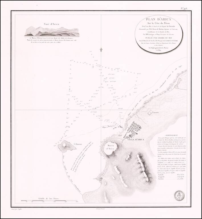
Rare separately published sea chart of the northern Chilean Coastline, centered on the town of Arica. Fine chart of the area around Arica in Chile, on the border with Peru, from Volume 7 of the Neptune Francois. The plan was drawn in 1822 during...
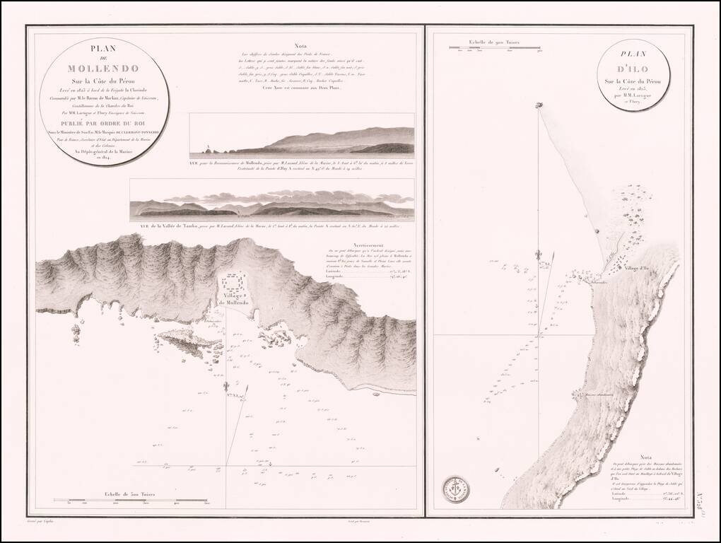
Antique Sea Chart of the The Southern Coast of Peru -- Mollendo and Ilo Rare separately published sea chart of the the areas around the southern Peruvian towns of Mollendo and Ilo, which was also issued in Volume 7 of the Neptune Francois. The plan...
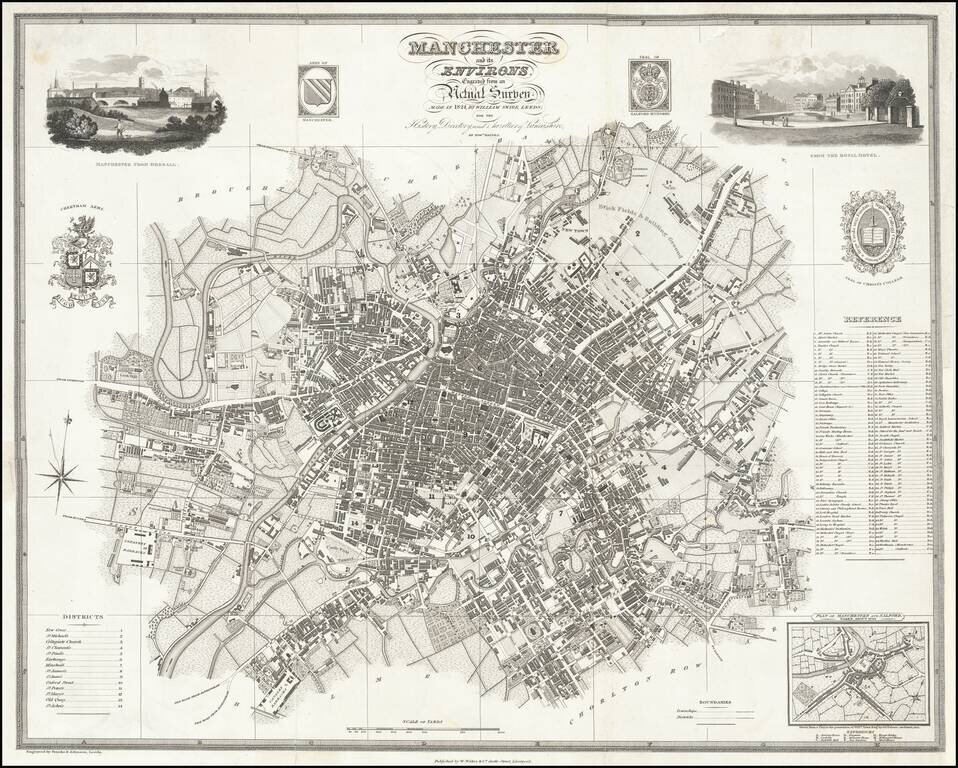
Highly detailed map of Manchester, published by Edward Baines. Includes 2 views and multiple coats of arms and vignettes.
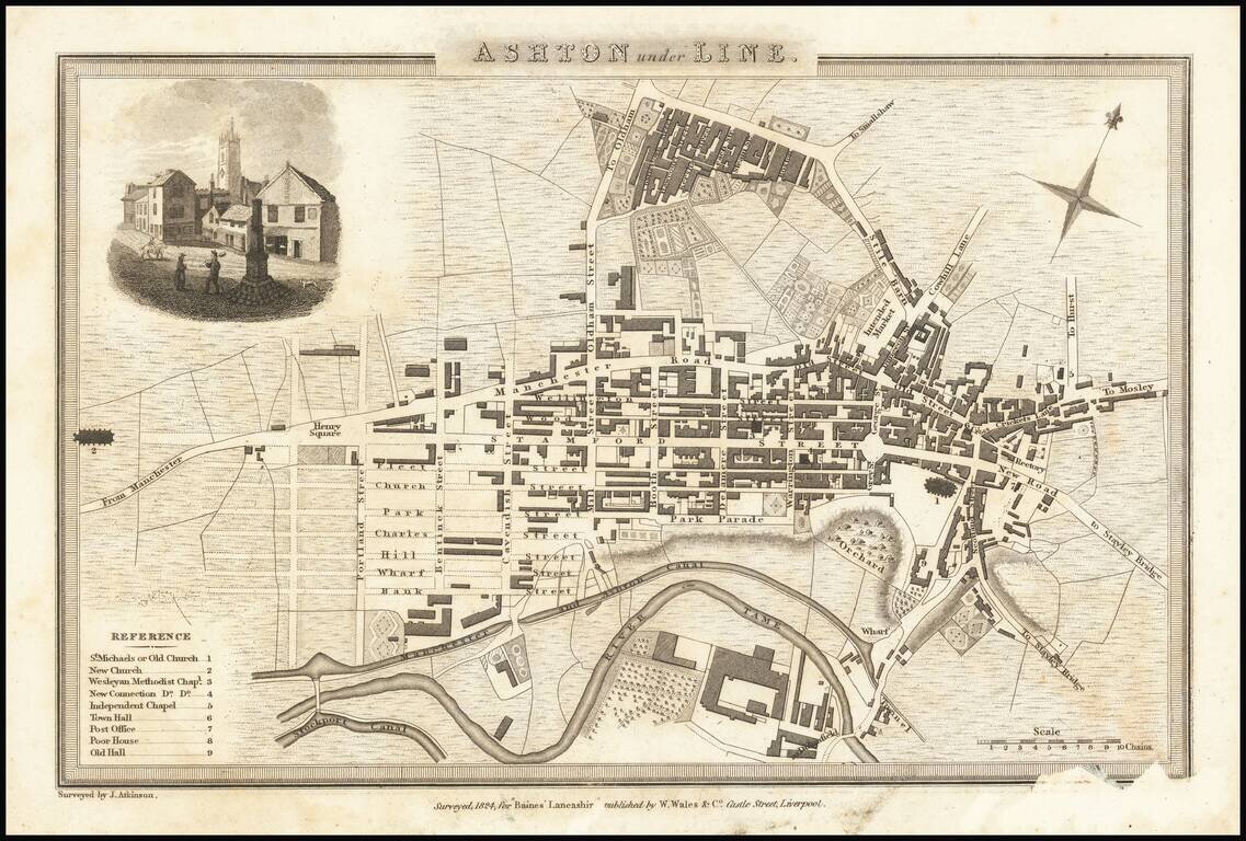
Detailed map of the town of Ashton under Line, in Lancashire, just east of Manchester.
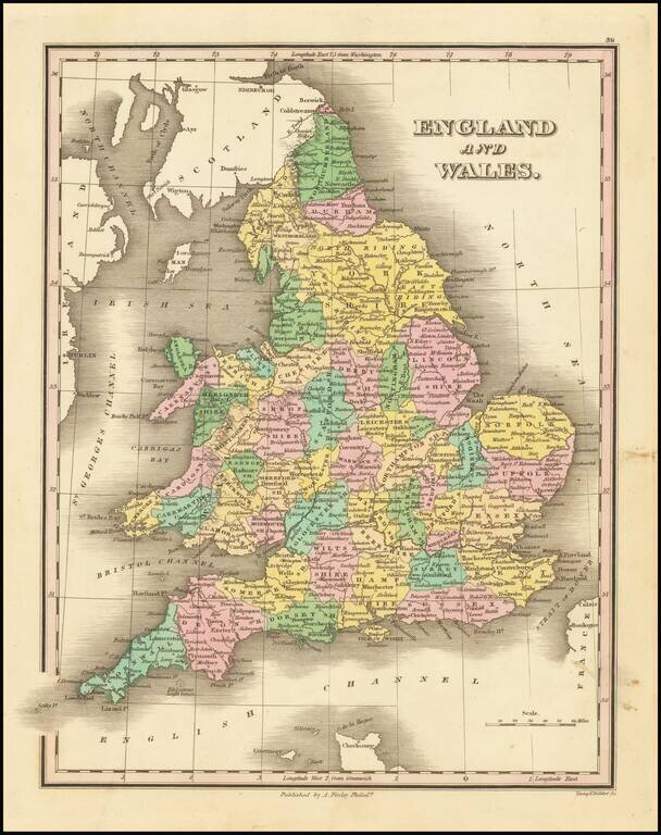
Decorative and detailed map of England and Wales, published in Philadelphia by Anthony Finley. The map is colored by counties.
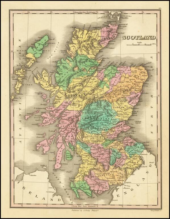
Decorative and detailed map of Scotland, colored by Counties, from Finley's New General Atlas. Wonderful color.
![Italy [shows Corsica, Sardinia, Sicily and Malta]](/map/small/67057.jpg)
Detailed map of Italy, Corsica, Sardinia, Sicily and Malta, colored by Kingdoms. The map appeared in an early edition of Finley's New General Atlas.
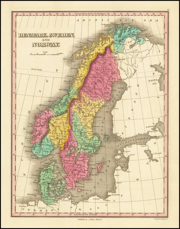
Decorative and detailed map of Scandinavia, colored by provinces, from Finley's New General Atlas. Wonderful color.
![[Sydney, Australia] Panorama du Port Jackson et de la ville de Sidney [i.e. Sydney], pris du'une colline pres de la riviere de Parramatta](/map/small/39898sb.jpg)
Rare single sheet French edition of this highly important panoramic aquatint view of Sydney, based upon Major James Taylor's 3 sheet panorama published in London, in 1823. This remarkable panorama is perhaps the earliest single sheet version of...