![[Western Australia] Carte de la Terre D'Edels et d'une partie De Celle D'Endracht (a la Nouvelle Hollande) Dressee Par M. L. Freycinet, Commandans la Goelette le Casuarina. (1801 & 1803) (Rare Separately Published Example)](/map/small/53267.jpg)
Rare Separately-Issued Chart of Western Australia from Freycinet's Surveys as Part of the Baudin Expedition Intricately detailed chart of the coastline of Western Australia, which until this time had only been sporadically encountered by Dutch ships...
![[Hunter Island / Tasmania] Carte des Iles Hunter dressee Par L. Freycinet, Commandant la Goelette le Casuarina, d'apres ses observations et celles de Mr. Boullanger Ingenieur Hydrographe -- December 1802. (Rare separately published example)](/map/small/53891.jpg)
Rare Separately Published Example of Freycinet's Rare and Separately Issued Chart of Hunter Island Striking separately published example of the Freycinet chart of Hunter Island, in the waters off Tasmania, or Van Diemen's Land. The chart is drawn...
![[]Hunter Island / Tasmania] Carte Trigonometrique des Iles Hunter dressee Par L. Freycinet, Commandant le Casuarina -- December 1802 (Rare Separately Published Example)](/map/small/53937.jpg)
Rare Separately-Issued Example of Freycinet's Trigonometric Survey of Hunter Island, off the Coast of Tasmania, the Earliest Detailed Charting of the Area Rare separately published example of this fine intricately detailed chart of the waters off...
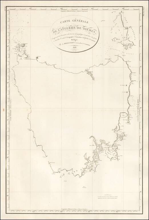
First Map of the Entire Island of Van Diemen's Land-Striking, Rare, Separately-Issued Chart of Tasmania from the Baudin Expedition Detailed chart of the island of Tasmania as surveyed during the Baudin expedition and published by expedition member...
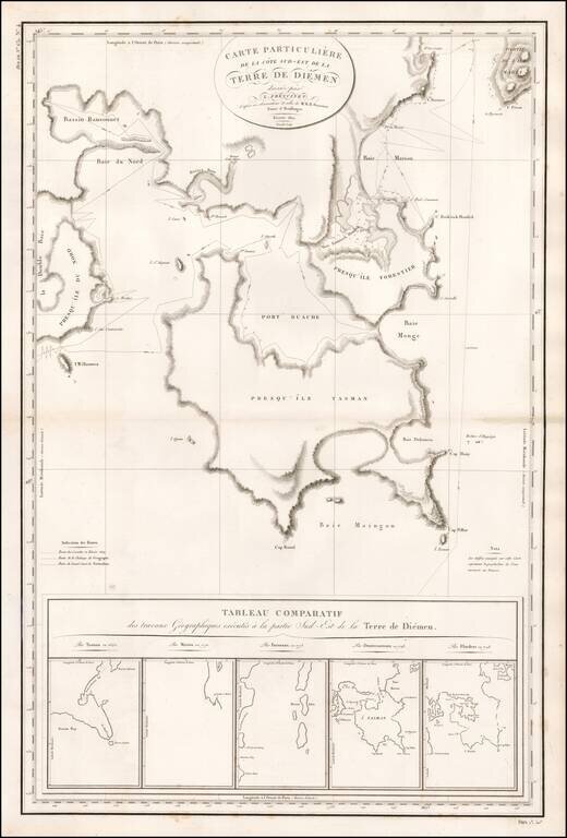
Rare, Detailed, Separately-Issued Chart of Southeast Van Diemen's Land from the Baudin Expedition Comprehensive chart of the southeast portion of the island of Tasmania as surveyed during the Baudin expedition and published by expedition member Louis...
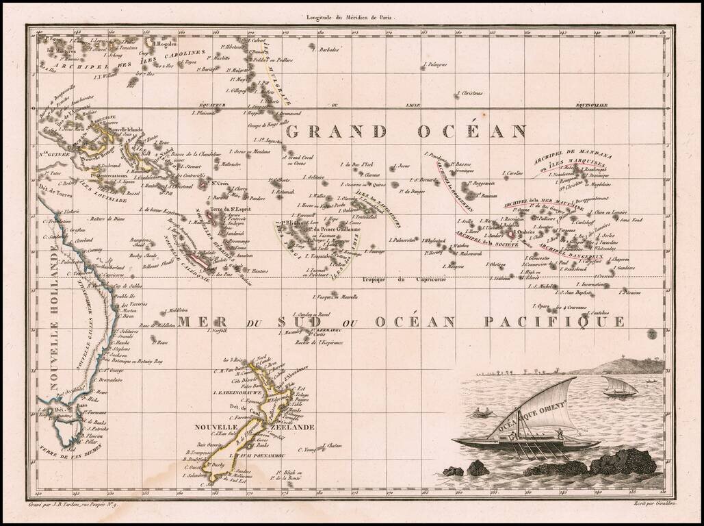
Decorative antique engraved map of the Eastern Pacific, from the Carolines, Eastern Australia, and Tasmania to the Marquesas, including all of New Zealand. Malte Brun's maps were extremely well researched, utilizing the most up to date information....