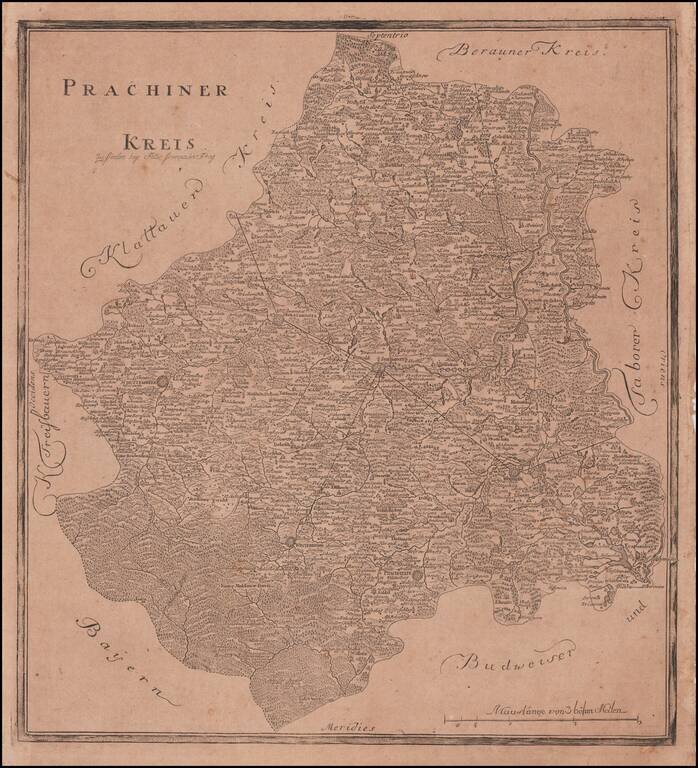
Rare Separately Published Map of Kauzim Province From The First Atlas of Bohemia Rare regional map of the Kaurzim Province, including Prag in the northwest, covering the central portion of the modern Czech Republic. The atlas contained 13 maps and...
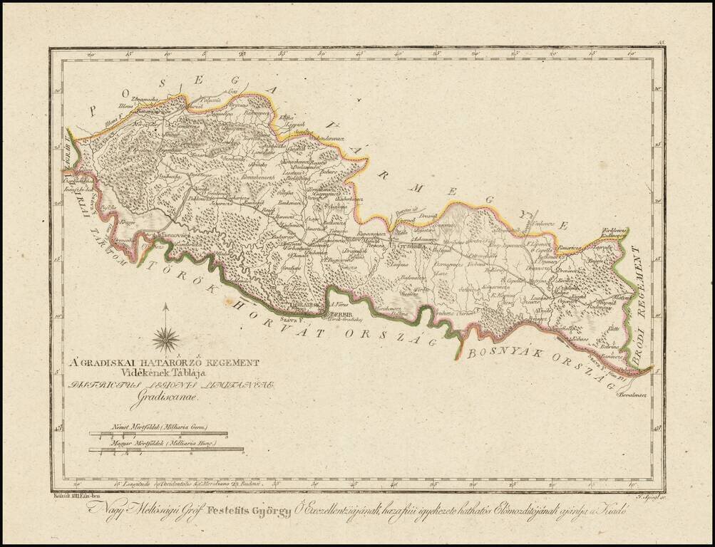
Finely engraved hand colored in outline map of the Gradisca region. Showing administrative boundaries, cities, towns, rivers, forests and mountains. Includes compass rose. Relief shown by hachures. The map is from Gorog's Magyar Atlas, the first...
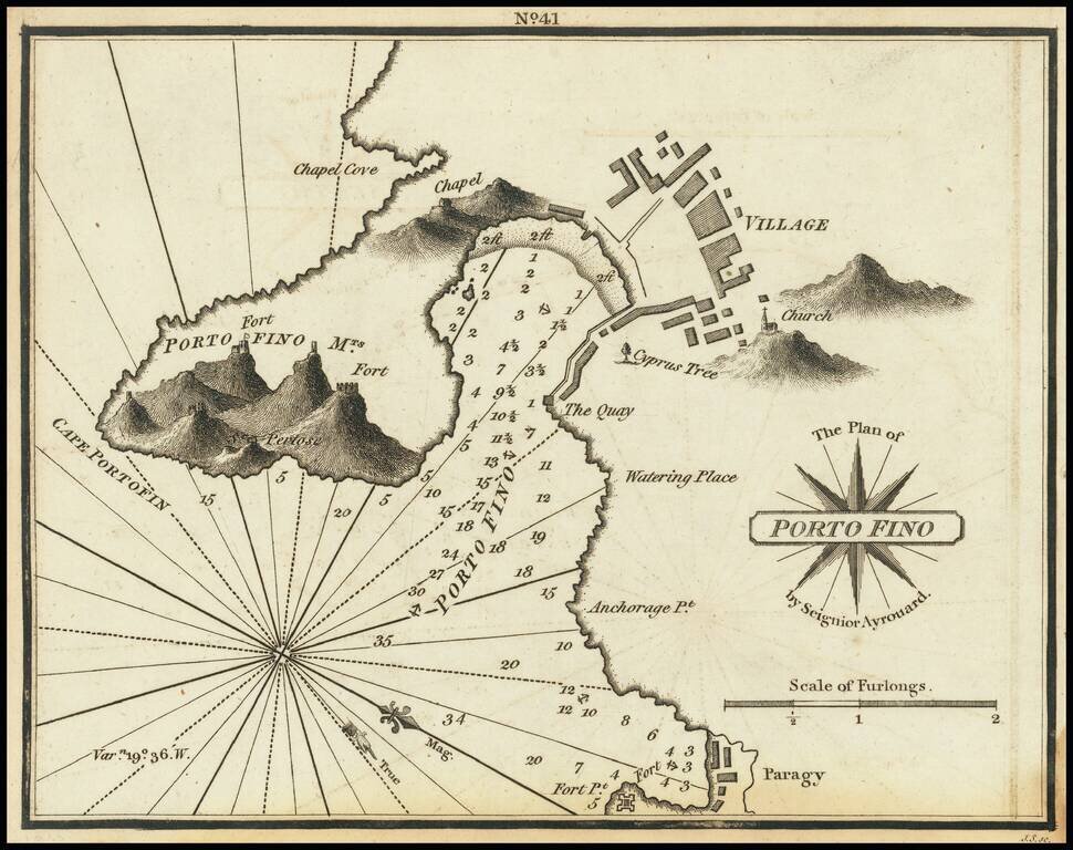
Rare chart of Portofino, Italy, published by William Heather in London. The chart is oriented with west at the top. Includes soundings, some topographical features, anchorages, a plan of the village, and several other points of interest. The chart...
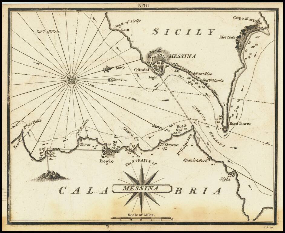
Rare chart of the Strait of Messina, separating Sicily and Calabria in Italy, published by William Heather in London. The chart is oriented with west at the top. It includes soundings, some topographical features, anchorages, and currents. The towns...
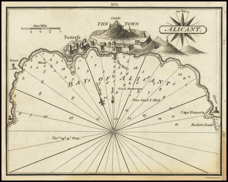
Rare chart of Alicante, Spain, published by William Heather in London. The chart is oriented with northwest at the top. Includes soundings, some topographical features, anchorages, a pictorial representation of the town and fortress, and several...
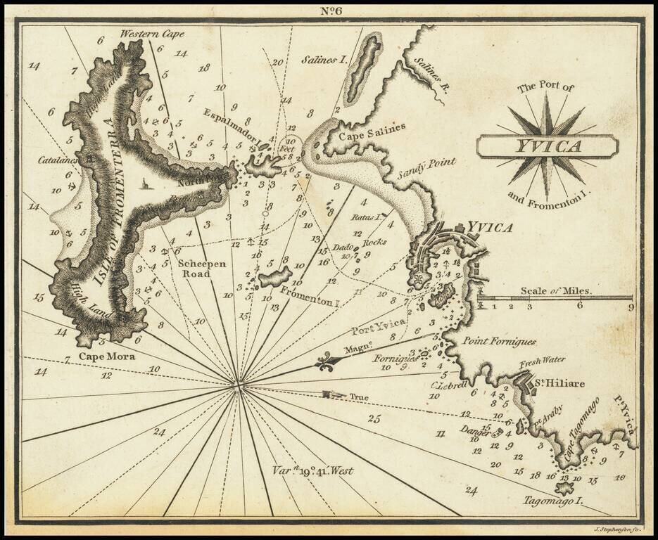
Very scarce miniature engraved chart of the town of Ibiza, on the Balearic Island of Ibiza. This is possibly the first English printed chart of the famous Spanish port city of Ibiza, now so well known for its world-class nightlife. The chart...
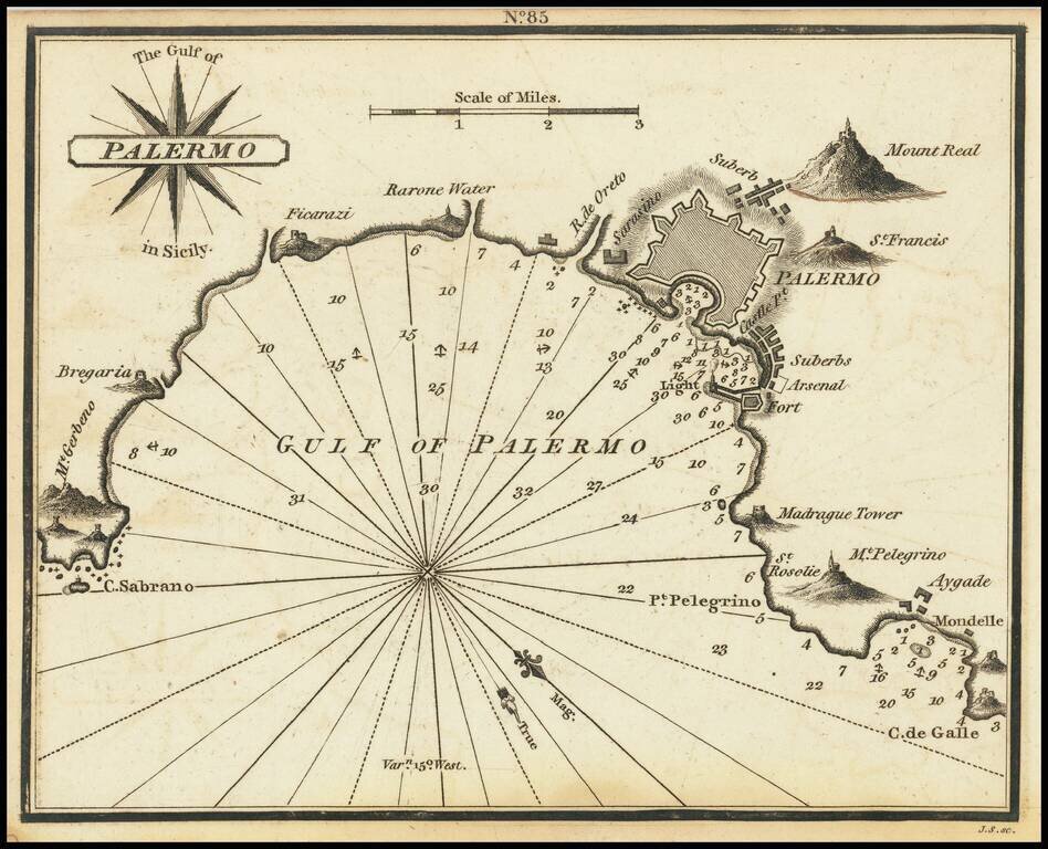
Rare chart of Palermo, published by William Heather in London. The chart is oriented with southwest at the top. It includes soundings, some topographical features, anchorages, and currents. Palermo is shown, along with several mountains. Rarity...
![[Greek Map of Philippines, Southeast Asia, China, etc.] Πίναξ γεώγραφικος της Ασιας (Pinax geographikos tis Asias)](/map/small/61785.jpg)
The present map is one sheet of a 4 sheet Greek language map of Asia, published in Vienna by Anthimos Gazi in 1802. The map is one of at least 4 maps created by Gazis in Vienna, as part of an effort to educate the Greek populous. Other maps include 4...

Highly detailed map of Egypt, the Holy Land and part of the Saudi Peninsula. Shows tracks of explorers and caravan routes. Key translates Arabic names. Includes Jerusalem in the east.
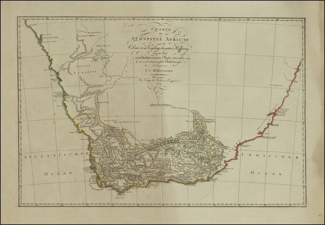
German edition of the First Modern Map of South Africa Detailed map of South Africa, published in Weimar in 1802, based upon a map produced by Sir John Barrow, which is considered the first modern map of South Africa. The map shows the settled and...
![[Nicolas Sanson] Nicol. Sanson. Konigl. Historiograph u. Geograph Geb. zu Abbeville d. 20 Dec. 1600 Gestorb. zu Paris d. 7 Jul 1667](/map/small/69289.jpg)
Rare miniature portrait of French mapmaker, Nicolas Sanson, published in Weimar by Westermayr. This is the first time we have ever seen this portrait.
![[Daniel Friedrich Sotzmann] D. F. Sotzmann Geh. exped Secretair beym Ingen. Depart. u Geograph dur Academie der Wissenschaften zu Berlin](/map/small/69324.jpg)
Rare miniature portrait of German mapmaker Daniel Friedrich, published in Weimar by Westermayr. This is the first time we have ever seen this portrait.