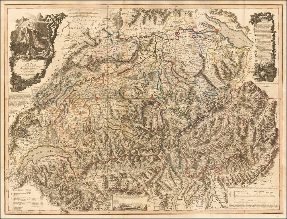
Scarce large format map of Switzerland and Northern Italy. The map is a remarkable depiction of the topography of the region, reminiscent of the work of Cantelli and Rossi at the end of the 17th Century. The map reflects the art of map printing at...
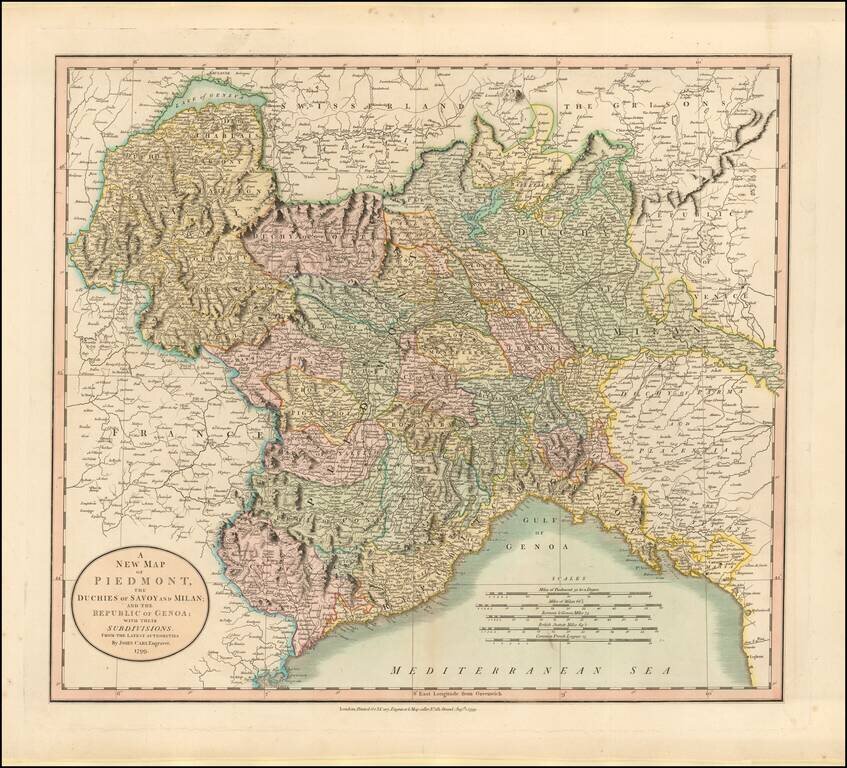
Detailed map regional map of Northwestern Italy, hand colored by provinces. Shows roads, rivers, lakes, mountains, towns, etc. One of the best large format English atlas maps of the period.
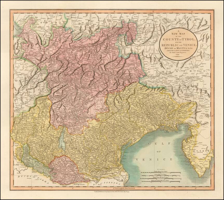
Detailed regional map of the area north of the Gulf of Venice, hand colored by provinces. Shows roads, rivers, lakes, mountains, islands, towns, etc. One of the best large format English atlas maps of the period. Gorgeous wide margined example.
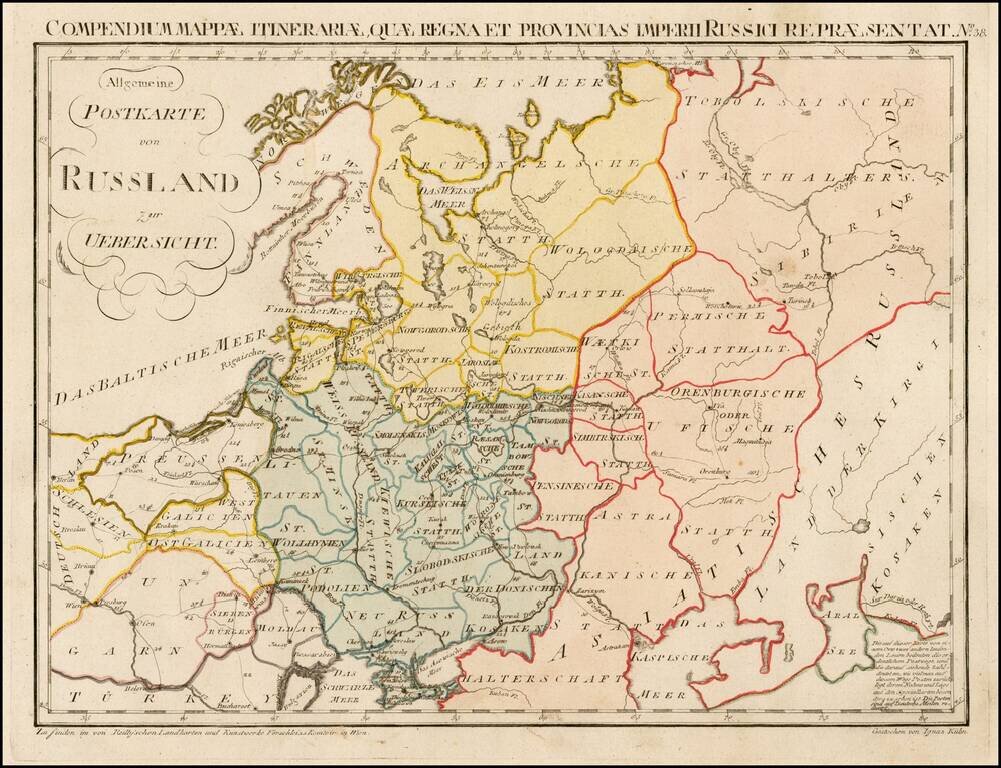
Rare postal map of the Russian Empire, which appeared in Von Reilly and Kuhn's Atlas Universae rei veredariae bilinguis ... Allgemeiner Postatlas von der ganzen Welt . . . , published in Vienna in 1799. Von Reilly & Kuhn's atlas is the first...
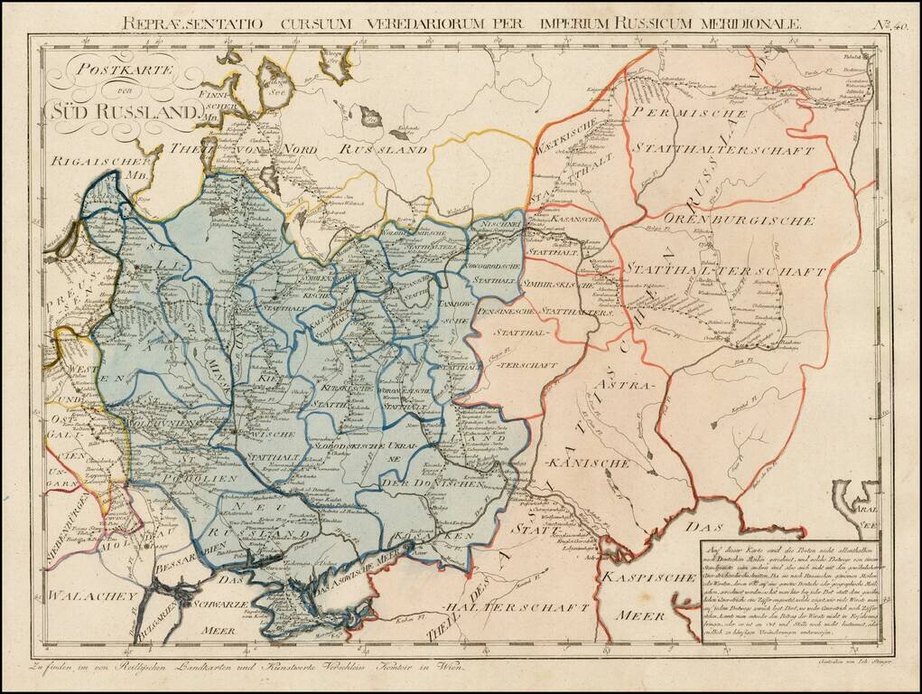
Rare postal map of Ukraine and Southern Russia, which appeared in Von Reilly and Kuhn's Atlas Universae rei veredariae bilinguis ... Allgemeiner Postatlas von der ganzen Welt . . . , published in Vienna in 1799. Von Reilly & Kuhn's atlas is the...
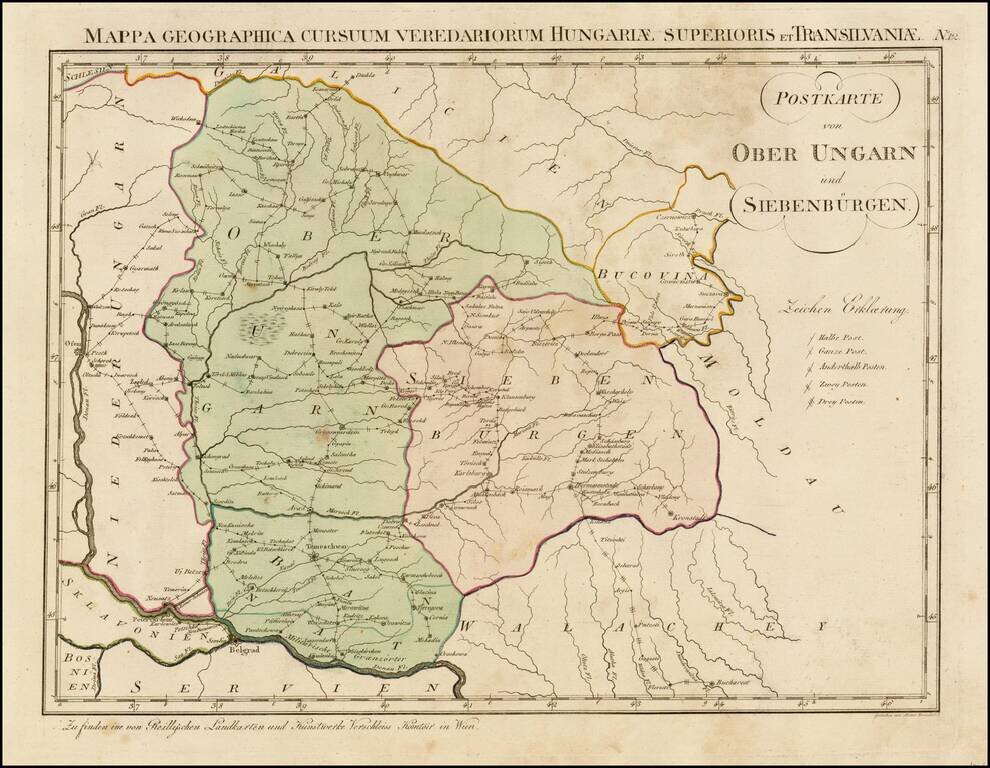
Rare postal map of Hungary, which appeared in Von Reilly and Kuhn's Atlas Universae rei veredariae bilinguis ... Allgemeiner Postatlas von der ganzen Welt . . . , published in Vienna in 1799. Von Reilly & Kuhn's atlas is the first postal atlas of...
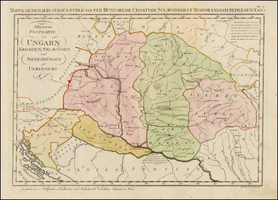
Rare postal map of Eastern Hungary, Slovenia, Croatia, Transilvania, and parts of Romania, Serbia, Bosnia, Galitzia and Bukowina, which appeared in Von Reilly and Kuhn's Atlas Universae rei veredariae bilinguis ... Allgemeiner Postatlas von der ganzen...
![[9 Sheet Map of Iberian Peninsula] Carte D'Espagne et de Portugal en Neuf Feuilles . . .](/map/small/66894.jpg)
Fine large map of the Iberian Peninsula, from the period of the Anglo-Spanish War. The map is quite remarkable in its details, most notably its extensive treatment of roads and in some cases a curious number system which we could not decipher.
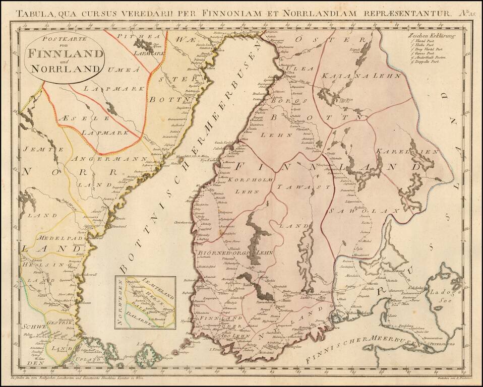
Rare postal map of Finland and part of Norway, which appeared in Von Reilly and Kuhn's Atlas Universae rei veredariae bilinguis ... Allgemeiner Postatlas von der ganzen Welt . . . , published in Vienna in 1799. Von Reilly & Kuhn's atlas is the...
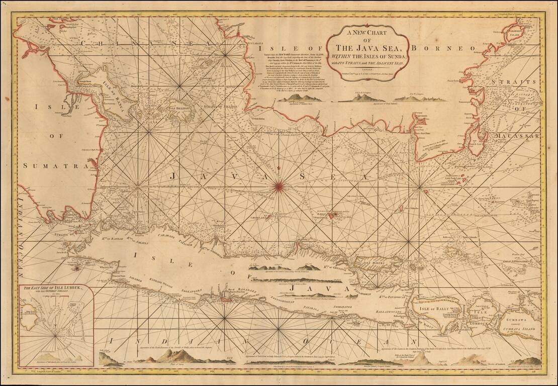
Detailed sea chart of the region from the southern part of Borneo, Sumatra and Pulau Bangka to Java, Bali and the islands to the east, published in London by Laurie & Whittle. The chart includes sailing direction, numeous profile views of the...
![[Philippines, Indonesia, Brunei, Malaysia, Singapore]](/map/small/68224.jpg)
Decorative map of the Southern Philippines, Indonesia, southern Malaysia, Singapore, Brunei, etc, published by Zatta. The map is bottom left sheet of a 4 sheet map of the region, but was issued as a separate sheet in Zatta's atlas. Antonio Zatta was...
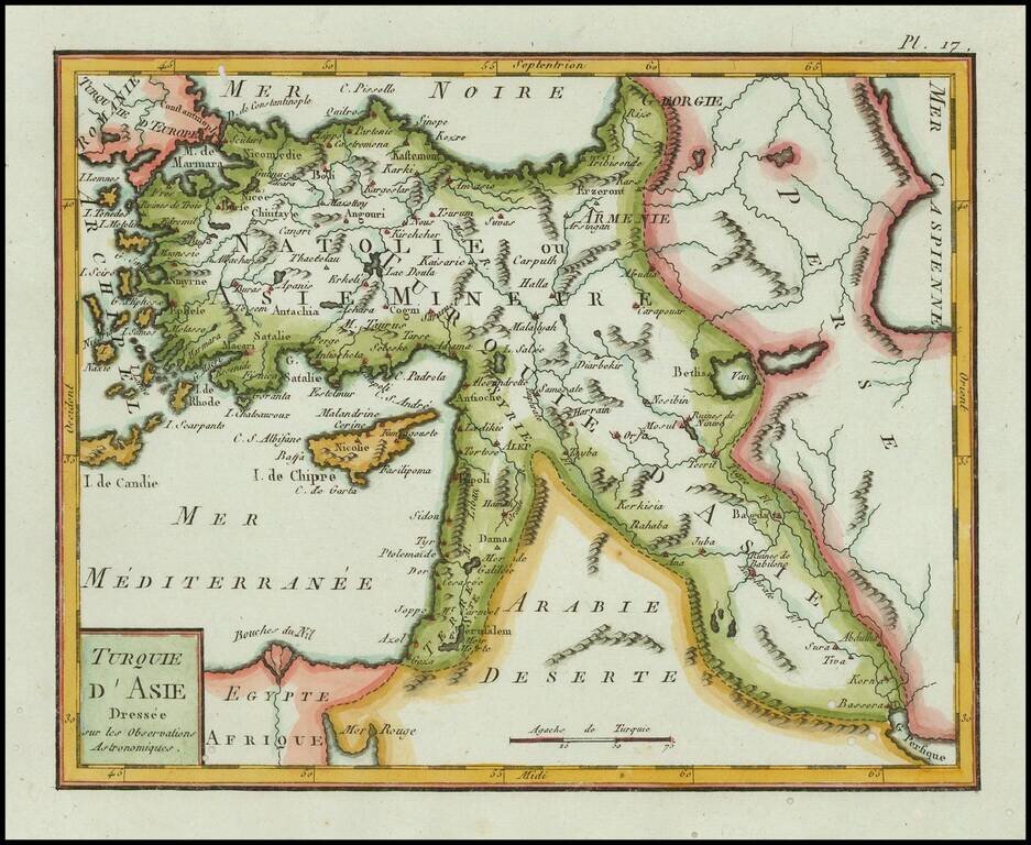
Finely engraved map of Asia Minor and Cyprus, published by Citoyen (Citizen) Berthelon in Paris, for the "Nouvelle Edition" of the Atlas Modern Portatif. . . . The Atlas Moderne Portatif was one of the most popular geographical atlases published at...