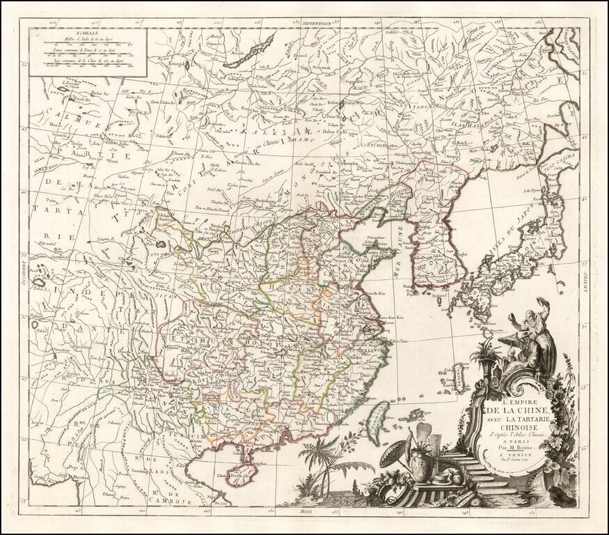
Fine large format map of China, based in part on information derived from Bonne's Atlas of China. The map shows all of China, with outline color for the provinces, and a decorative thematic cartouche.
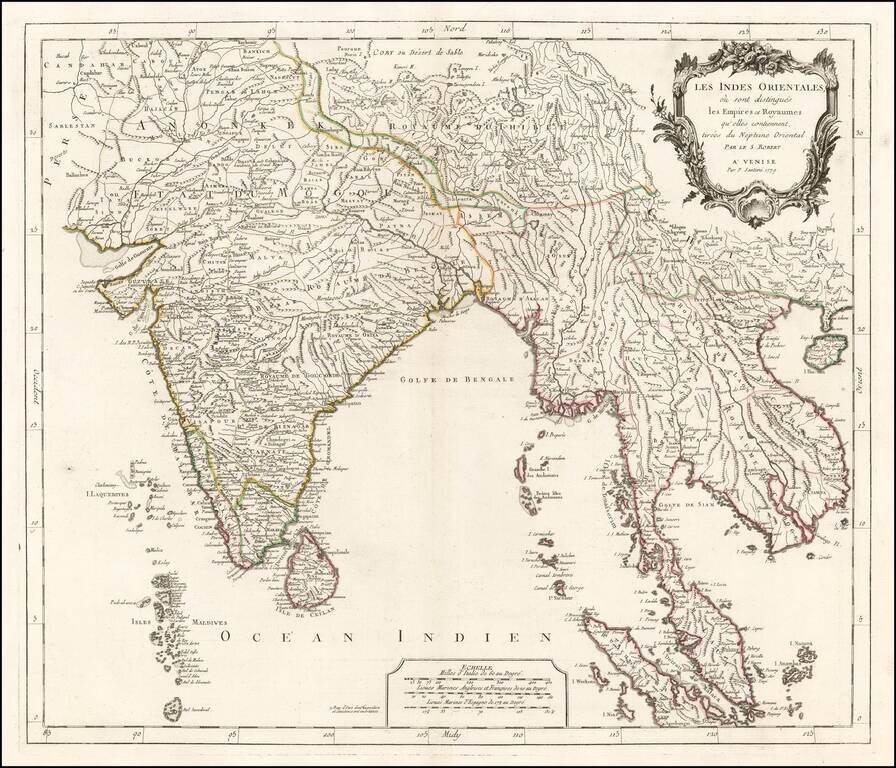
Detrailed map of India and Southeast Asia, published in Venice by Paolo Santini. The map extends from the Kingdom of Tibet and northern India to the Maldives and the Straits of Malacca. Includes islands, towns, mountains, rivers, lakes and a host of...
![[Java Sea, Java and Parts of Sumatra, Borneo, Bali & Madura]](/map/small/0249gh.jpg)
Rare seperately published English Sea Chart of the Java Sea, Java and parts of Borneo, Bally and Sumatra, with an inset map of part of the Island of Lubeck, published by William Herbert. Herbert is perhaps best known for his A New Directory for the...
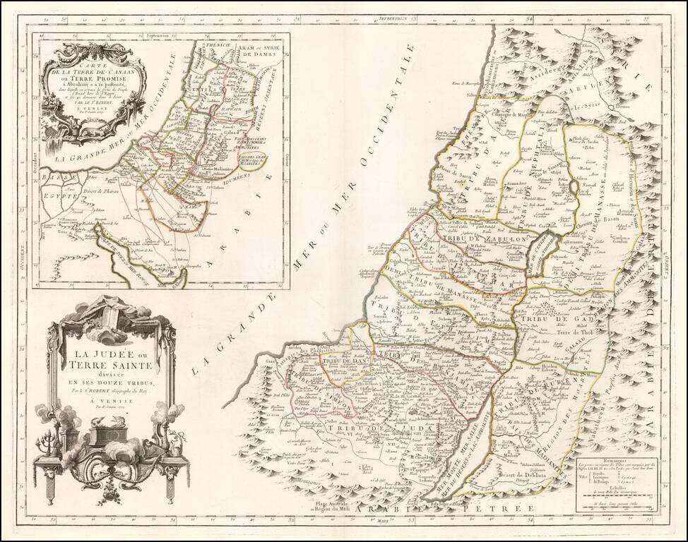
Fine large format map of the Holy Land, published in Venice, in 1779, by Santini and engraved by Remondini. The map presents a fine detailed depiction of Judea or the Holy Land, divided into the regions controlled by the 12 Tribes of Israel. A large...
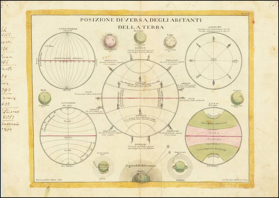
Scarce set of five spheres and eight drawings of the known planets, the sun and the moon. The large central sphere describes the spatial relationship of the "Residence of the Land" on different parts of the Earth. Saturn is shown with five satellites...