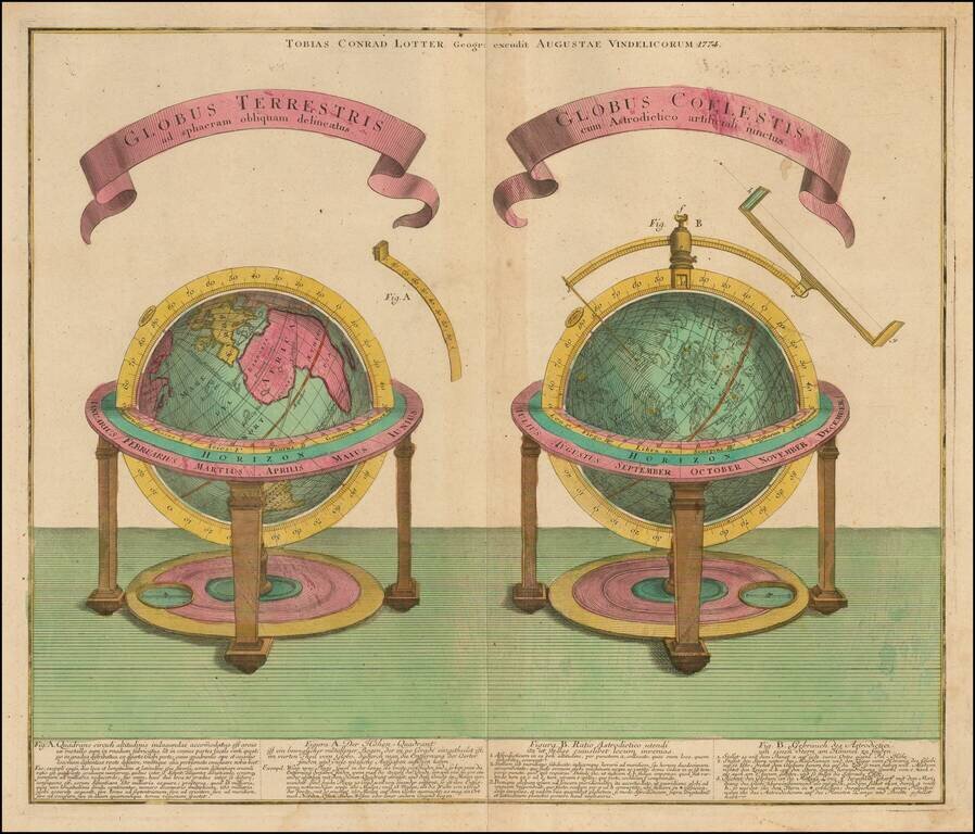
Finely engraved celestial and terrestrial globe, published in Augsburg by T.C. Lotter in 1774. Each of the spheres is described below the image in both Latin an German.

Interesting map of the Western Hemisphere showing explorers routes with dates, an early New Zealand and one very curious anomaly. At first look, the NW Coast of America has been updated to include the entire western coastline above Capo Mendocino and...
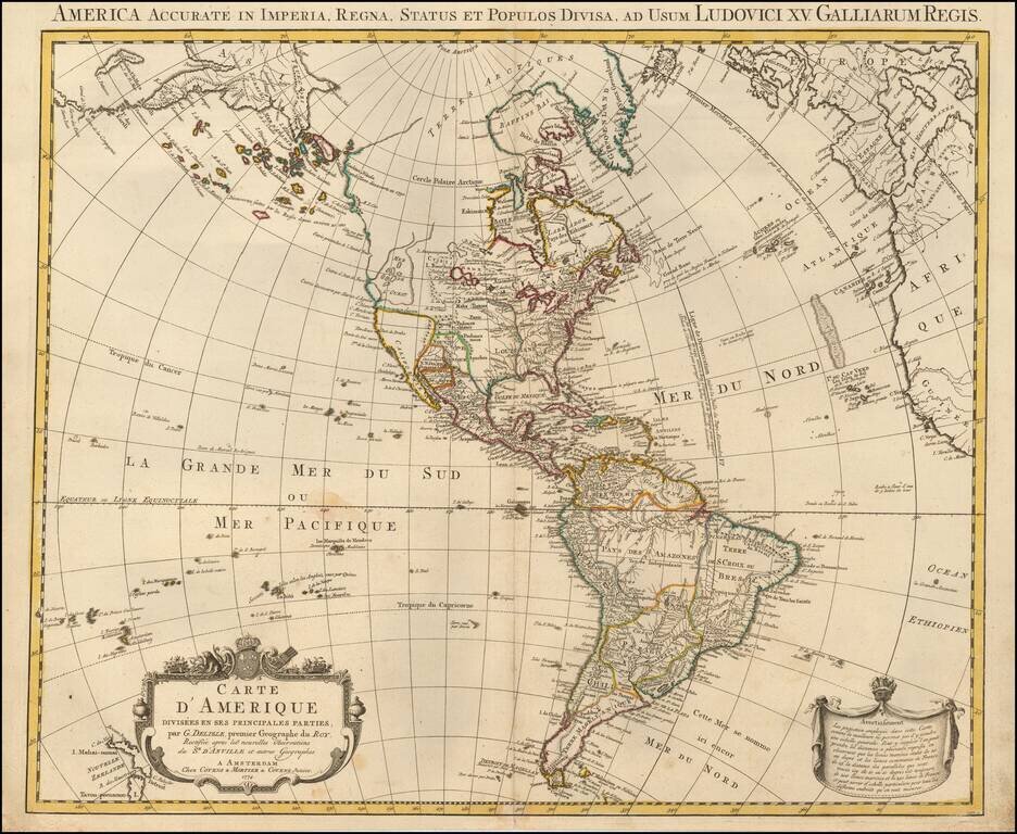
Rare Late State of De L’Isle's Map of America, Showing the Sea of the West and Recent Russian Discoveries A Covens & Mortier state of De L’Isle’s map of the Americas, with revisions to 1774. The map borrows from many contemporary sources,...
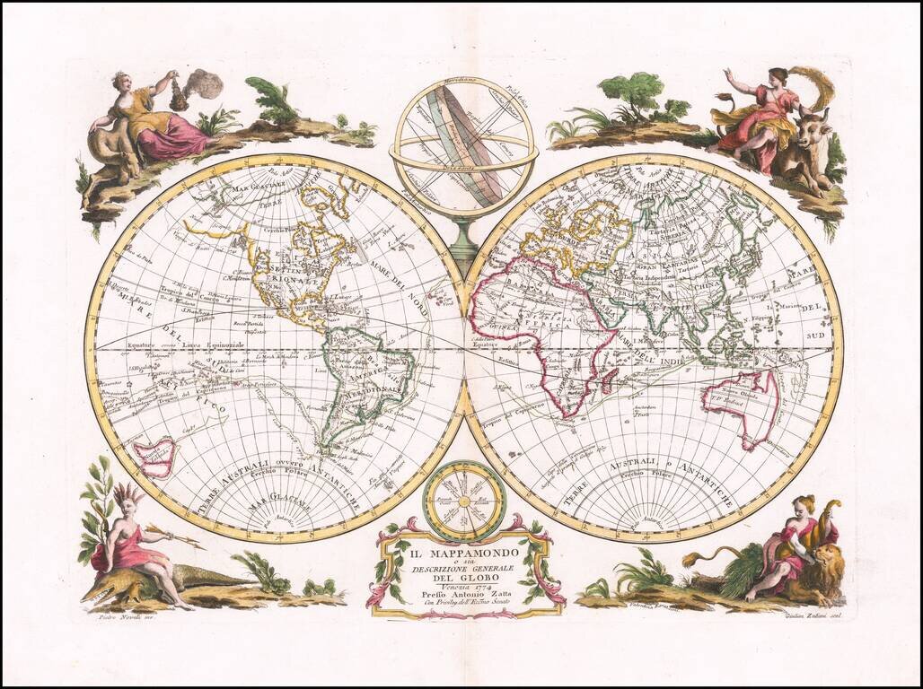
First edition of Antonio Zatta's decorative double hemisphere map of the World, published in Venice in 1774. Includes allegorical vignettes of the 4 continents, embellishing the outer corners. The map depicts the recent discoveries of Captain James...
![[Port Louis, Mauritius] Legende du Plan du Port-Louis](/map/small/51740.jpg)
Handsome and highly detailed manuscript map of Port Louis, the capital of Île-de-France (present-day Mauritius), done in pen and watercolor, showing the town, surrounding countryside, and the harbor, with many points keyed and identified in the...
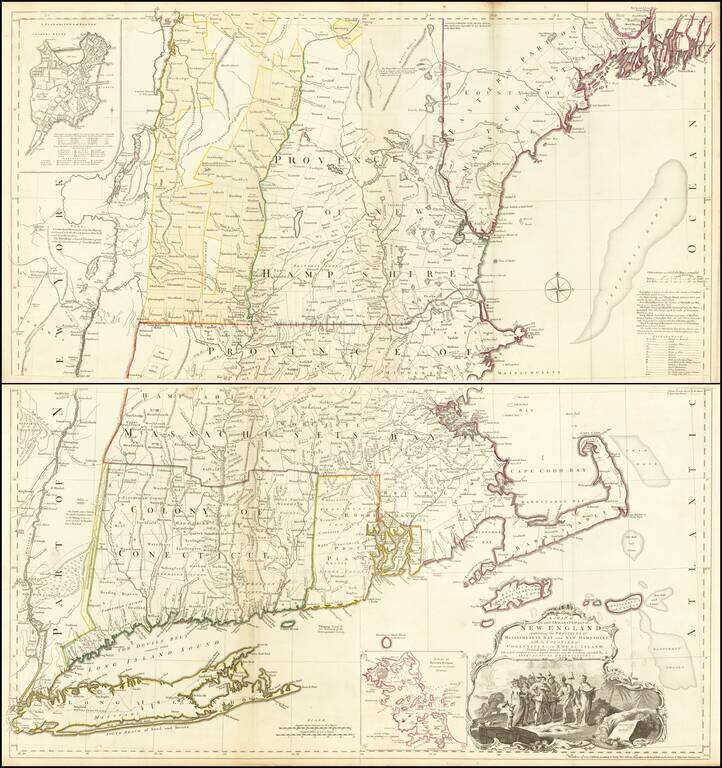
The Most Important Map of New England At The Time of the American Revolution Nice example of Bradock Mead's remarkable large format map of New England & Long Island, the most important general map of the region at the commencement of the...

Rare Dutch Edition of Didier Robert De Vaugondy's Comparative Cartographic Gem -- The Final De Vaugondy Map In The Greatest Cartographic Debate of the 18th Century Didier Robert De Vaugondy's Nouveau System Geographique . . . represents the final...
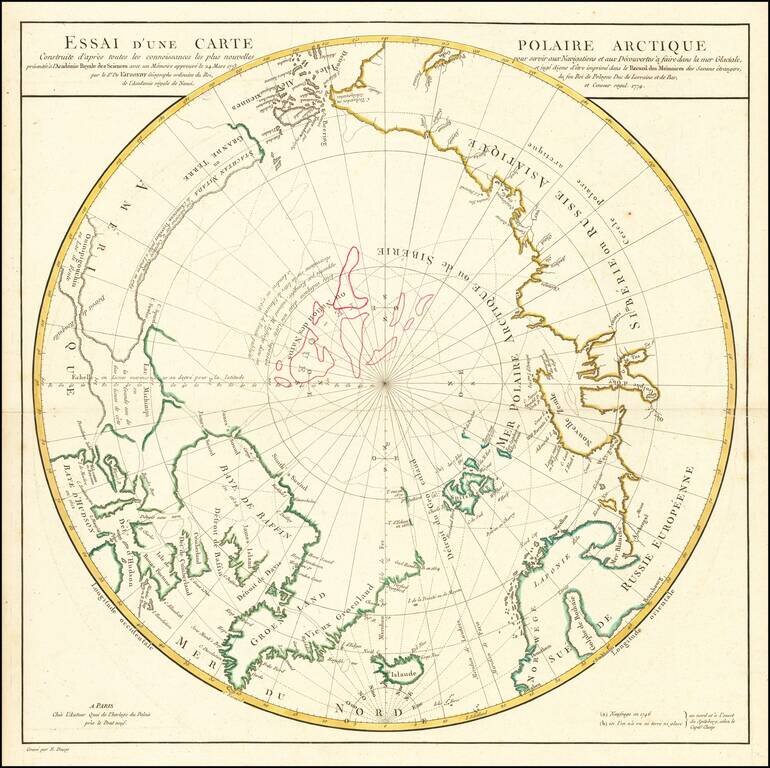
A Cartographic Landmark -- De Vaugondy's Presentation to the French Royal Academy on the Most Practicable Sailing Routes to the Pacific via the North Polar Regions Extremely rare polar map produced to illustrate a presentation made by Didier Robert...
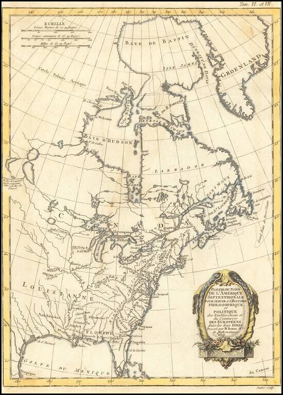
Decorative map of North America, published in 1774. The map extends west to include Texas and much of the supposed course of the Missouri, north to a mythical set of lakes referenced as the supposed location of the Sea of the West. Includes Indian...
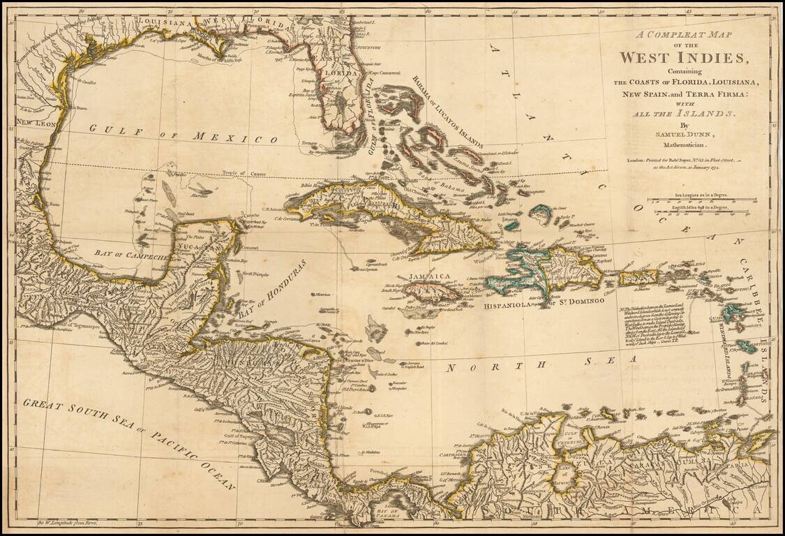
Detailed map of the West Indies, Florida, the Gulf Coast, Central America and part of Meixco.
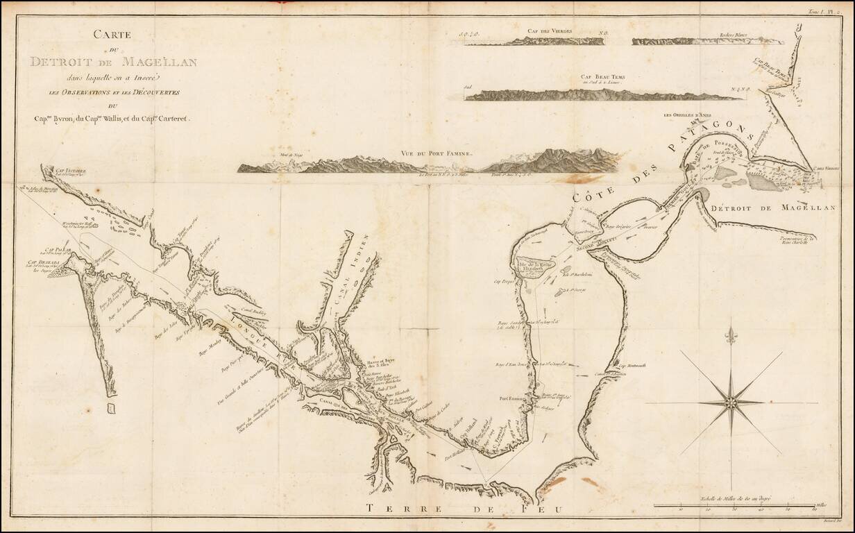
Rare chart of the Straits of Magellan from the Relation des Voyages Entrepris par Ordre de sa Majeste Britannique, the French edition of the official account of the first voyage of James Cook. The chart details the Straits of Magellan and the truly...
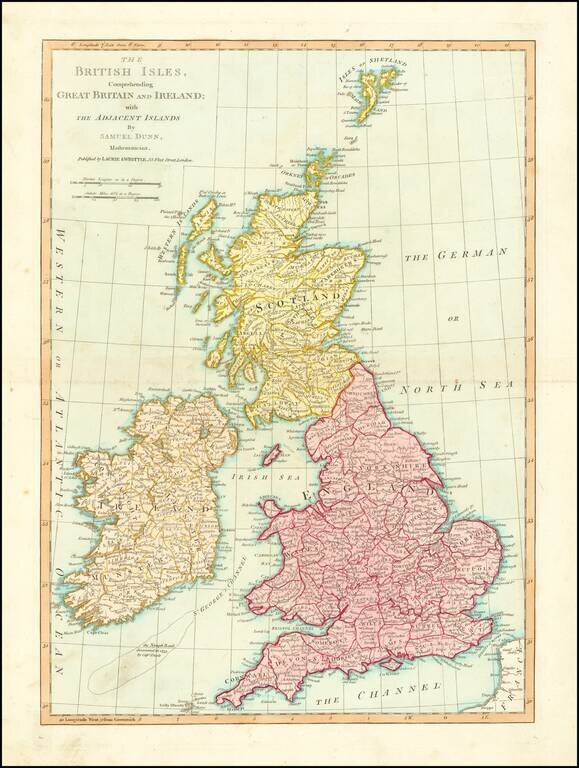
Nice detailed map of the British Isles, colored by counties. Includes towns, roads, mountains, rivers, lakes, islands, etc. From Dunn's New Atlas or Mundane System of Geography.
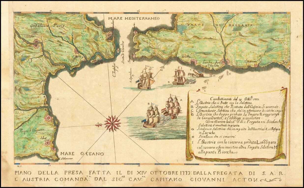
Map illustrating a battle between the Tuscan Navy and the Barbary pirates. The Tuscans, aboard the S.A.R. Austria, were led by Captain Giovanni (John) Acton. The key at the right provides details of the battle. Sir John Francis Edward Acton VI,...
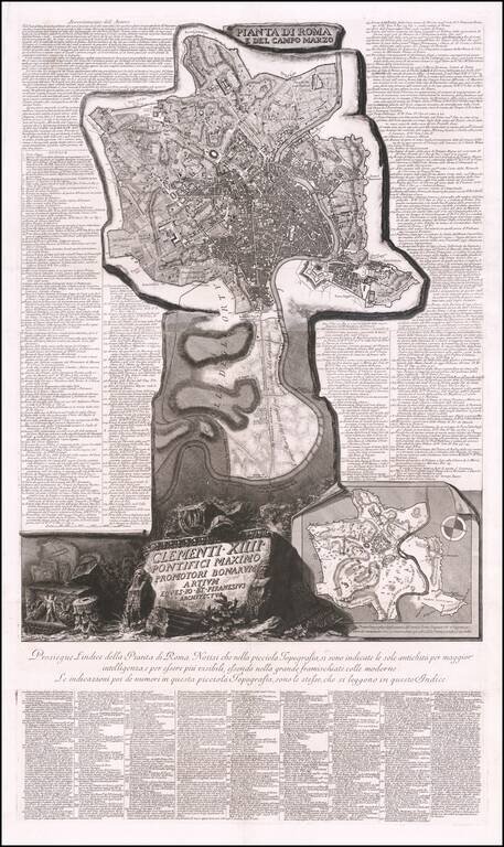
Fine example of Piranesi's remarkable modern map of Rome, dedicated to Pope Clement XIV. First issued in 1774, the map is oriented with south at the top. Piranesi's remarkable large format map shows the modern city of Rome within Aurelian Walls,...
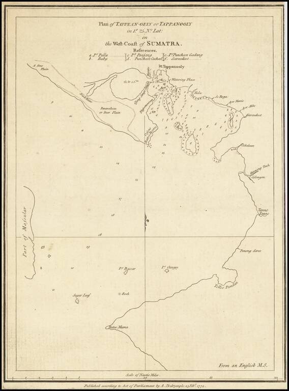
Rare early chart of Sibolga Bay and vicinity, on the west coast of Sumatra. The map notes that it is published from an English manuscript map. Alexander Dalrymple served as the first hydrographer to the admiralty from 1795 - 1808.
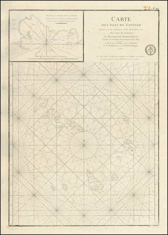
Detailed map of the Cape Verd Islands, with a large inset "Plan de la Rade de Praye" on the Island of S. Yago. Excellent and highly detailed chart from the Depot de la Marine, which was then perhaps the most prolific of all sea chart makers in the world.