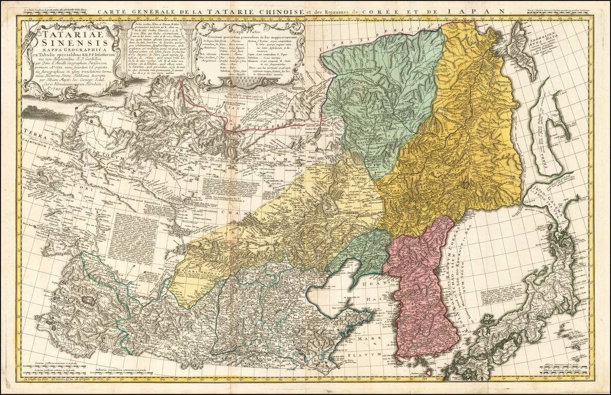
A scarce and interesting regional map of Chinese Tartary, extending from the Gobi Desert in the West to Mongolia in the East. Includes extensive notes and explanations in Latin. Based upon D'Anville's seminal work in 1732 map. The map Includes far...
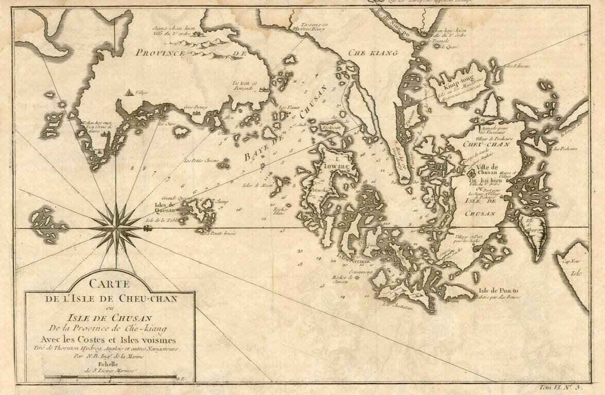
Detailed map of the area east of Ningbo in the Chinese province of Chekiang, located across the bay from Shanghai. The compass rose orients the chart with north to the right.
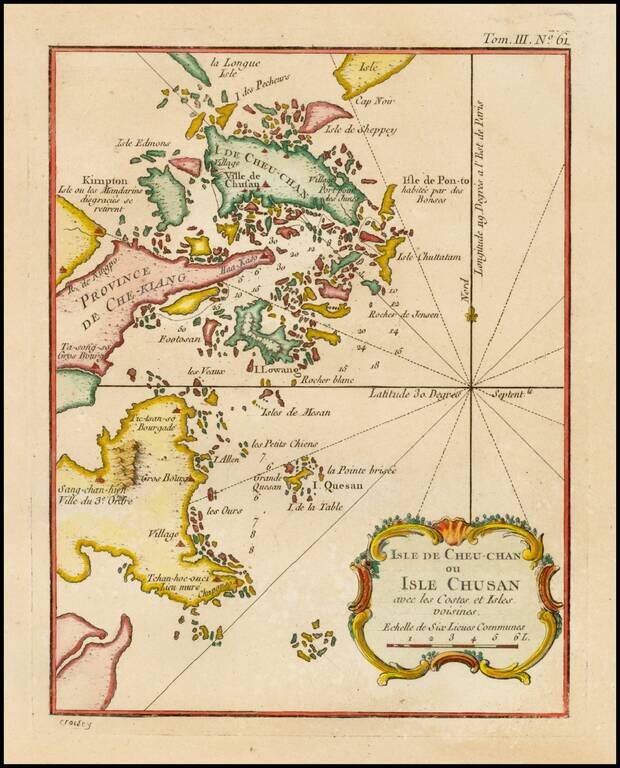
Detailed map of the area east of Ningbo in the Chinese province of Chekiang, located across the bay from Shanghai.
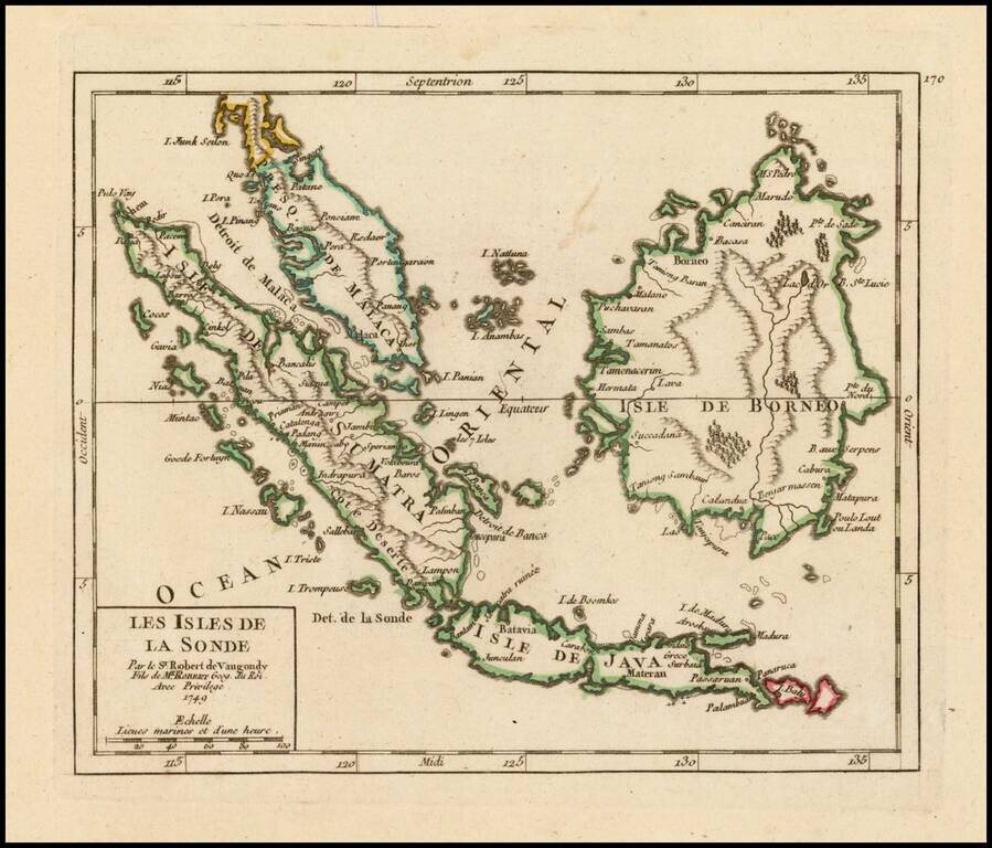
Attractive map of the Straits of Singapore, Sumatra, Java, Malaca, Borneo and neighboring islands, showing towns, harbours, bays, and other details. The map appeared in De Vaugondy's Atlas Portatif.
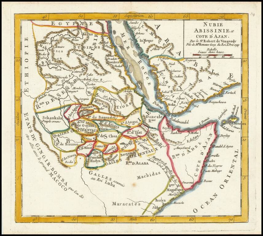
Detailed map of part of the area centered on the Red Sea and the Horn of Africa, featuring modern-day Somalia and Ethiopia. The map features numerous small kingdoms, including the "Rme. de Magadoxo" in Somalia, presumably related etymologically to...
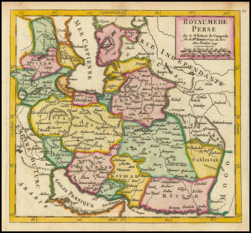
Detailed map of Persia, showing the extent of its territory from the border with the Mogol Empire to the Caucasus and the eastern side of the Caspian Sea. Internal regions are named and colored individually.
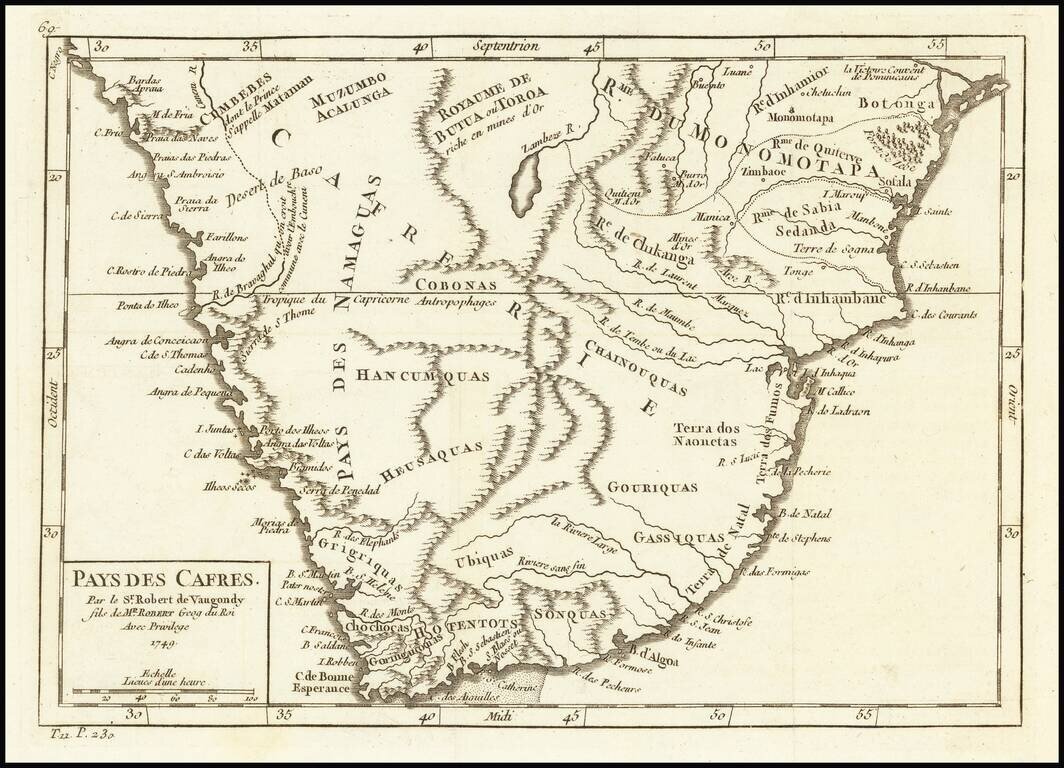
Attractive map of South Africa, from this popular atlas of the mid-18th Century.
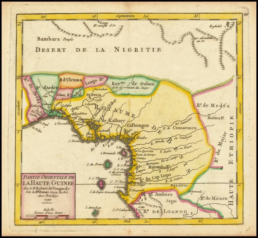
Detailed map of the Gulf of Guinea, published in Paris in 1749 Includes all or part of the modern countries of Ghana, Togo, Benin, Nigeria, Cameroon, Equatorial Ginea and Gabon, which at the time was primarily the "Kingdom of Benin."