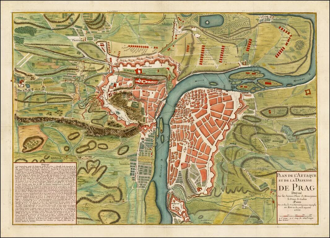
Finely executed battle plan, showing the Siege of Prague in 1742. French forces first under the command of de Broglie were surrounded by a large Austrian army in June 1742. A French relief column forced the Austrians to partially lift the siege in...
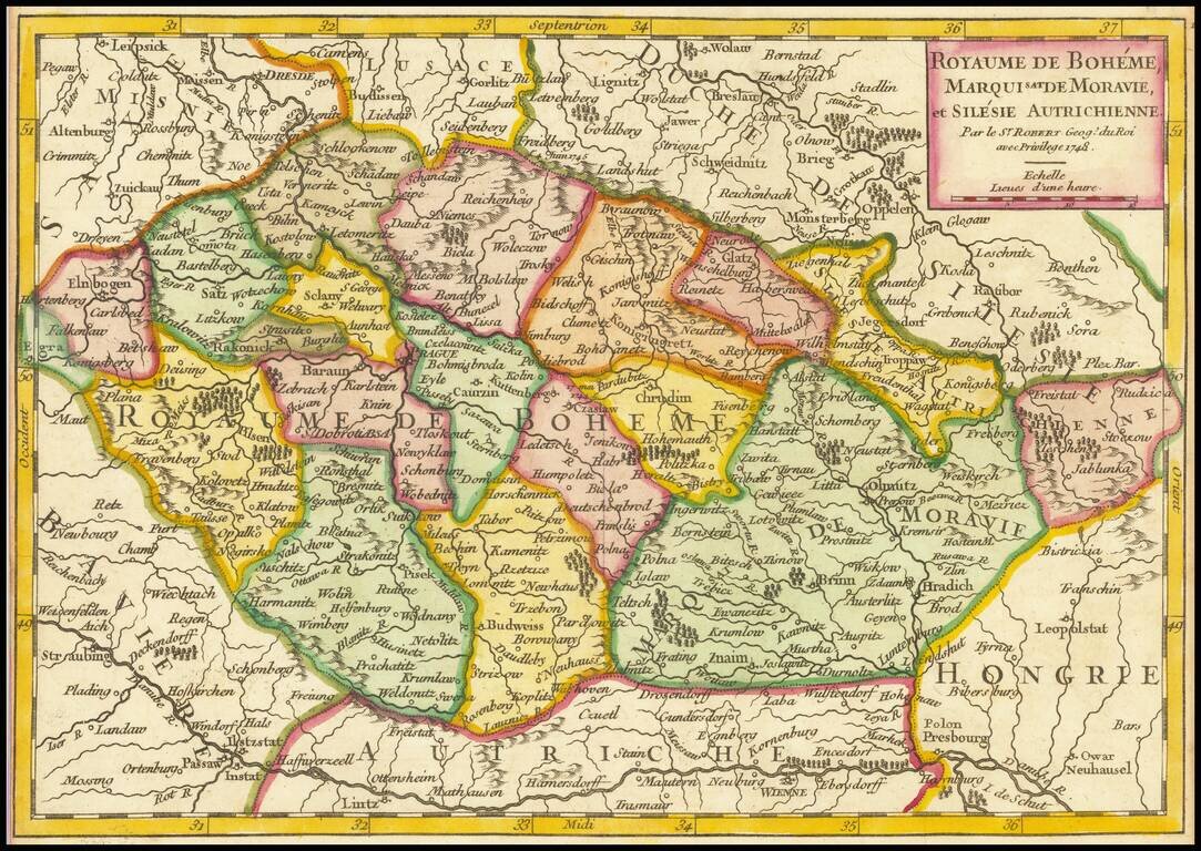
Detailed map of the Bohemia, Moravia and Austrian Silesia, published in De Vaugondy's first atlas.
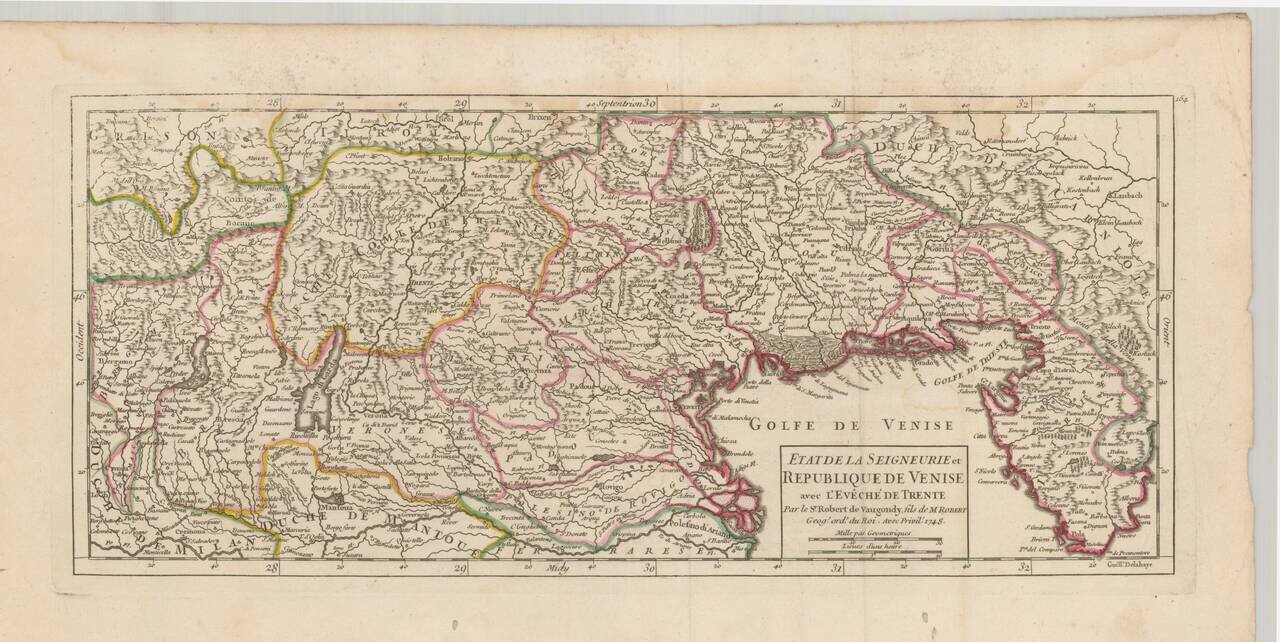
Striking example of De Vaugondy's map of the northeast part of Italy and neighboring Balkan regions, from his Atlas Portatif, Universel et Militaire. . . , first published in Paris in 1748. The map extends from Bergamo and Milan in the west to...
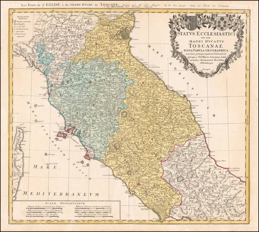
Nice example of Homann's second map of Central Italy, from Ferrara, Parma and Cremona to Territorium Romanum, centered on Florence and Sienna and showing Rome. Includes 2 coats of arms and other details.
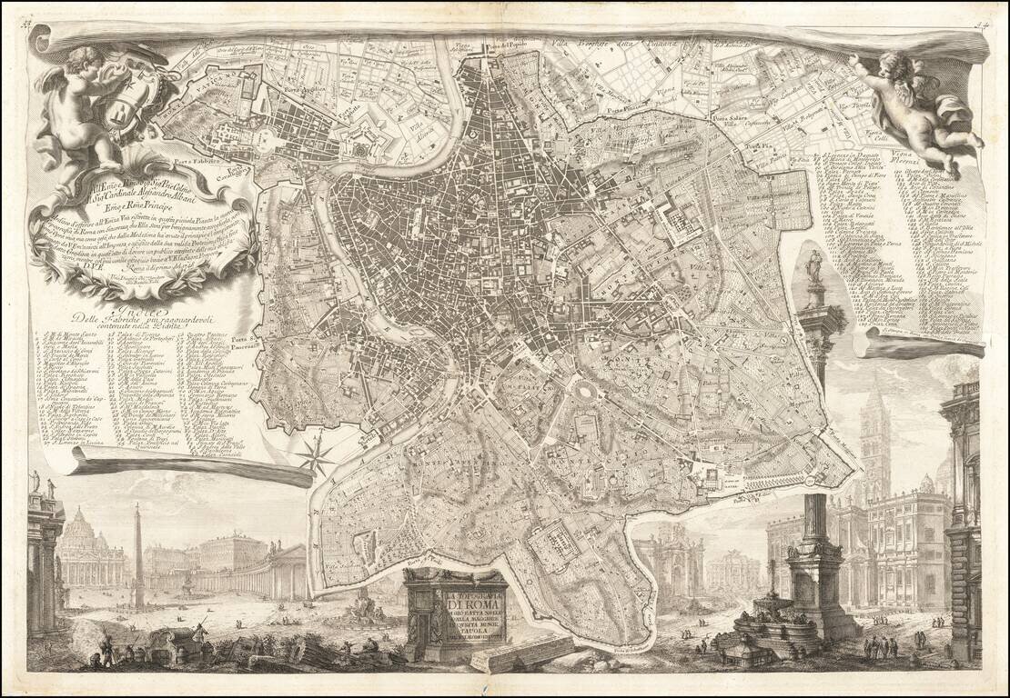
Piranesi's Map of Rome Nice example of this celebrated plan of Rome, engraved by Giovani Battista Nolli and Charles Nolli, with decorative elements engraved by Giovanni Battista Piranesi. The map shows the center of Rome in great detail, lying on a...
![Les Isles Canaries . . . [With inset map of the Islands of Madeira and Porto-Santo]](/map/small/70853.jpg)
Detailed map of the Canary Islands, from De Vaugondy's Atlas Portatif, Universal et Militaire. Large inset of Madera and Porto Santo. Lots of place names shown.
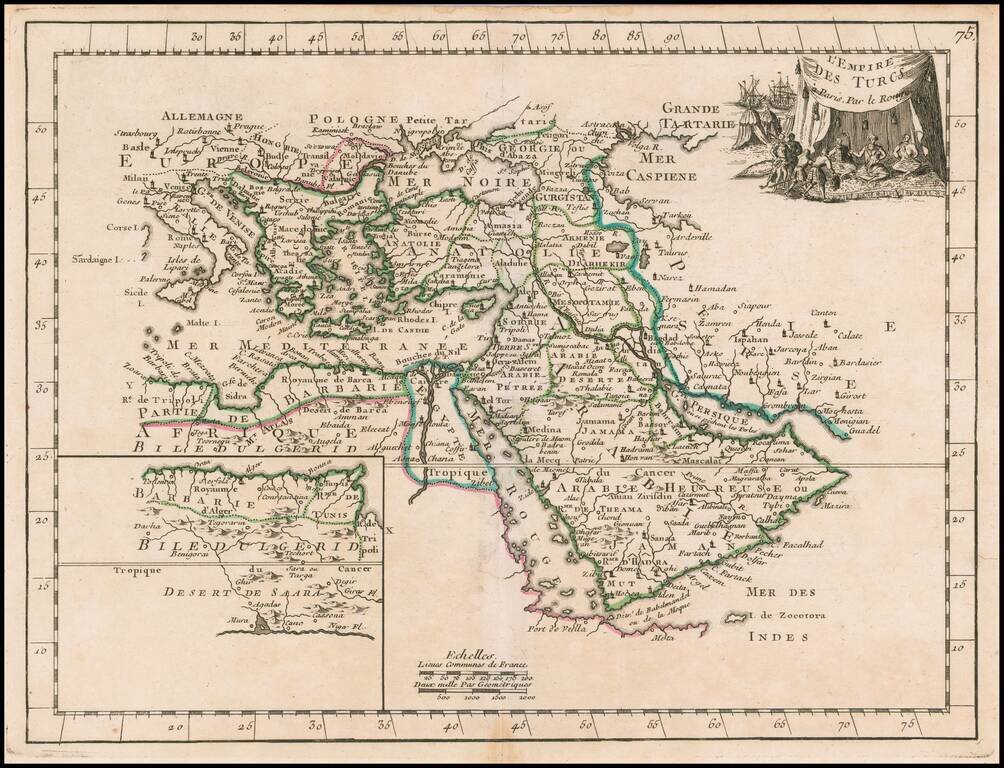
Scarce map of the Turkish Empire, from Le Rouge's Atlas Nouvel Portatif . . . , first issued in Paris in 1748. Includes a fine decorative cartouche.
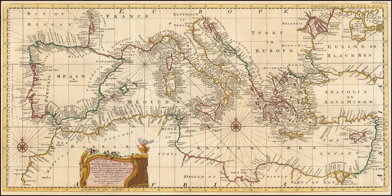
Fine example of Bowen's map of the Mediterranean and contiguous regions, from Harris' Navigantorum. The map is done in the Portolano style, focusing on coastal features. Hundreds of placenames and fine detail throughout. Decorative cartouche and 2...
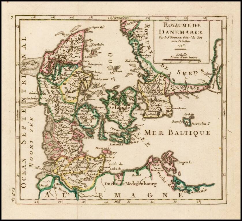
Detailed map of Denmark, colored by Dioceses, and showing towns, rivers, mountains, ports, islands, etc. From De Vaugondy's Atlas Portatif.
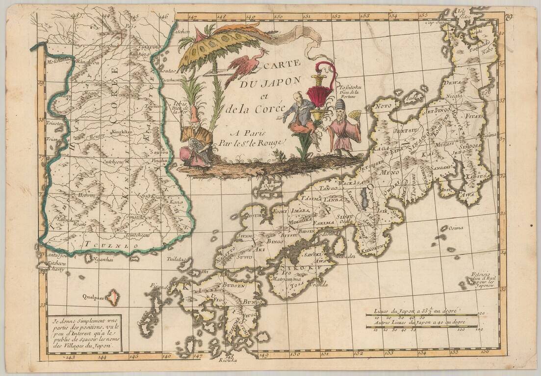
Scarce map of Japan and Korea, from Le Rouge's Atlas Nouvel Portatif . . . , first issued in Paris in 1748. Japan is divided into its provinces, with mountains, lakes and rivers named. Korea includes major cities, lakes, rivers and mountains....
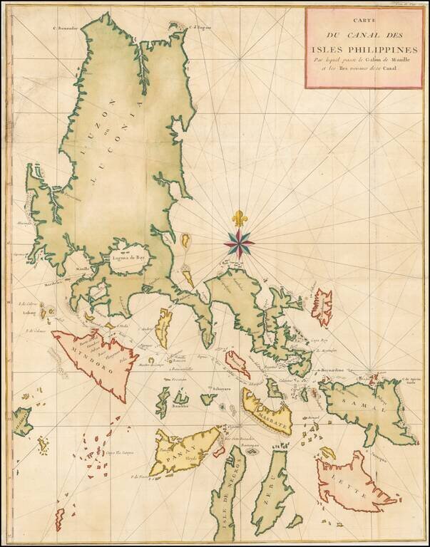
Large detailed chart of the Islands of the Philippines from the French edition of Anson's Voyages. One of the most detailed charts of the Philippines of the era. Shows Islands, bays, reefs, soundings tracks of the Manila Galleon route, etc. Includes a...
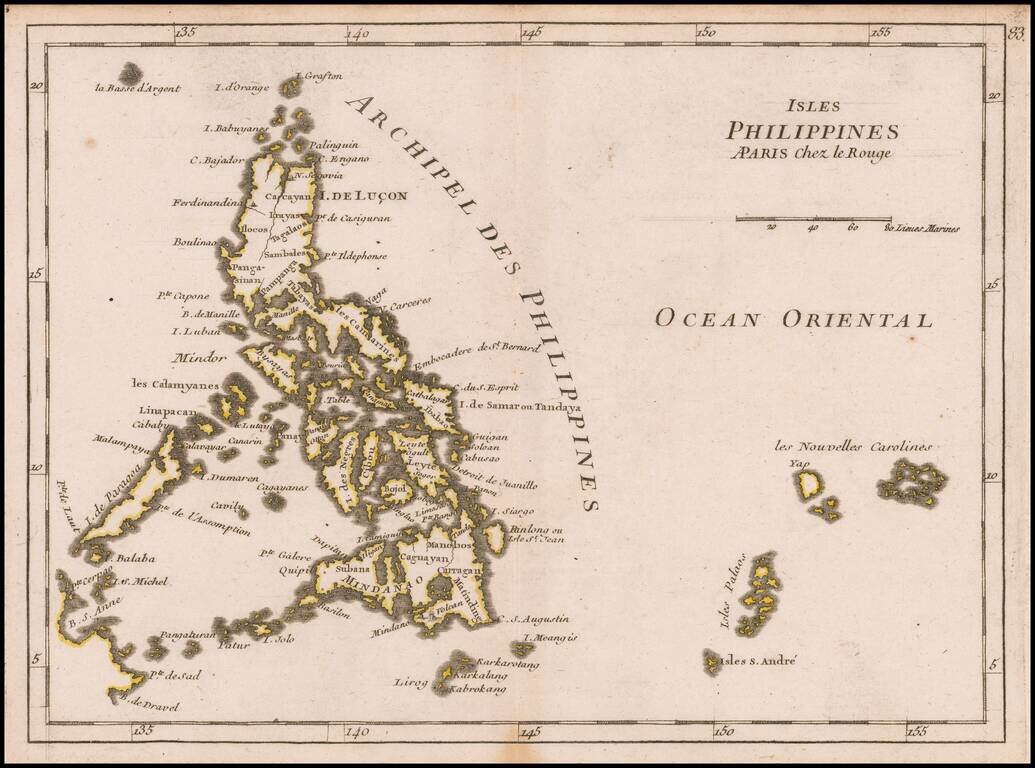
Detailed map the Philippines, from Le Rouge's scarce Atlas Nouveau Portatif, published in Paris in 1748. One of the earliest obtainable separately published maps of the Philippines.
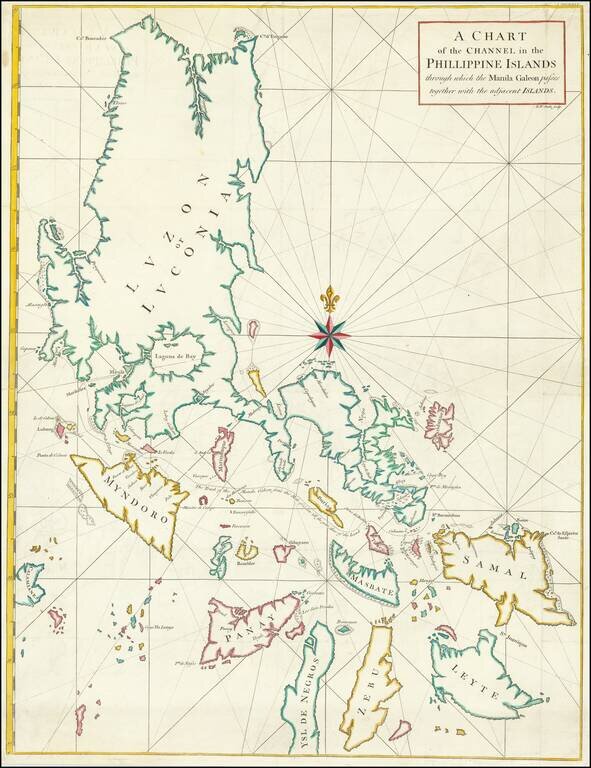
Chart of Philippines from Anson’s Voyage round the World, Part of His Plan to Capture a Spanish Treasure Galleon Nicely colored example of George Anson's chart of the Philippine Islands, showing the area from Luzon to Leyte, Zebu and Ysle De...
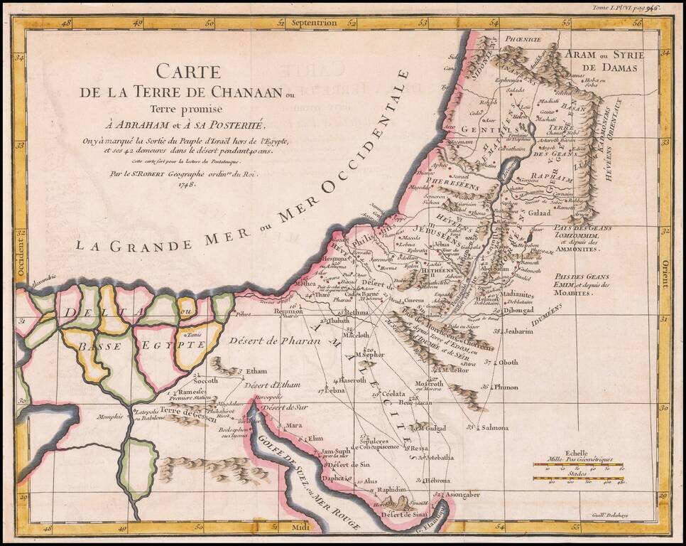
Detailed map of Ancient Canaan and the Nile River Delta. Includes the route of Moses and the Israelites as they wandered the Desert for 40 years.
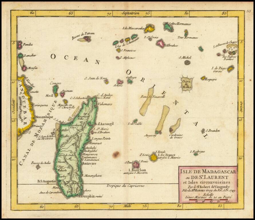
Detailed engraved map of Madagascar, the Mascarene Islands, and other nearby Indian Ocean African islands, published in De Vaugondy's first atlas. The map extends as far east as Chagos and as far west as Zanzibar.
![[Eclipse of 1748] Vorstellung der in der Nacht zwischen den 8. u. 9. Aug. 1748 vorfallenden partialen Mond-Finsternis](/map/small/42703.jpg)
Rare celestial chart, depicting the Eclipse of August 8 and 9, 1748. The chart illustrates a partial lunar eclipse, as observed and recorded by Tobias Maier in 1748.