
A rare map of the North Sea (Atlantic Ocean) from the Polar Circle to the Equator, showing much of North America, the Caribbean, and parts of Europe and Africa. The detail in the British Colonies in North America includes Carolina, Virginia, Maryland,...
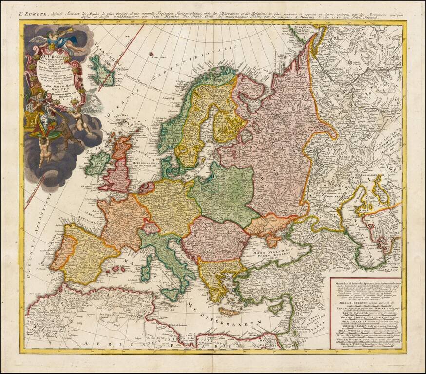
Decorative map of Europe, based upon Haase's stereographic horizontal projection, which was featured in his book on cartographic methodology. The map is hand colored by country, showing cities, towns, rivers, mtns, lakes, etc. Large decorative...
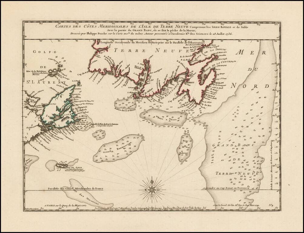
Philippe Buache Responds To Errors In Popple's Map of the British Colonies. Scarce map of the coast of Southern Newfoundland and part of Nova Scotia by Philippe Buache in 1736, as part of his critique of the accuracy of Henry Popple's map of 1733....
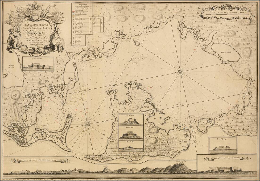
An Impressive and Rare Separately Issued Map of the Battle of Cartagena in 1741, showing Vernon's Fleet in Action in the Harbor. Engraved map of Cartagena and environs with touches of original hand-coloring. The present map is an exceptional example...
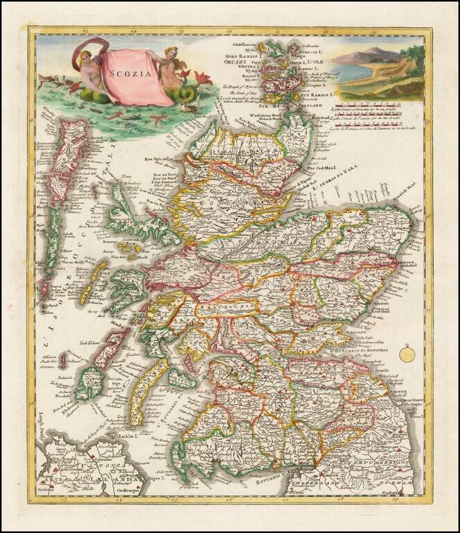
A nice example of Albrizzi's scarce map of Scotland, with 2 decorative cartouches. The map is remarkably detailed, showing towns, roads, rivers, mountains, lakes, etc.
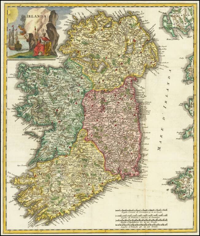
A nice example of Albrizzi's scarce map of Ireland, with decorative cartouche. The map is remarkably detailed, showing towns, roads, rivers, mountains, lakes, etc.
![[St. Petersburg, Russia]. Grond-Tekening van de Russische Hoosdstadt St. Petersburg, door Czaer Pieter de Eerstre In't Jaer 1703 aengelegt. . . . .](/map/small/40904.jpg)
A rare and detailed separately-issued early plan of St. Petersburg by Johann Matthias Hase, printed in Utrecht by Johannes Broedelet. This fine plan shows St. Petersburg shortly after the initial phases of its construction had been completed. In...
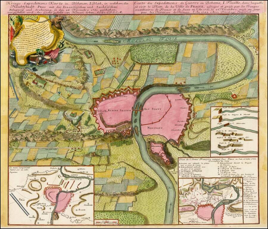
Plan of the fortifications of Prague, published by Homann Heirs in Nuremberg. The plan shows a region extending up and down the Moldava River and illustrating a battle fought between the French and Saxon Troops in November 1741. Shows battle plans,...
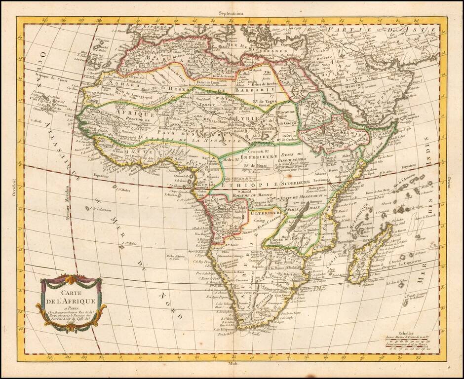
Rare map of Africa, published in Paris by Pierre Bourgoin. The map illustrates the limited European knowledge of the interior of Africa.
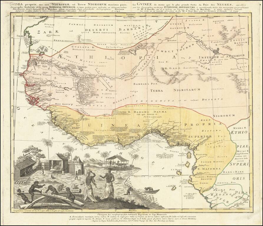
Strikingly-Illustrated Eighteenth-Century Atlas Map of West Africa Dynamic example of this highly decorative and detailed antique map of West Africa, published by the Homann Heirs in 1743. This is one of the best atlas maps of the region made during...
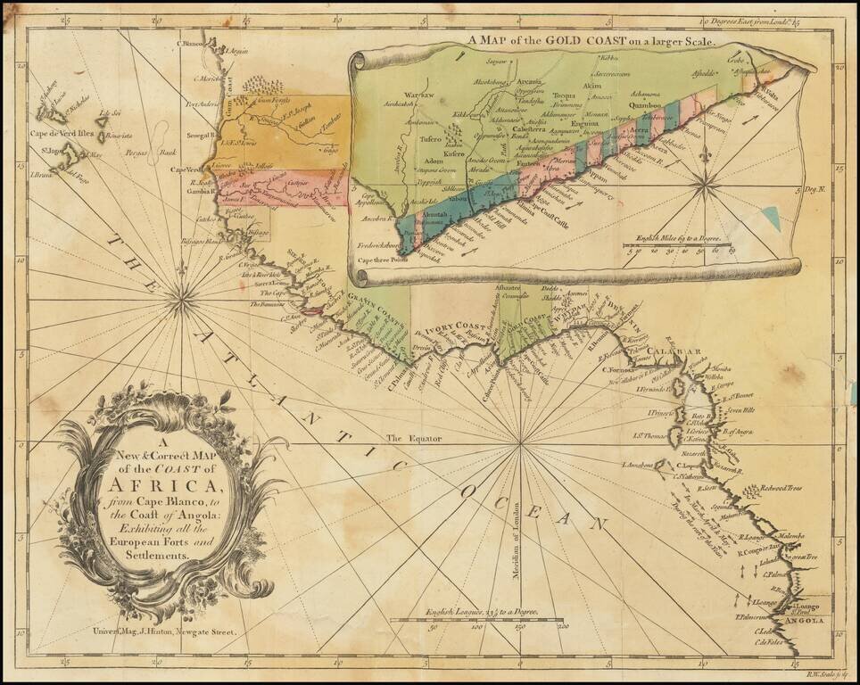
Detailed map of the of the West African Coastline, with a large inset of the Gold Coast, from an early edition of the Universal Magazine. These early Universal Magazine maps are quite rare on the market.
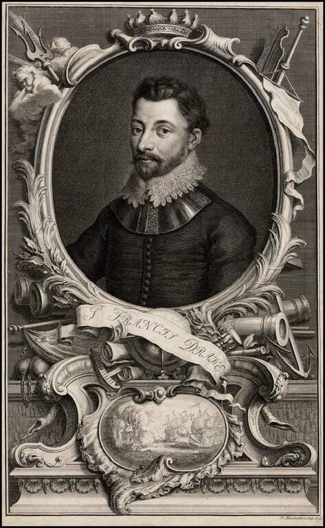
Fine early portrait of Sir Francis Drake, after a painting by Sir Godfrey Kneller. Sir Francis Drake (1540-1596) was England's most famous 16th Century mariner. As the first Englishman to circumnavigate the globe, Drake was responsible for a wide...
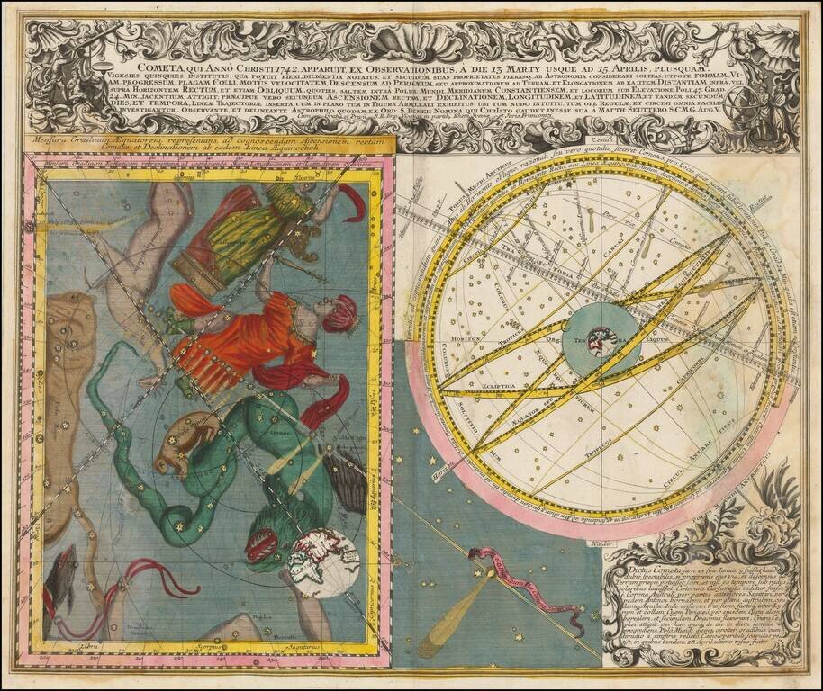
Fine pair of celestial models illustrating the bright comet which transited the sky in March and April of 1742. On the right is an image of the Celestial Sky, illustrating the various constellations visible in the sky at the time of the transit of the...