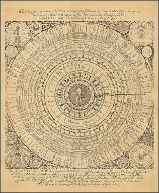
With an Early Depiction of Global Time Zones Superb separately-issued engraved broadside with Hermes at the center and a series of concentric rings emanating outward, allowing the calculation things as diverse as astronomical phenomena, phases of the...
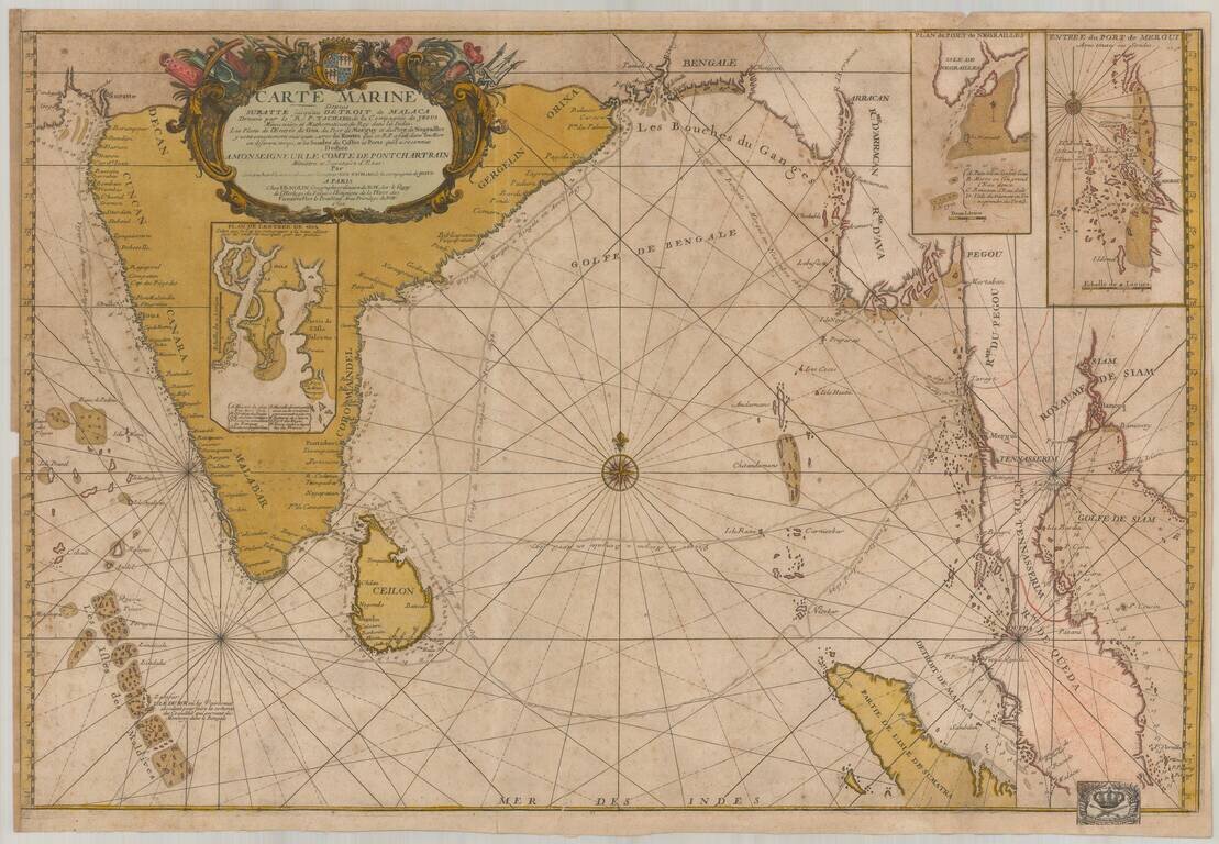
Old color example of this important chart of the Indian Ocean, illustrating the route of the Jesuit priest Guy Tachcard in 1697. The present example bears the bookplate (bottom right) of the Prussian Royal Academy of Sciences ( Königlich-Preußische...
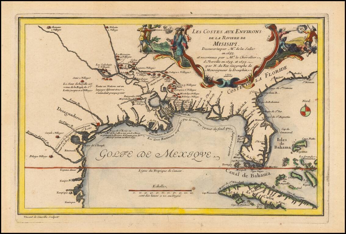
Rare 1701 First Edition Nice example of this historically important and fascinating map of the Gulf Coast and Mississippi River region, from Nicolas De Fer's Atlas Curieux. In preparing this fine map, the leading French cartographer Nicolas De Fer...
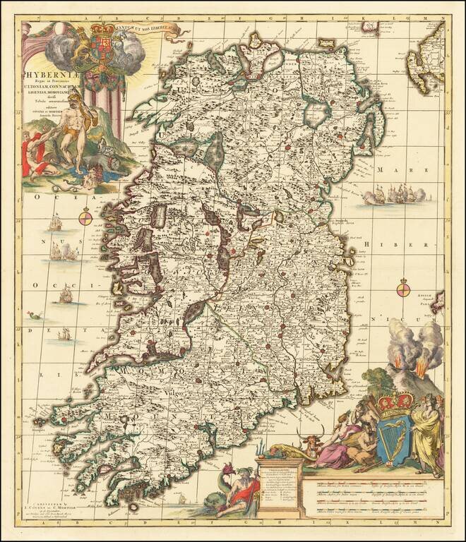
A spectacularly detailed map of Ireland, fabulously embellished with cartouches and scenes of the Spanish Armada surrounding the Island. Includes two of the largest and dramatic cartouches.
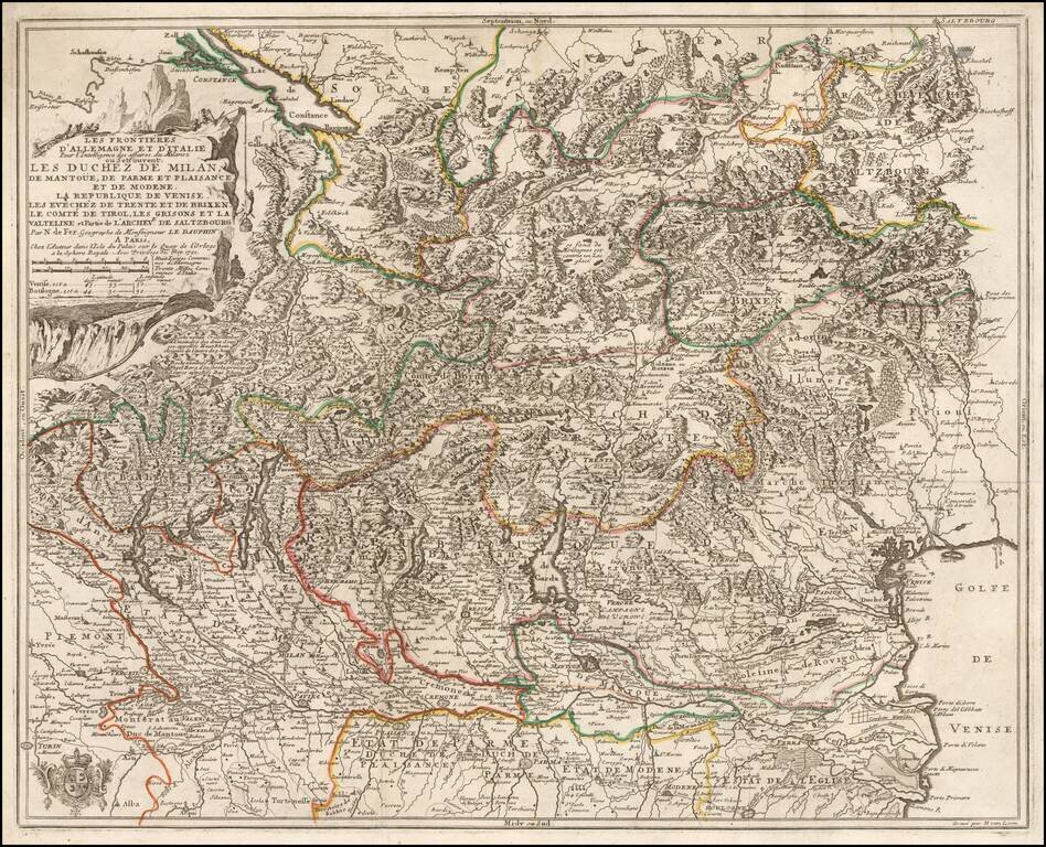
Detailed map of the Theater of War in Northern Italy, published in 1702 by Nicolas De Fer. The map extends from Locarno and Lake Constance to the Gulf of Venice and Saltzurg.
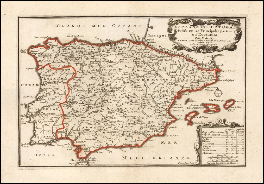
Scarce first state of this detailed map of Spain and Portugal, with decorative cartouche. Includes the Balaeric Islands.
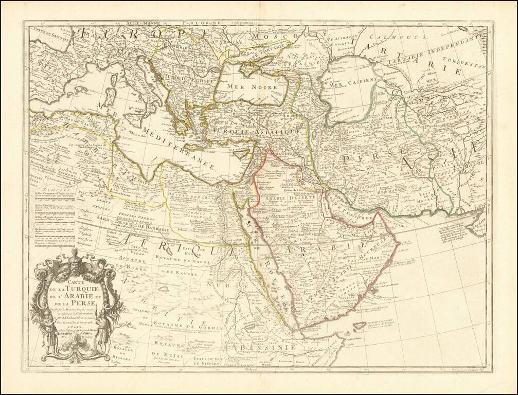
Fine example of an state of De L'Isle's map of the Turkish Empire and Arabian Peninsula, with De L'Isle's "Quai de l'Horlogie al Aigle d'Or" address, which was used only briefly after his move from Rue de Cannettes. Includes the Turkish Empire,...
![Barbary and Bildulgerid. [on sheet with:] Egypt and Barca &c.](/map/small/70916.jpg)
Antique engraved map with images of northwest Africa on top and Egypt on the bottom, with a further inset of Malta above the bottom title block. The map was published in Herman Moll's 1701 System of Geography. It is reasonably scarce, this being the...
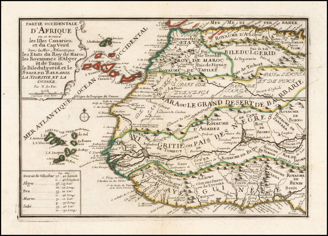
A striking decorative map of the northwestern portion of Africa and Madeira, the Canary and Cap Verde Islands, showing excellent detail throughout. From De Fer's Atlas Curieux. Nice wide margins and decorative cartouche.