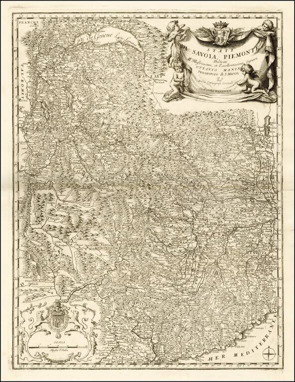
Fine example this striking map of Piemonte and Savoye, from Vincenzo Maria Coronelli's Corso Geographico, published in Venice. The map provides a fantastic image of the topography of the region, naming mountains, rivers, lakes, towns, castles, etc....
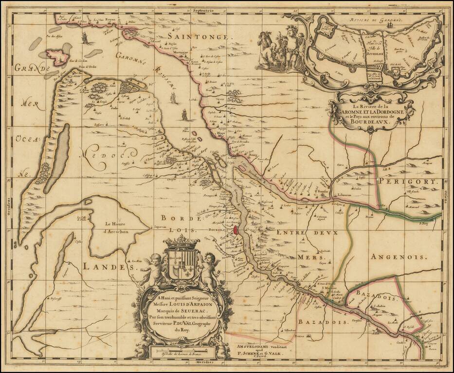
Rare map of Map of the Gironde estuary, published in Amsterdam by Schenk & Valk. The map shows the area where the Dordogne and Garonne rivers meet, and includes a plan of the fortified walls of the city of Bordeaux, along with several elaborate...
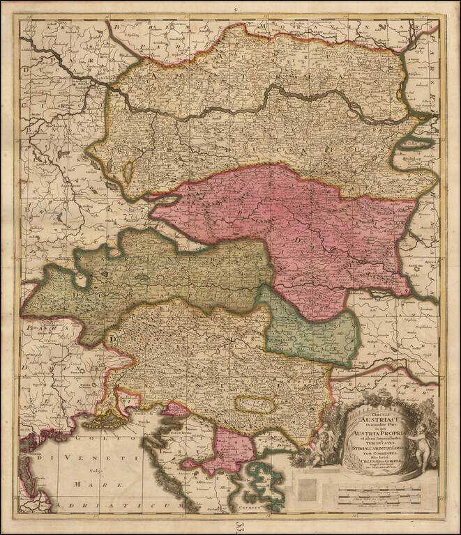
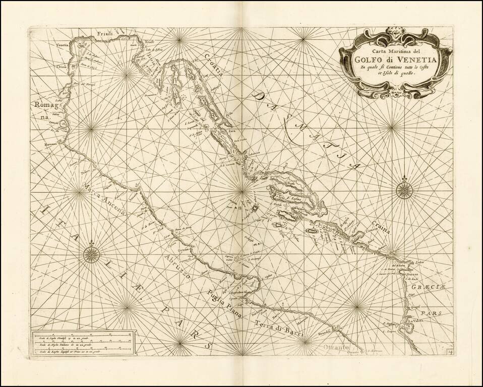
Fine example of Gerard Valk's map of Austria, the Gulf of Venice and part of Croatia and Istria. Highly detailed map of the region bounded by the Gulf of Venice and the Golfo Carnero, Stiria and Cherso Island in the South, and extending to north of the...
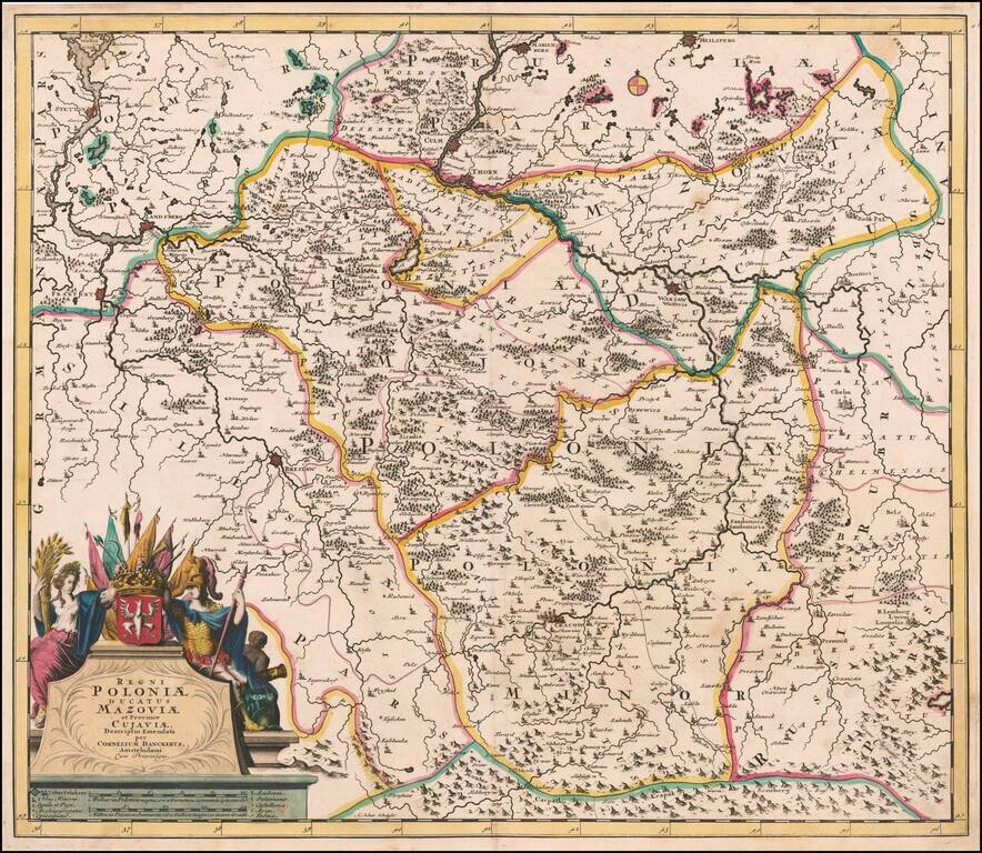
Fine old color example of this rare map of Poland Lithuania and Ukraine, etc., published in Amsterdam by Cornelis Danckerts and engraved by A. Schut. The map was later issued by Reiner & Josua Ottens during the first part of the 18th Century. The...
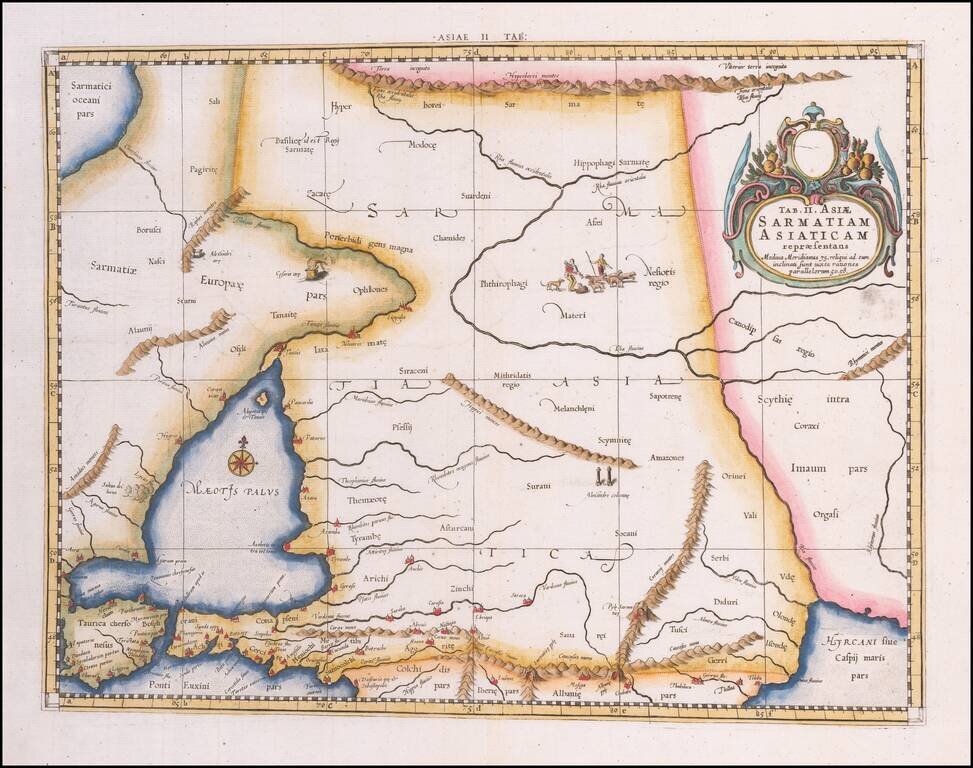
Colored example of Mercator's map of Armenia, Georgia, eastern Turkey, and parts of Ukraine and Southern Russia, from Mercator's Geographia, first published in 1578 and republished in Amsterdam beginning in 1695. Includes decorative cartouche and sea...
Fine chart of the Gulf of Venice and Northern Part of the Adriatic Sea, which appeared in Volume 1 of Coronelli's Corso Geographico, published in Venice. The sea chart would appear to be the chart originally issued in 1663 by Francesco Maria Levanto...
![Stato Di Milano Parte Occidentale [and] Stato Di Milano Parte Orientale](/map/small/33886.jpg)
Fine example of this detailed 2 sheet map of the Stato Di Milano, from Vincenzo Maria Coronelli's Corso Geographico, published in Venice. The map provides a fantastic image of the topography of the region, naming mountains, rivers, lakes, towns,...
![Il Monferrato . . . [and] Parte Settentrionale Del Monferrato](/map/small/33919.jpg)
Fine example of this detailed 2 sheet map of Monferrato, from Vincenzo Maria Coronelli's Corso Geographico, published in Venice. The map provides a fantastic image of the topography of the region, naming mountains, rivers, lakes, towns, castles, etc....
Finely engraved map of the area around Venice, focusing on the rivers and Canals, published by Coronelli. Vincenzo Maria Coronelli was among the most important and influential map makers of the late 17th Century. After starting his career in Venice,...
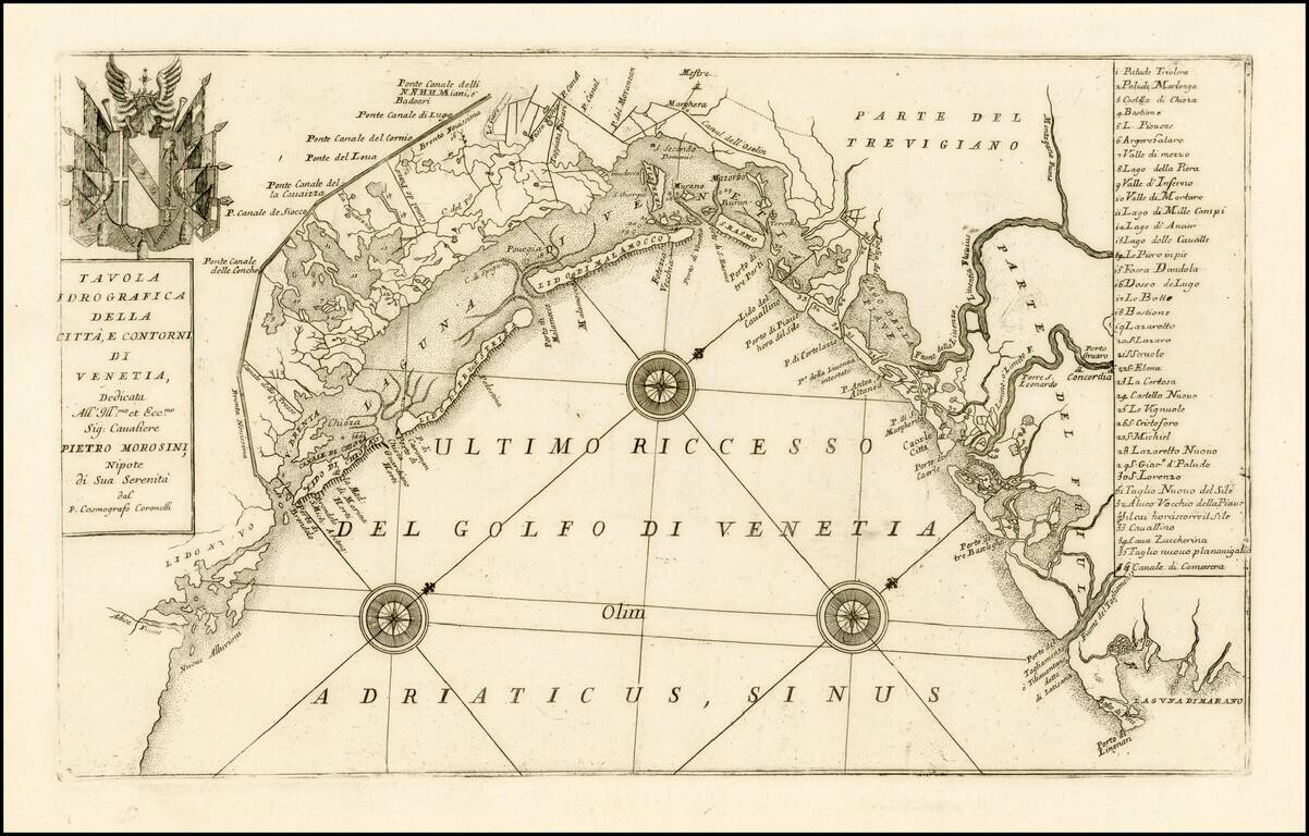
Finely engraved map of the area around Venice, focusing on the rivers and canals, published by Coronelli. Includes a decorative coat of arms and table locating 35 places in the area. Vincenzo Maria Coronelli was among the most important and...
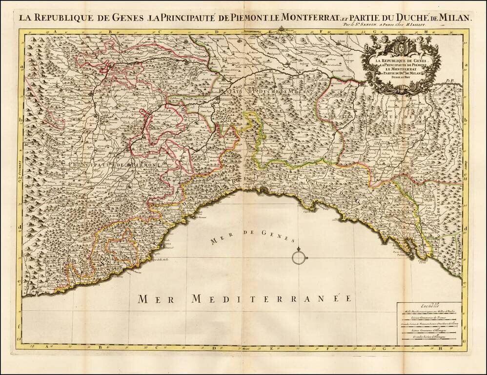
Striking large and highly detailed map of the Italian Mediterranean Coast and extending north to Milan. A fine decorative example with wide clean margins and large cartouche.
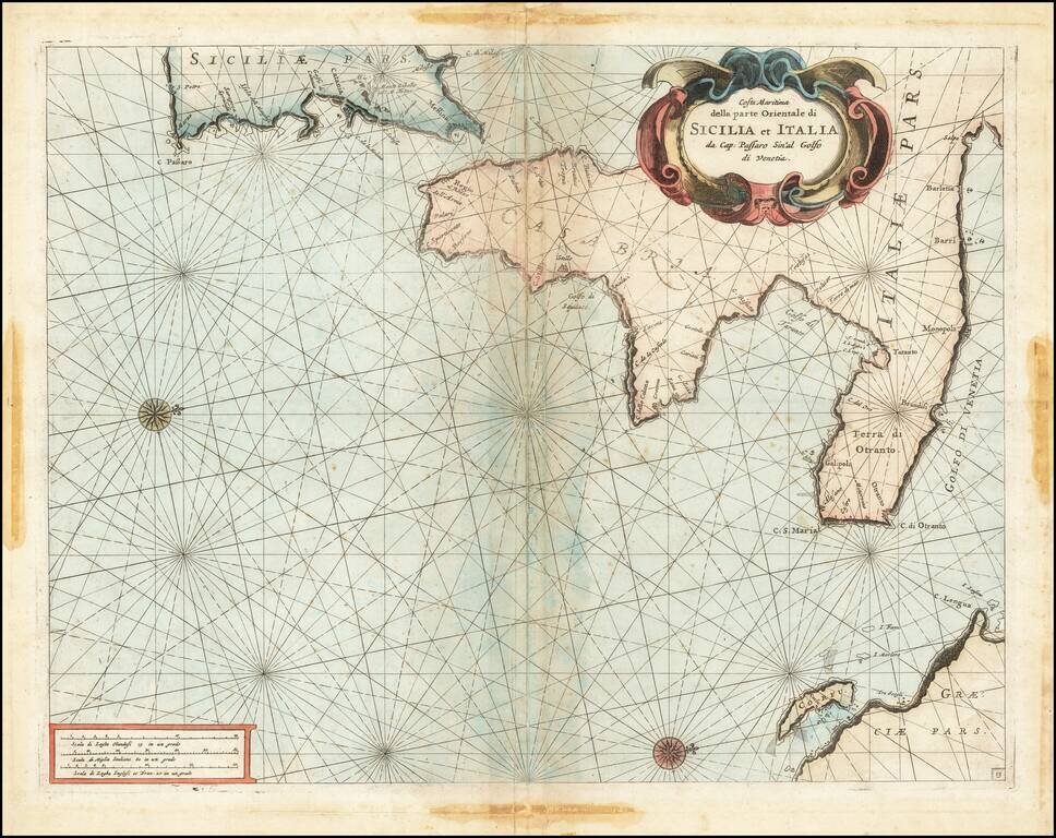
Fine chart of the Mediterranean coastline Southern Italy and southern part of Sicily, which appeared in Volume 1 of Coronelli's Corso Geographico, published in Venice. The sea chart would appear to be the chart originally issued in 1663 by Francesco...
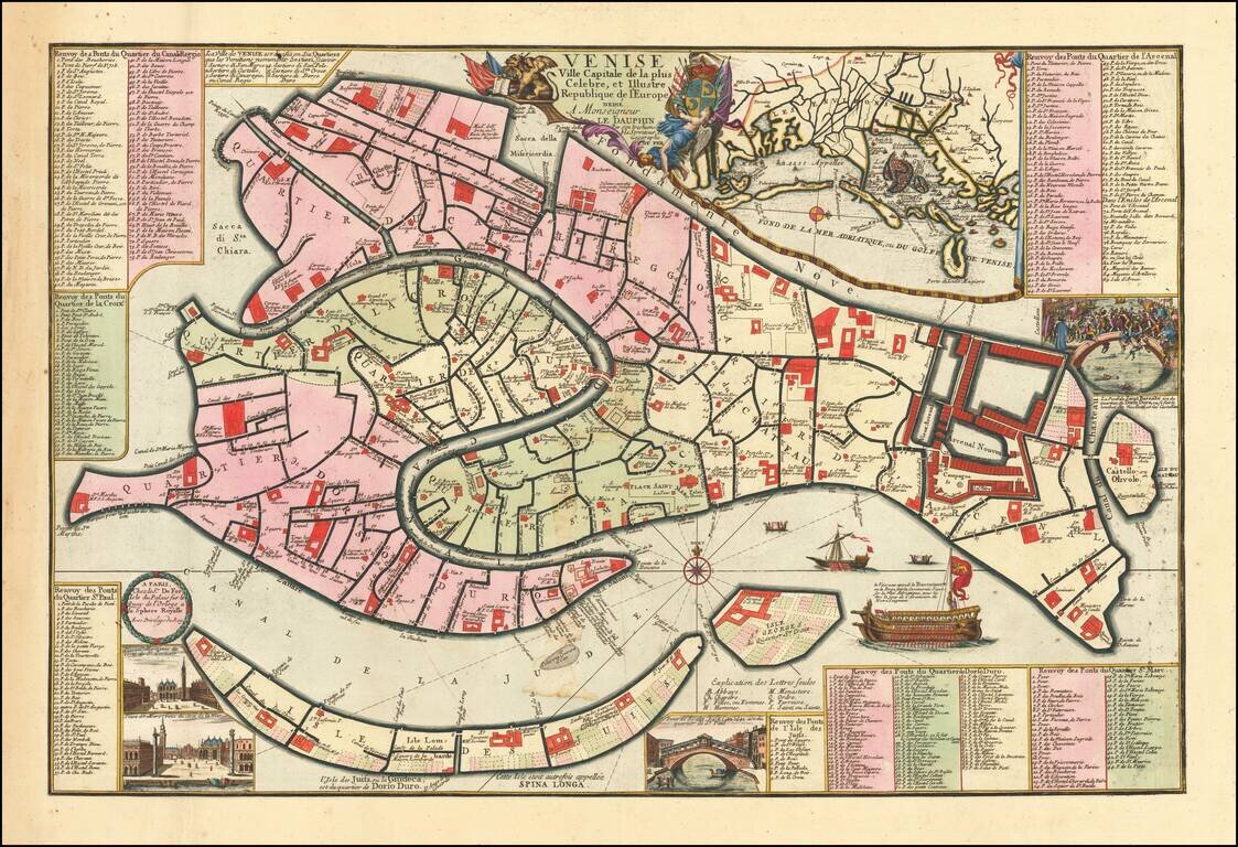
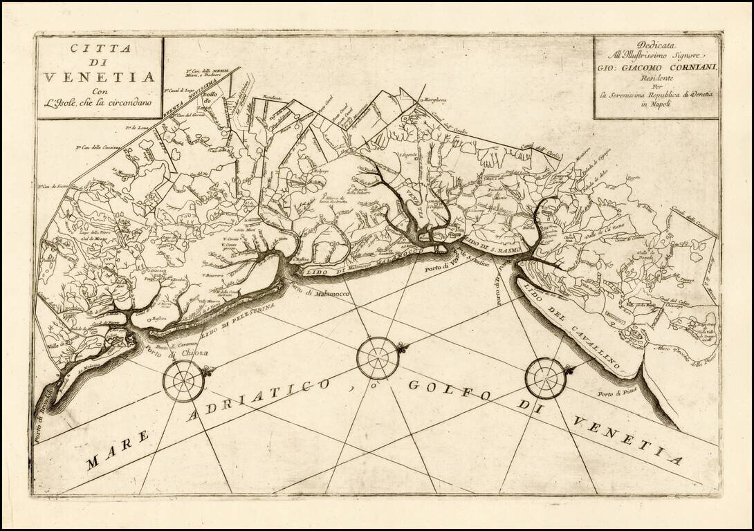
Fine example of this early edition of Nicolas De Fer's rare separately published plan of Venice, first published in Paris in 1695. The map includes an inset of the Lagoon of Venice near the title, inset vignettes of the Lagoon, two views of the Piazza...
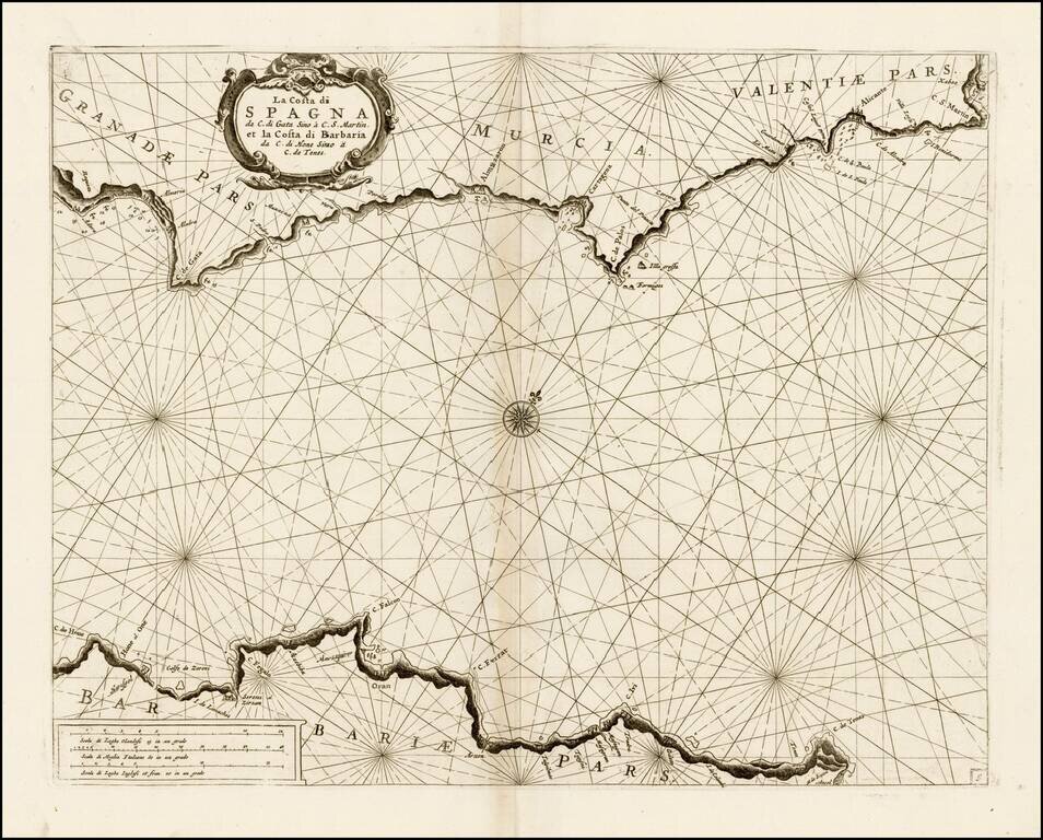
Fine chart of the Mediterranean coastline of part of Spain and North Africa, which appeared in Volume 1 of Coronelli's Corso Geographico, published in Venice. The chart covers the coast of Granada, Murcia, and Valencia, along with the contiguous...
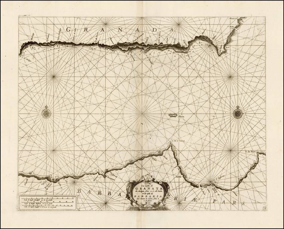
Fine chart of the Mediterranean coastline of part of Granada and North Africa, which appeared in Volume 1 of Coronelli's Corso Geographico, published in Venice. The chart covers the coast of Granada, from Malaga to Carboneras and the contiguous...
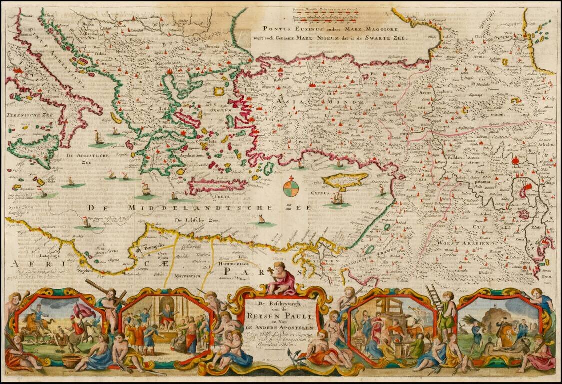
Nice example of Stoopendahl's map of the Eastern Mediterranean, showing the Travels of the Apostels. The map illustrates the travels of Paul in the Mediterranean, and includes 8 biblical scenes from Paul's travels.