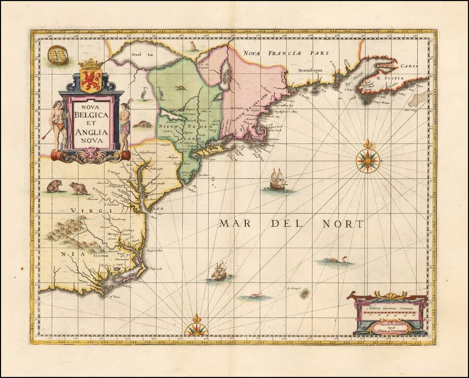
Valk & Schenk's edition of Jansson's highly influential map of the East Coast of North America, from the Carolinas to Nova Scotia. Jansson based his map upon Johannes De Laet's map of 1630 (created and engraved by Hessel Gerritsz of the Dutch East...
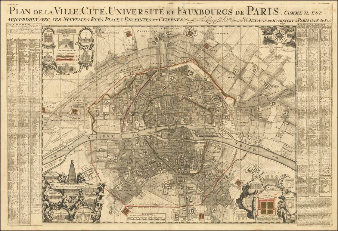
Rare large plan of Paris by Jouvin de Rochefort, published by Nicolas de Fer in 1694. Rochefort's map is of note as the second map to present Paris in a North-South axis, with the Seine being illustrated horizontally. The plan shows the city's five...
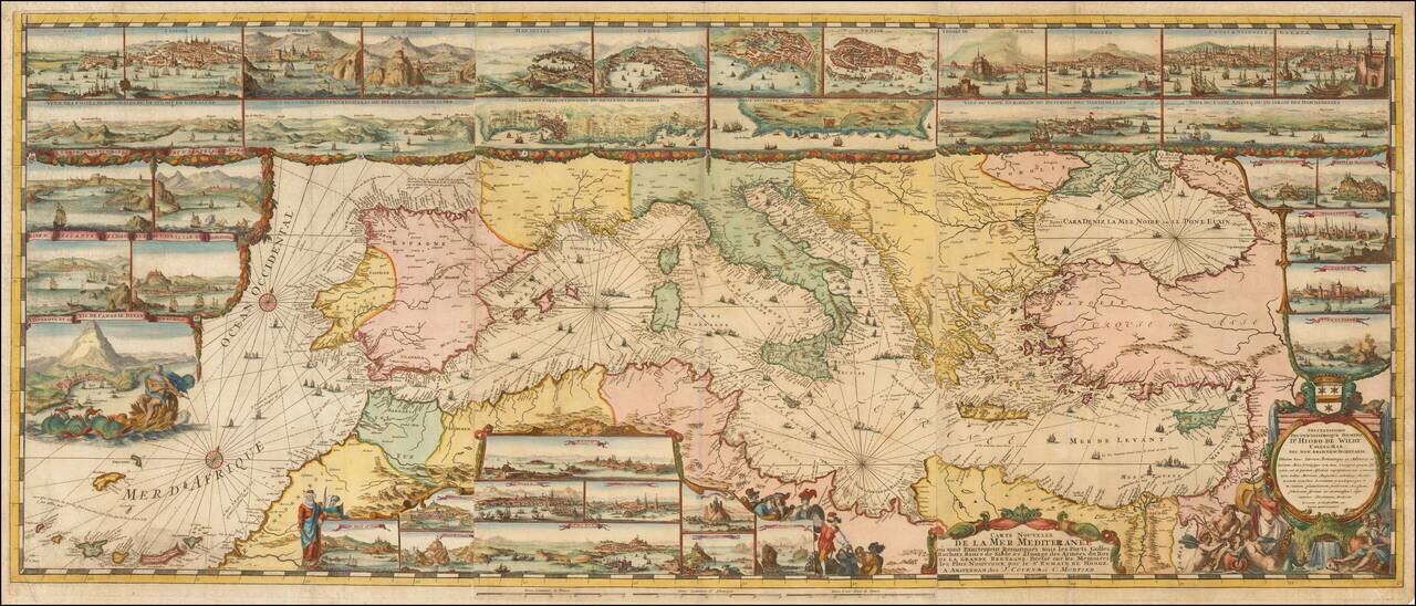
The Most Lavishly Illustrated Map of the Mediterranean of the 17th Century Covens & Mortier edition of Romeyn De Hooghe map of the Mediterranean, embellished with 38 inset maps and views of the major ports and harbors of the Mediterranean. Fine...
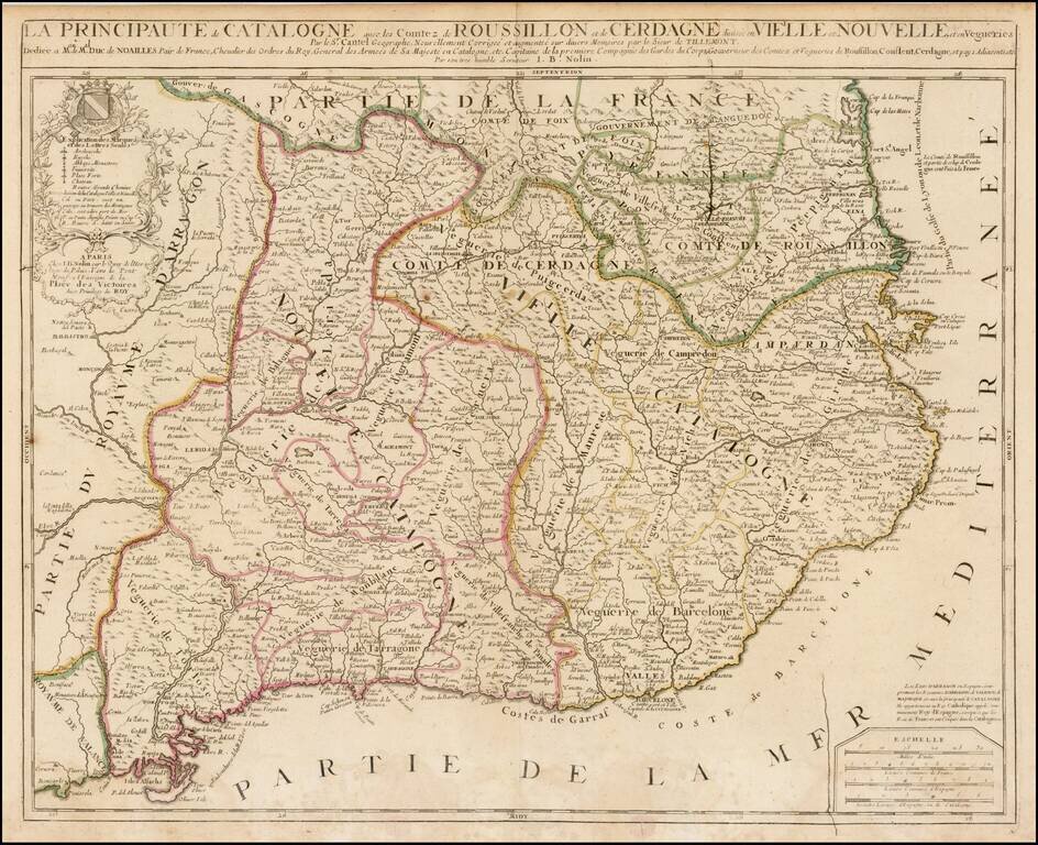
Detailed 17th Century map of Catalonia and Roussillon, by Jean-Baptiste Nolin, based upon an early map by Cantelli, which was thereafter revised by Tillemont. The map is finely detailed, showing towns, roads, rivers, mountains, lakes, cities, bays,...