
Extremely rare miniature map of the North Pole, from Seller's Atlas Maritimus. Both the cartographic detail and embellishments are based upon the Hondius/Jansson map of the North Polar Regions. Includes a coat of arms.
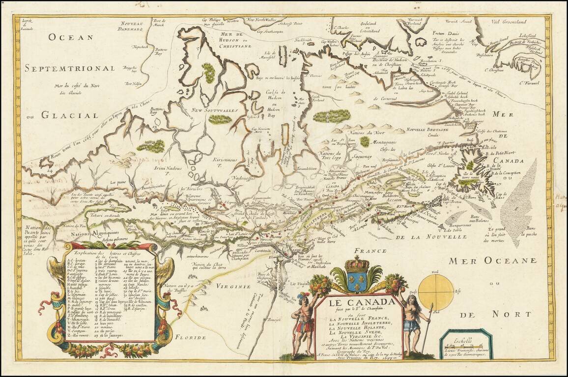
Fine example of this highly important map of Canada, the Great Lakes and Northeastern United States, originally engraved for Samuel de Champlain's 1619 Les Voyages. Du Val's Le Canada facit par le Sr. de Champlain . . . is unquestionably one of the...
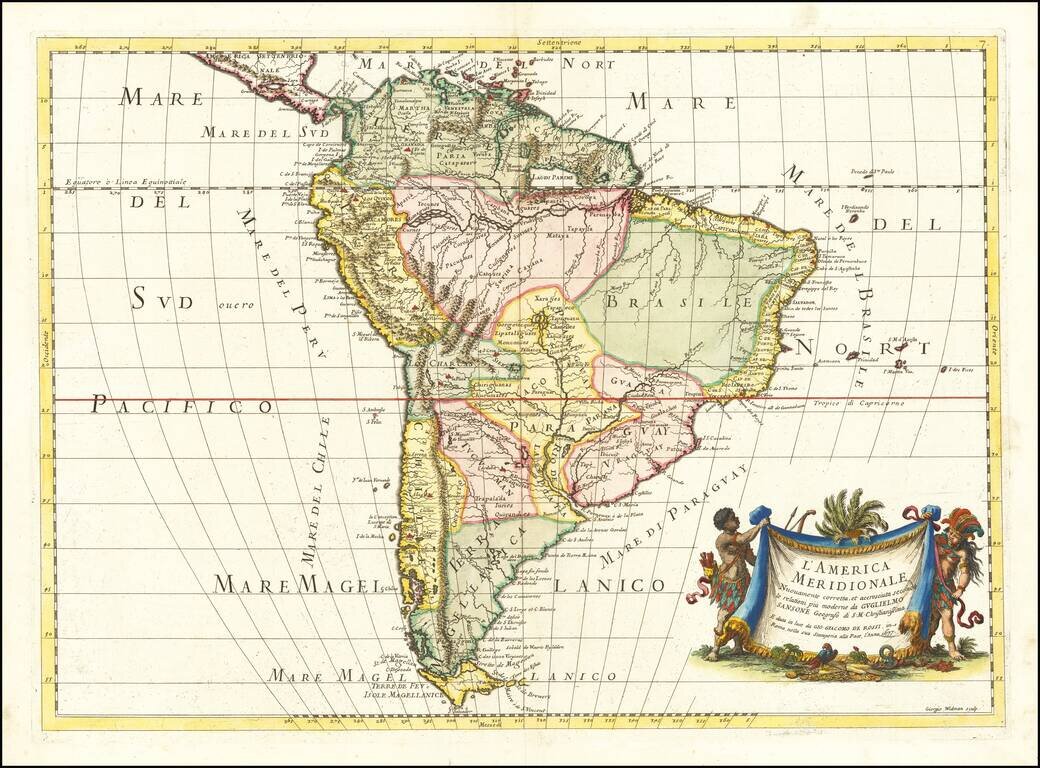
First edition of Rossi's map of South America, published in Rome. The map provides a fine detailed treatment of South America, based upon the work of Nicolas Sanson. The map is engraved by master engraver Giorgio Widman. A later edition was issued...
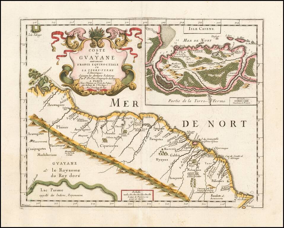
Very rare map of the Northeast coastline of South America, from the mouth of the Orinoco River to the mouth of the Amazon River, centered on Galibis, Sapayes and the Isle de Cayene. Shows a number of early place names, rivers, and a single cordillera...
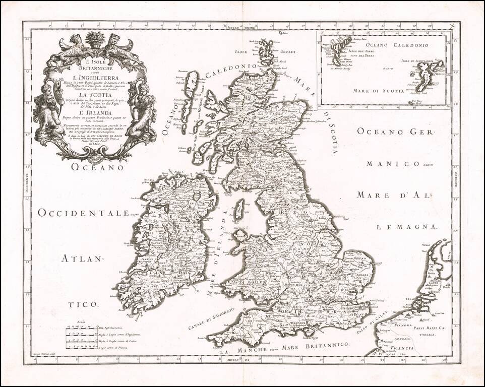
Striking late 17th Century map of the British Isles, from Rossi's Mercurio Geographico. Engraved by George Widman. Includes an inset map of the Faroe and Shetland Islands.
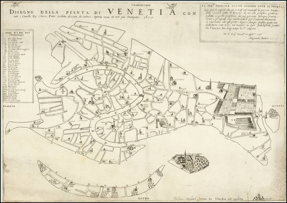
Nice example of one of the most important early plans of Venice. This is the Fourth and final edition of this interesting plan, first published in 1627 by the otherwise unknown publisher Alessandro Badoer. Scolari has retouched the contours and...
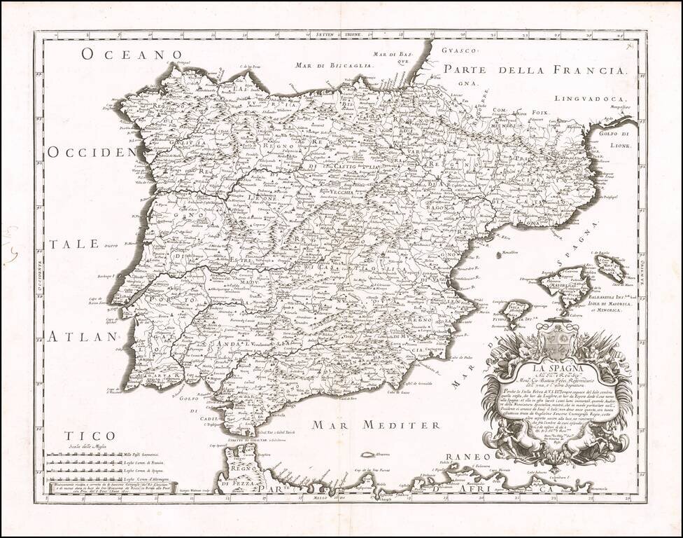
Detailed map of Spain, Portugal and the Balearic Islands, from Rossi's Mercurio Geographico. Remarkable highly detailed map, engraved by Giorgio Widman. Shows tribal regions, towns, rivers, lakes, mountains, islands, bays, rivers. and many other details.
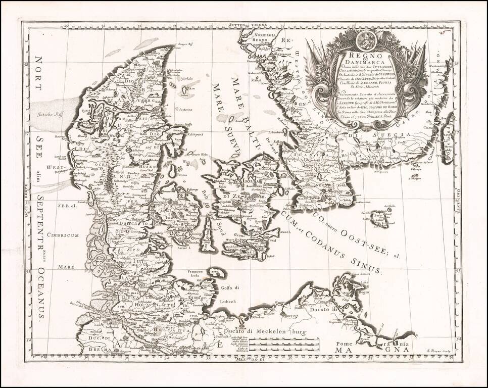
Striking map of Denmark and the southernmost part of Sweden, published in Rome by Giovanni Giacomo Rossi. The map is finely engraved, with an elaborate cartouche.
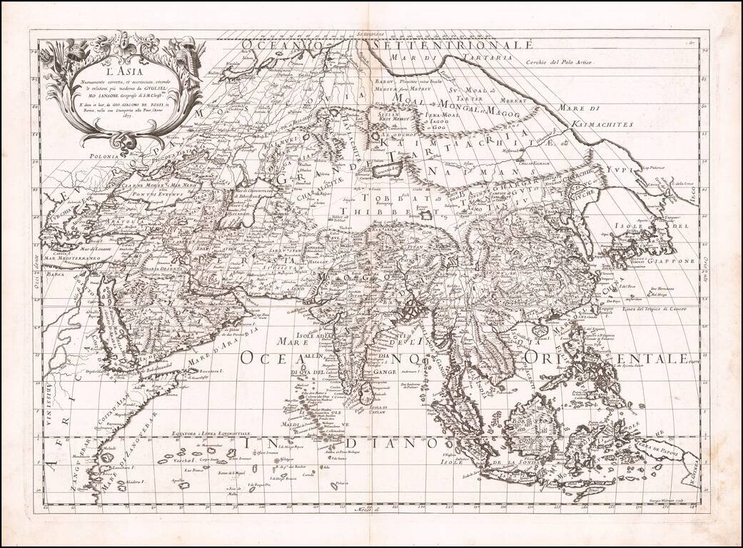
First state of Giacomo Rossi's map of Asia, published in Rome. The map provides an excellent depiction of the Philippines and China (revised to based upon Martini). To the north of Japan, the lands and coastal features are still largely unknown and...
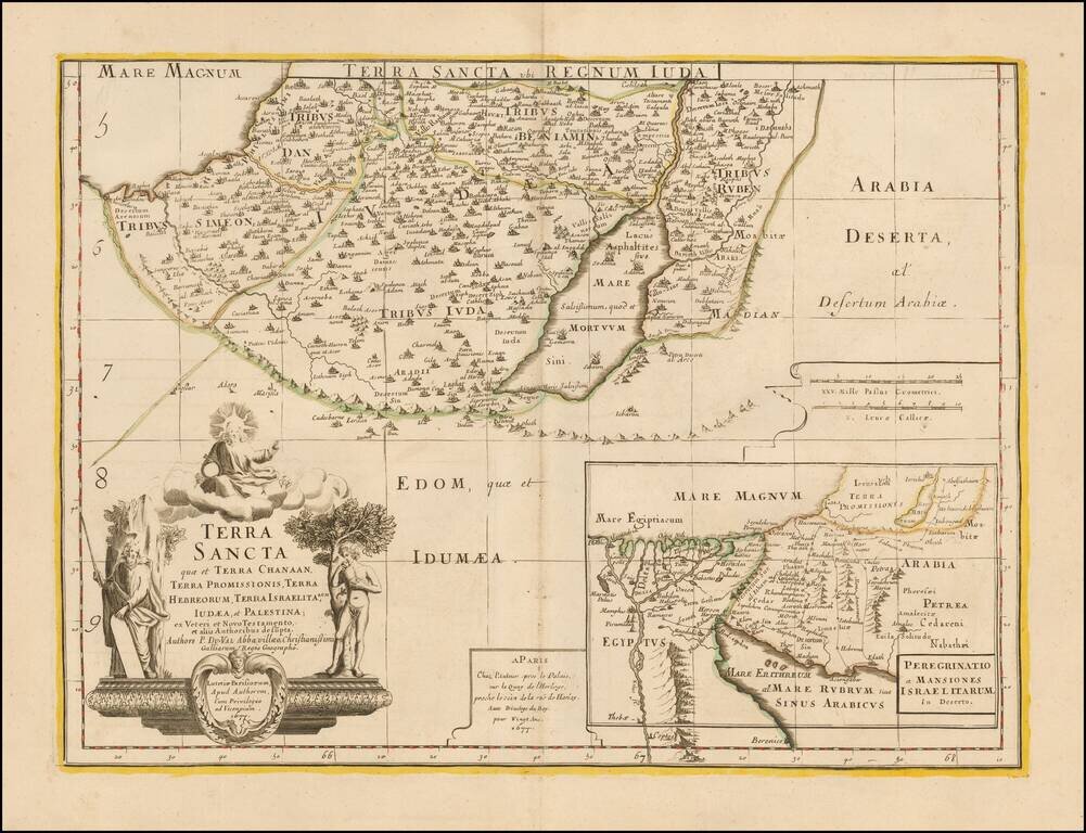
Southern half of Du Val's scarce 2 sheet map of the Holy Land. The map is centered on the Dead Sea and includes a large map showing the 40 years of wandering of the House of Israel through the desert after leaving Egypt.