logo

1677. L'Isole Britanniche ouvero L'Inghilterra Divisa in sette Regni, quattro de Sassoni, e Tre dell Inglesi, et il Principato di Galles. . . 1677

  • L'Isole Britanniche ouvero L'Inghilterra Divisa in sette Regni, quattro de Sassoni, e Tre  dell Inglesi, et il Principato di Galles. . . 1677

L'Isole Britanniche ouvero L'Inghilterra Divisa in sette Regni, quattro de Sassoni, e Tre dell Inglesi, et il Principato di Galles. . . 1677 information:

Year of creation: 
Resolution size (pixels): 
 13636x10890 px
Disk Size: 
 25.0182MiB
Number of pages: 
 1
Place: 
 Rome

Print information. Print size (Width x height in inches):
Printing at 72 dpi 
  189.39 х 151.25
Printing at 150 dpi 
 90.91 х 72.6
Printing at 300 dpi 
 45.45 х 36.3

An example of detailing the file of this map of in a printable high-resolution:

Click to open in high resolution (open in new tab).
Attention! this is just the central piece (central area 960x960 px) of the map file!
This is an example, so that you can see and study the level of detail of a given map. The entire Map will be fully available after payment!

L'Isole Britanniche ouvero L'Inghilterra Divisa in sette Regni, quattro de Sassoni, e Tre  dell Inglesi, et il Principato di Galles. . . 1677

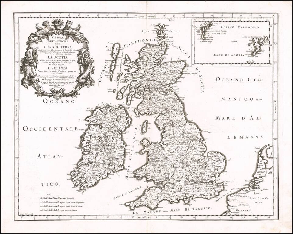
Striking late 17th Century map of the British Isles, from Rossi's Mercurio Geographico.

Engraved by George Widman. Includes an inset map of the Faroe and Shetland Islands.

Sold by Robert in London.

Special conditions for students!

If you are a student, write to us in telegram: @antiquemaps and indicate what material you need and for what work you need a map in high detail. We are ready to provide material on special terms. For students only!

Item information:

Year of creation:
Size:
13636x10890 px
Disk:
25.0182MiB
Number of pages:
1
Place:
Rome
Author:
Giacomo Giovanni Rossi. Giacomo Cantelli da Vignola.
$14.99

Related item