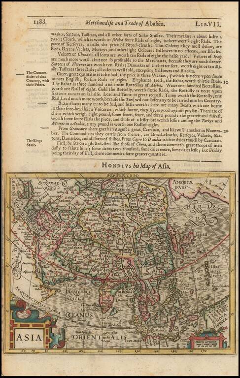
Excellent early map of Asia, extending south to include Nova Guinea and Java Major and east to the South Pacific. Includes the NW Coast of America, with a narrow Fretum Anian seperating the continents. and marvelous detail in the NE coast of Asia,...
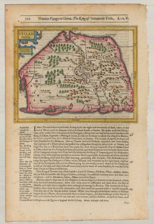
Striking early map of Ceylan with decorative cartouche. From the 1625-26 edition of Purchas His Pilgrims, one of the seminal early 17th Century English Language travel works. On a 13 x 9 inch sheet with English text, front and back.
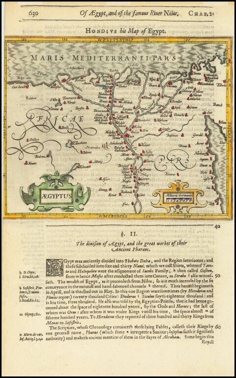
Attractive map of Egypt tracking the Nile from Aswan to the Mediterranean and extending East to the Red Sea, based upon a larger map by Hondius. Includes two cartouches. From the 1625-26 edition of Purchas His Pilgrims, one of the seminal early 17th...
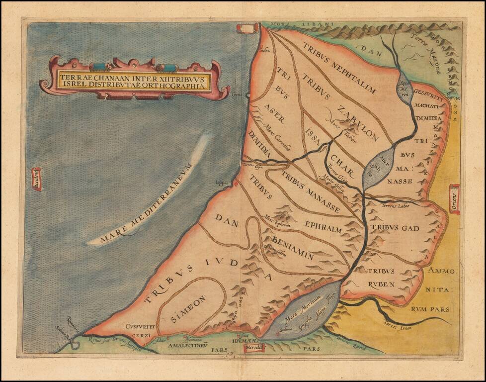
Finely colored example of this early map of the Holy Land, showing the distribution of the 12 Tribes of Israel within the Holy Land. The present example is a rare re-issue of the original 1611 map, with "Isrel" spelled incorrectly in the title.
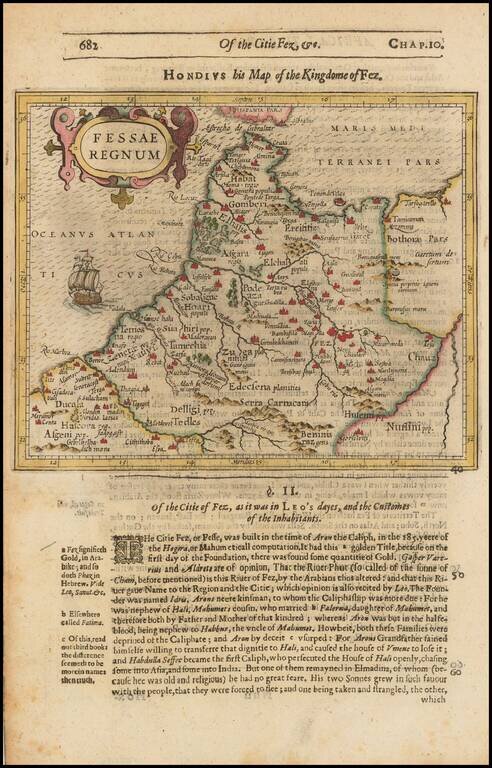
Detailed map of Morocco, Algeria, etc., exending south to Beninia and Nussini. Includes sailing ship and cartouche. From the 1625-26 edition of Purchas His Pilgrims, one of the seminal early 17th Century English Language travel works. On a 13 x 9 inch...
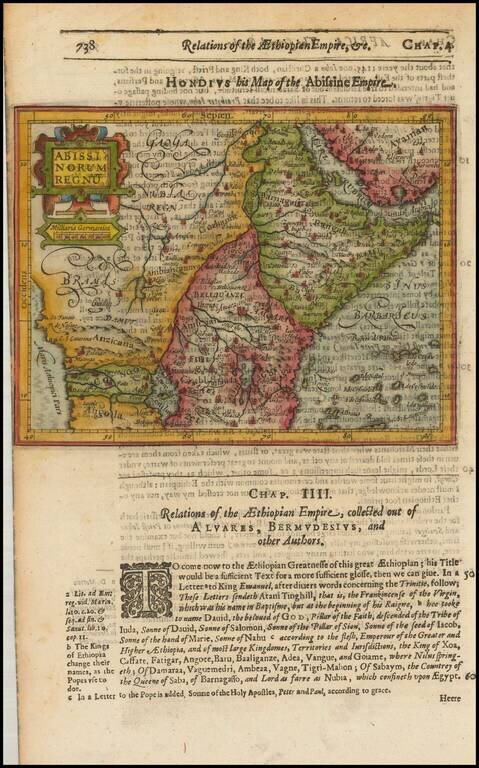
Detailed map of Prester John's Kingdom, extending from the Red Sea and Nubia the Angola, the Congo and Cafates. Shows a large lake Zaire. Includes a large decorative cartouche. Text discussion of Prester John. From the 1625-26 edition of Purchas His...
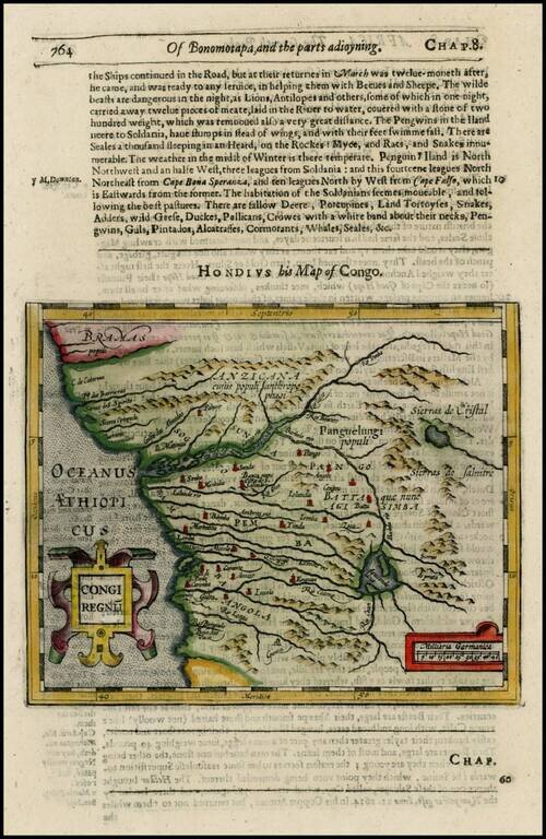
Detailed regional map, extending from Bramas to Angola and extending inland to Sierras de Cristobal and Salnitre. From the 1625-26 edition of Purchas His Pilgrims, one of the seminal early 17th Century English Language travel works. On a 13 x 9 inch...
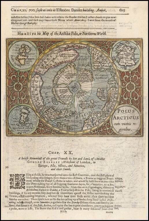
Excellent early map of the North Polar regions, based upon early maps by Mercator and Hondius. Shows the mythical land masses near the pole, the clearly navigable NW and NE passages, a massive California, as discovered by the Spanish, the Davis...