![[ Canis Minor ]](/map/small/70696.jpg)
Striking full color example of Bayer's celestial chart of the constellation Canis Minor. The map includes early hand written annotations in the margins, naming the surrounding constellations and other details. Bayer's Uranometria, is one of the most...
![[ Corona Borealis ]](/map/small/70742.jpg)
Fine example of Bayer's celestial chart of Corona Borealis. Corona Borealis is a small constellation in the northern sky. Its name is Latin for "northern crown", a name inspired by its shape; its main stars form a semicircular arc. It was one of the...
![[ Orion ]](/map/small/70760.jpg)
Fine example of Bayer's map of the constellation Orion, one of the 48 constellations listed by the 2nd century astronomer Ptolemy, which remains one of the 88 modern constellations defined by the International Astronomical Union. The map includes...
![[Perseus]](/map/small/70819.jpg)
Perseus is a constellation in the northern sky, named after the Greek hero Perseus. It was one of the 48 constellations listed by the 1st century astronomer Ptolemy and remains one of the 88 modern constellations defined by the International...
![[ Serpens ]](/map/small/70872.jpg)
Fine example of Bayer's map of the Constellation Serpens, one of the 48 constellations listed by the 2nd century astronomer Ptolemy, which remains one of the 88 modern constellations defined by the International Astronomical Union. The plate was...
![[Synopsis Coeli Superioris] and [Synopsis Coeli Inferioris Austrina]](/map/small/70919.jpg)
Very nice example of Bayer's northern and southern celestial hemispheres Bayer's Uranomatria...
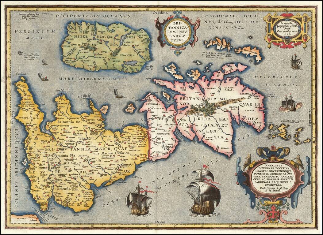
Notable Atlas Map of the British Isles, From the First Modern Atlas Scarce, fine map of the British Isles, from Ortelius' ground-breaking atlas, Theatrum Orbis Terrarum. Oriented to the west, the British Isles are shown as if on their side. The...
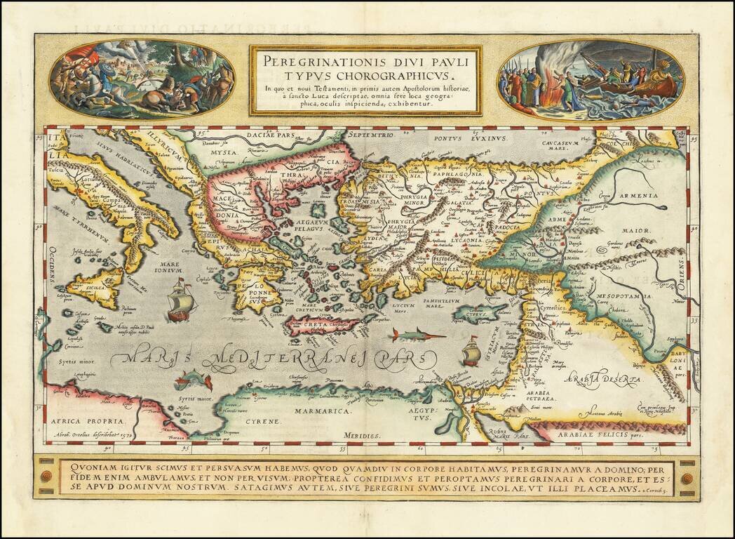
A gorgeous example of Ortelius' map of the travels of St. Paul the Apostle through the Mediterranean, extending west to Italy and east to the Euphrates, including parts of the Red Sea and the Black Sea. Several sailing ships and sea monsters in the...