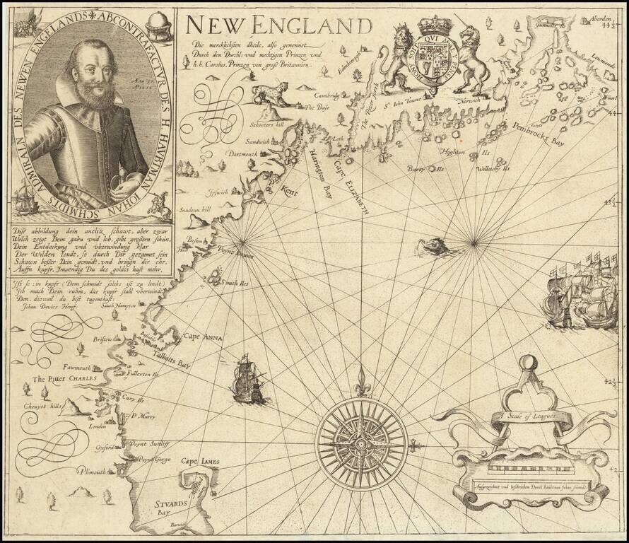
The Earliest Obtainable Smith Map of New England Finely engraved example of the Levinus Hulsius edition of John Smith's map of New England, published one year after the original London edition of 1616. Hulsius' map of New England is one of the...
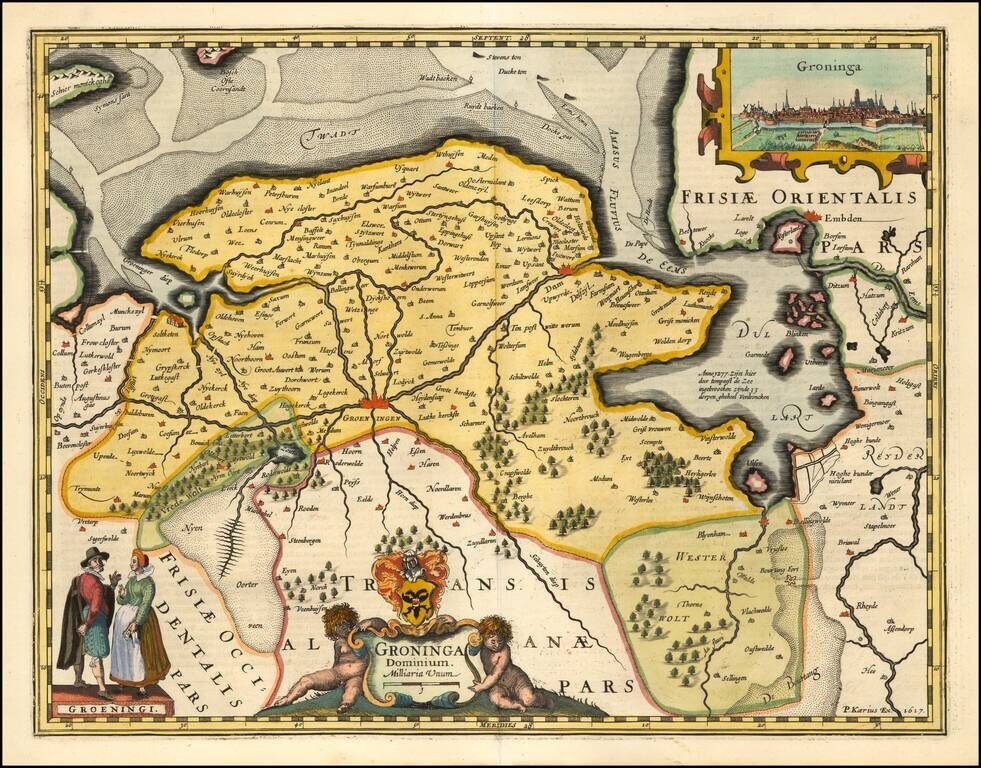
A fine early map of the the Groningen region, which appeared in Petrus Kaerius's (Peter Van der Keere) Germaniae Inferior id est, XVII Provinciarum ejus novae et exactae Tabulae Geographicae, first published in Amsterdam in 1617. Van der Keere's atlas...
A fine early map of the Deventer region, which appeared in Petrus Kaerius's (Peter Van der Keere) Germaniae Inferior id est, XVII Provinciarum ejus novae et exactae Tabulae Geographicae, first published in Amsterdam in 1617. Van der Keere's atlas was...
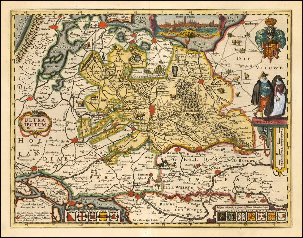
A fine early map of the Utrecht region, which appeared in Petrus Kaerius's (Peter Van der Keere) Germaniae Inferior id est, XVII Provinciarum ejus novae et exactae Tabulae Geographicae, first published in Amsterdam in 1617. Van der Keere's atlas was...
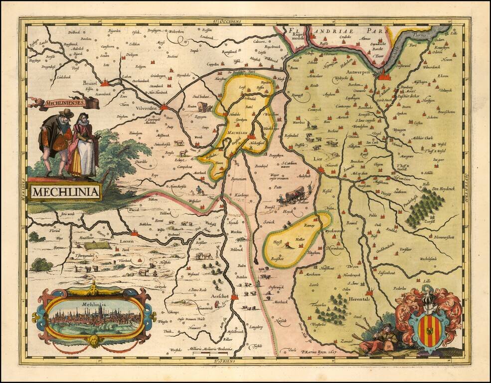
A fine early map of the the Mechelen region, which appeared in Petrus Kaerius's (Peter Van der Keere) Germaniae Inferior id est, XVII Provinciarum ejus novae et exactae Tabulae Geographicae, first published in Amsterdam in 1617. Van der Keere's atlas...
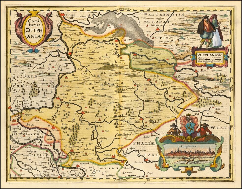
A fine early map of the part of Gelderland, in the region then controlled by the Counts of Zuthpen, which appeared in Petrus Kaerius's (Peter Van der Keere) Germaniae Inferior id est, XVII Provinciarum ejus novae et exactae Tabulae Geographicae, first...
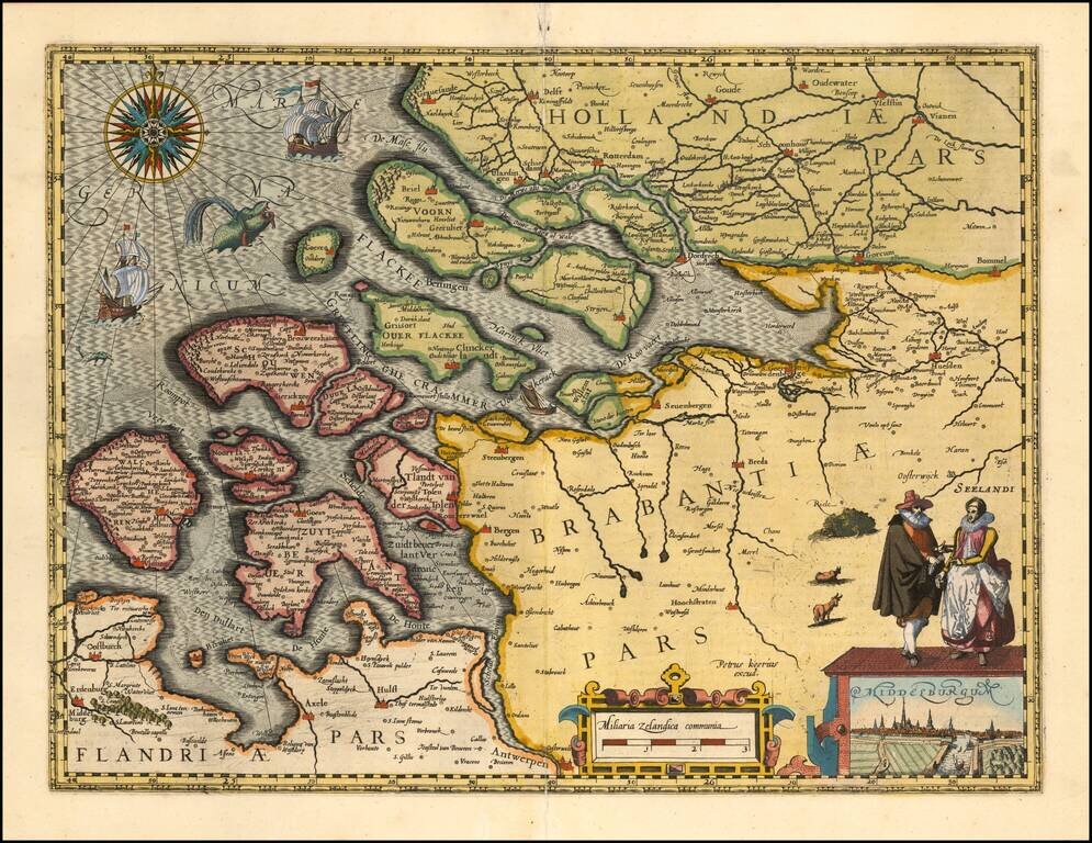
A fine early map of Middelburg which appeared in Petrus Kaerius's (Peter Van der Keere) Germaniae Inferior id est, XVII Provinciarum ejus novae et exactae Tabulae Geographicae, first published in Amsterdam in 1617. Van der Keere's atlas was the first...
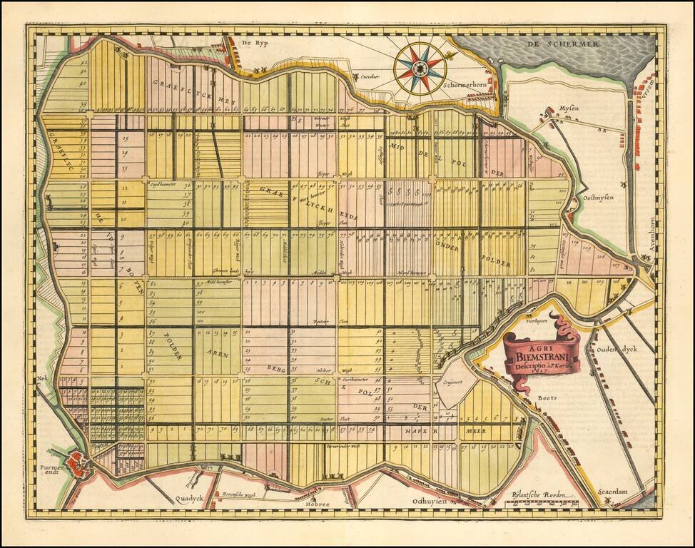
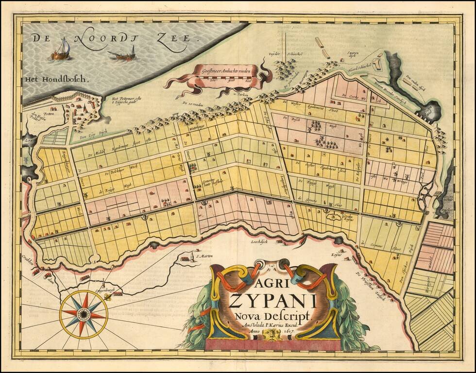
The Oldest Area in the Netherlands Reclaimed from the Sea. Fine map of the polder Beemster in Noord Holland, including the towns of Purmerend, De Ryp, Oudendijk, etc. The map appeared in the first separately issued atlas of the Low Countries which...
A fine early map of the Zijpe region of North Holland, which appeared in Petrus Kaerius's (Peter Van der Keere) Germaniae Inferior id est, XVII Provinciarum ejus novae et exactae Tabulae Geographicae, first published in Amsterdam in 1617. Van der...
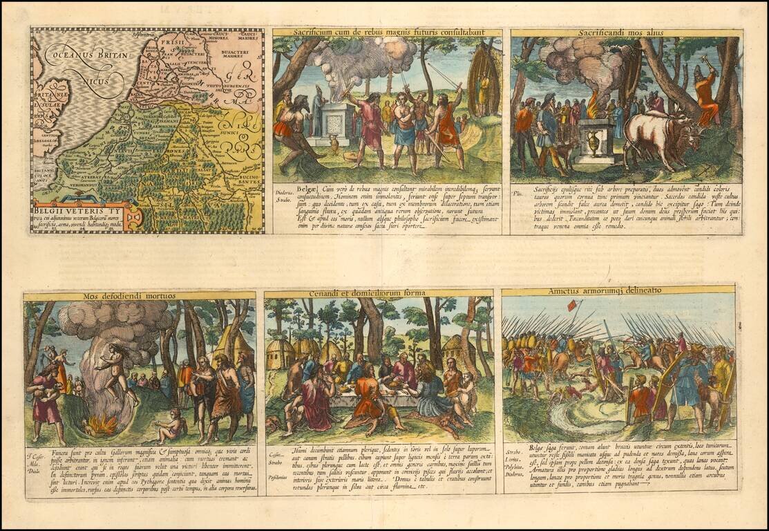
Daily Lives of Ancient Celts Nice example of the Peter van der Keere (Petrus Kaerius) map of the Low Countries in Ancient Times. The map is augmented with scenes showing the daily lives of ancient Belgian Celtic Tribes. The additional images show...
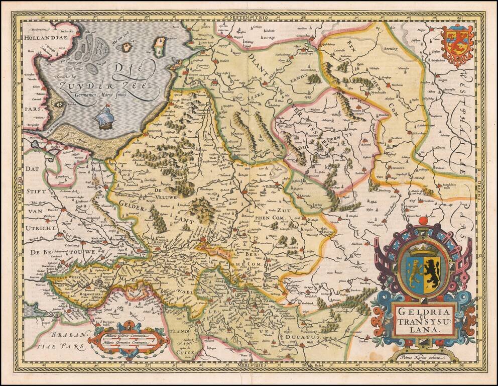
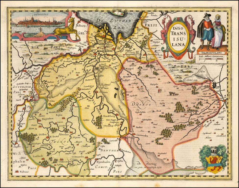
A fine early map of the Gelderland, Overijssel and adjoining regions, which appeared in Petrus Kaerius's (Peter Van der Keere) Germaniae Inferior id est, XVII Provinciarum ejus novae et exactae Tabulae Geographicae, first published in Amsterdam in...
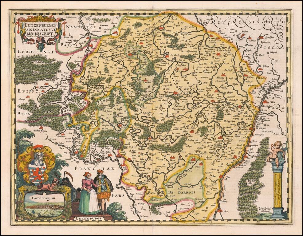
A fine early map of Luxembourg which appeared in Petrus Kaerius's (Peter Van der Keere) Germaniae Inferior id est, XVII Provinciarum ejus novae et exactae Tabulae Geographicae, first published in Amsterdam in 1617. The map includes a view of the City...
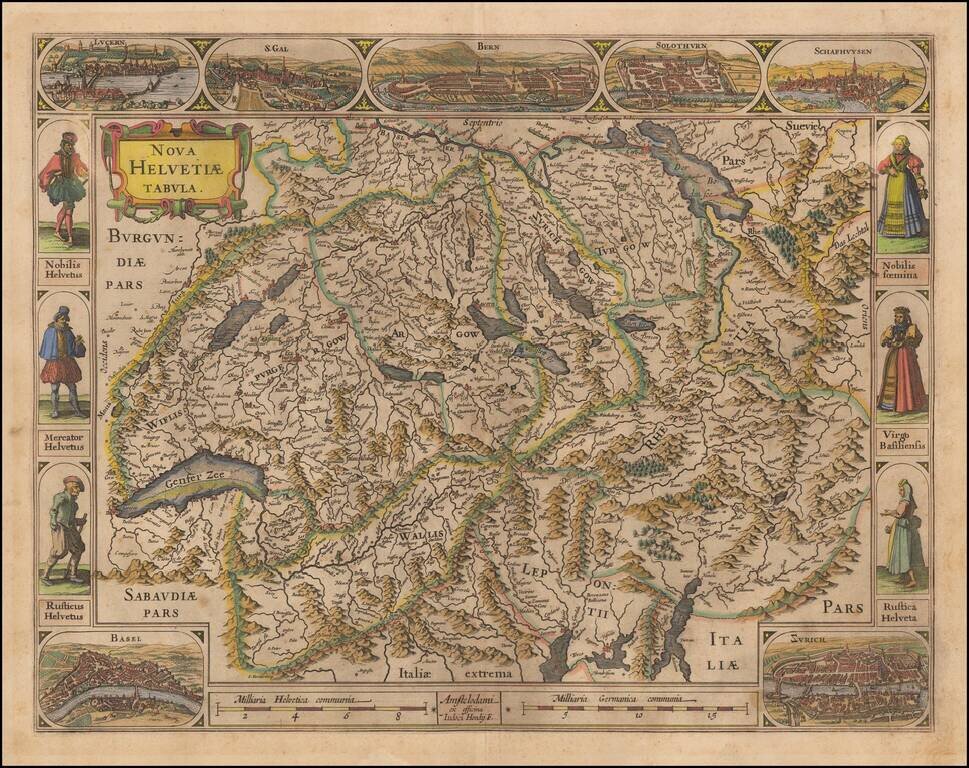
One of the Most Decorative 17th Century Maps of Switzerland. Decorative early map of Switzerland, including 7 city views and 6 costumed figures. Hondius' map of Switzerland is one of the most decorative single sheet maps of Switzerland published in...
![[Warsaw] Varsovia](/map/small/66354.jpg)
Fine old color example of this important early view of Warsaw, first published by Braun & Hogenberg in Theatri praecipuarum Totius Mundi Urbium Liber Sextus Anno MDCXVII, the rare 6th and final volume of their monumental work of City Views of the...
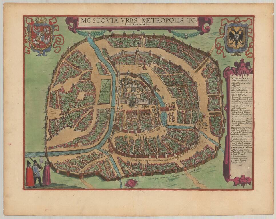
Finely colored example of Braun & Hogenberg's Plan of Moscow. This decorative and detailed plan of Moscow (Moskva) appeared in volume 6 of Braun & Hogenberg's of the Civitatus Orbis Theatrum. Because first appeared in 1617 in the final volume...