
The First Printed Map of the Pacific Ocean Old color example of Ortelius' Maris Pacifici . . . , the first printed map of the Pacific Ocean. Ortelius's Maris Pacifici map was first issued in 1590. The map is based upon Mercator's world map of 1569,...
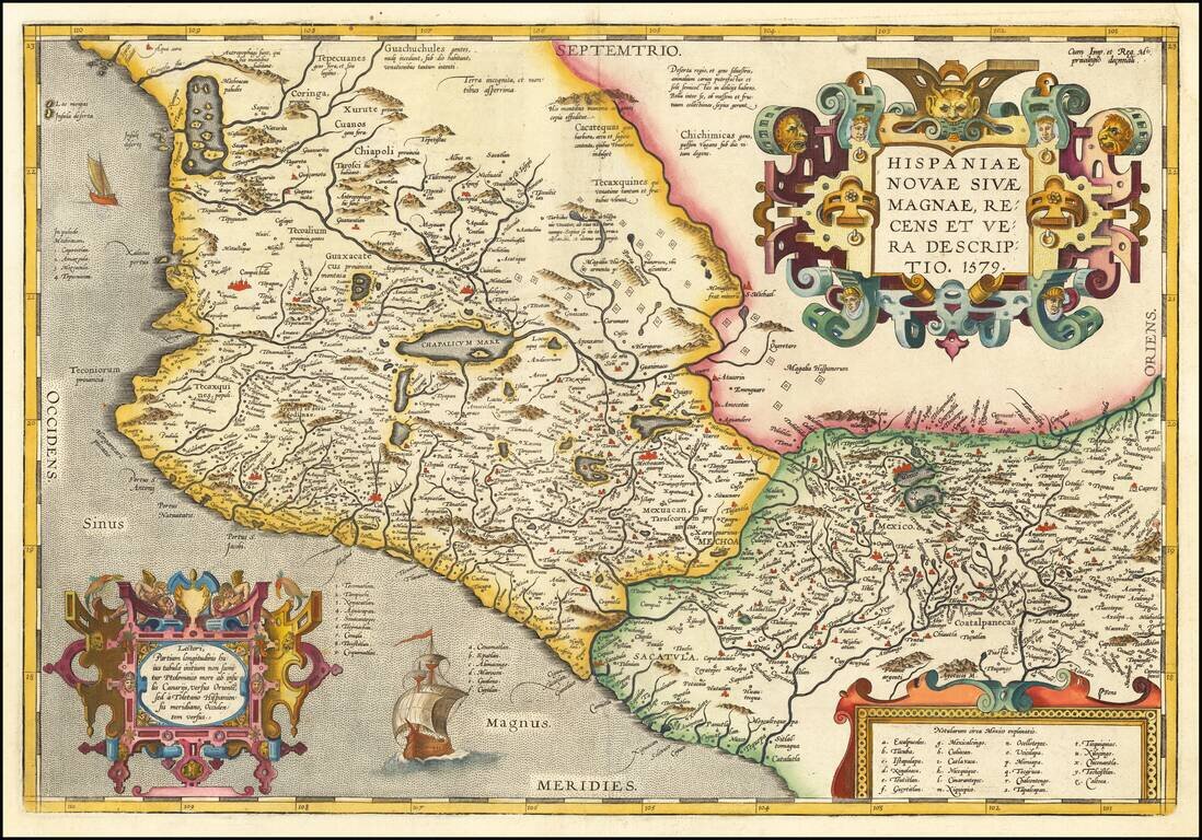
Ortelius' Map of Mexico, One of the Earliest Printed Maps of New Spain Nice example of Ortelius' map of western New Spain, showing the recently-created Spanish settlements, many rivers, and large lakes, including Lake Chapala and a mythical sea with...
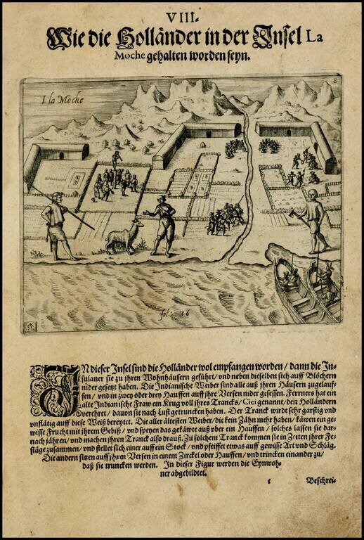
Theodore De Bry's edition of this rare view of settlement on the Island of Mocha in Chile, including an indigenous chiliquenes (Llama), copied from Olivier Van Noort's expedition narrative. The island was historically inhabited by an indigenous...
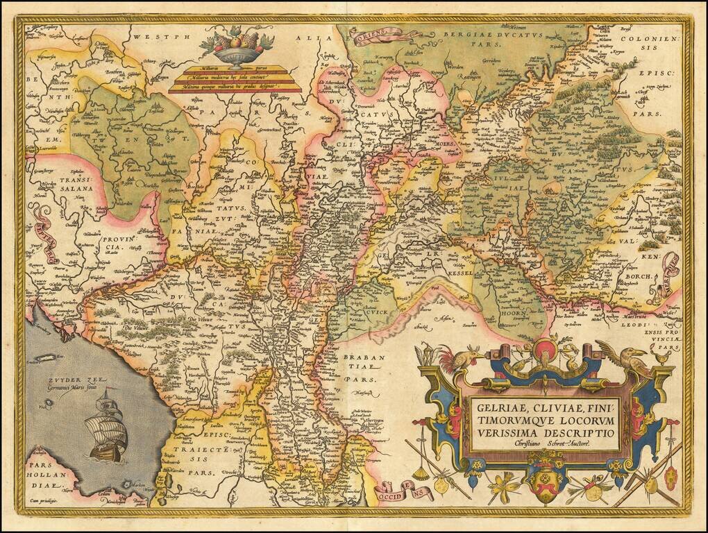
Striking regional map of the Low Countries from Ortelius' Theatrum Orbis Terrarum, the first modern atlas of the world. Includes a large cartouche, war ship and scale of miles.
![Daniae Regni Typus [with] Cimbricae Chersonese nunc Iutiae descriptio ..](/map/small/63315.jpg)
A nice full color example of Ortelius maps of Denmark and Jutland, along with Fiona, Alsen and Langeland. This is Ortelius' third map of Denmark, first issued in 1595. It shows many more details within Denmark and was improved cartographically as...
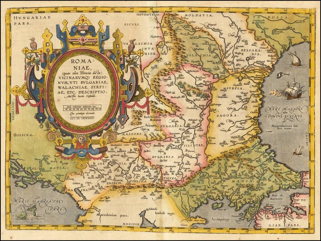
Striking example of Ortelius' map of Romania and contiguous regions west of the Black Sea and north of the Adriatic Coast. Countries located include Bessarabia, Valachia, Bulgaria, Moldova, Syrfia, Romania, Dalmatia and Servia. From Ortelius'...
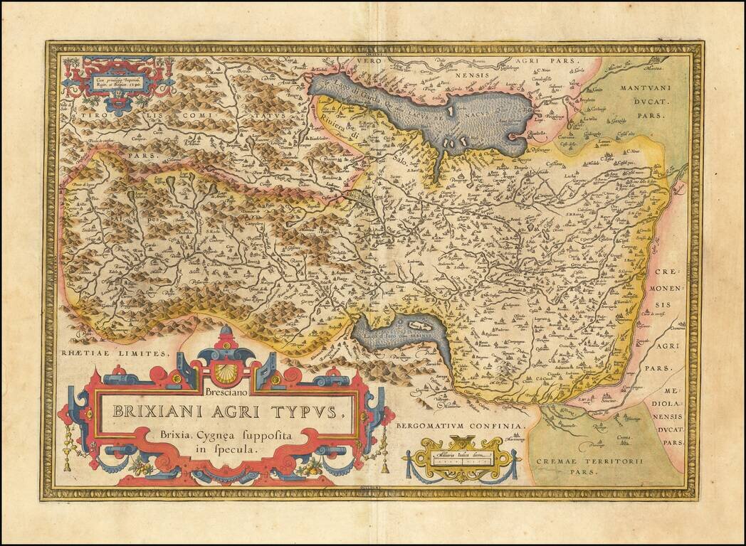
Detailed regional map of northern Italy from Ortelius' Theatrum Orbis Terrarum, the first modern atlas of the world. The map is oriented with east at the top and shows Lago Di Garda, Brescia, Lago d'Iseo, Lago de Idro, etc. Strong dark impression...
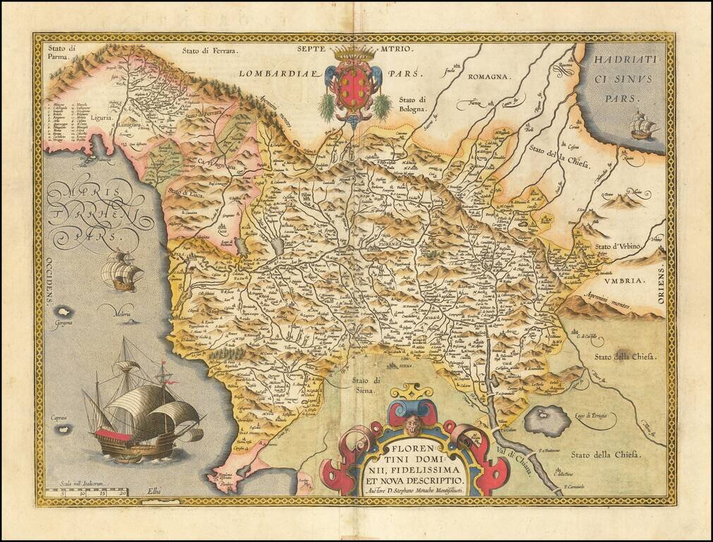
Finely colored example of this scarce map of the Province of Florence in Tuscany, issued in the Vrients editions of Ortelius' Theatrum Orbis Terrarum. The map is centered on the city of Florence and extends to Liguria, the Apennine Mountains, the...
![Hanc Insulam Perlustrabat . . .[Bay of Cadiz] [with] Carpetaniae . . . 1584 [Toledo] [with] Guipuscoae Regionis Typus. . .](/map/small/65037.jpg)
Finely colored example of Ortelius' striking regional map of Spain, showing the Island and Bay of Cadiz, the departure point for Columbus and many other important voyages to the New World during the great age of Spanish exploration. The primary map...
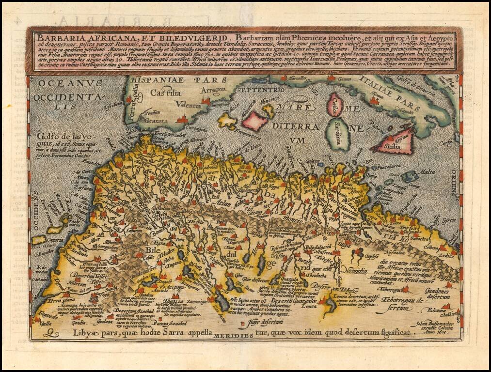
Scarce early map of North Africa and the Mediterranean, engraved by Johann Bussemacher and published by Quad in Cologne.
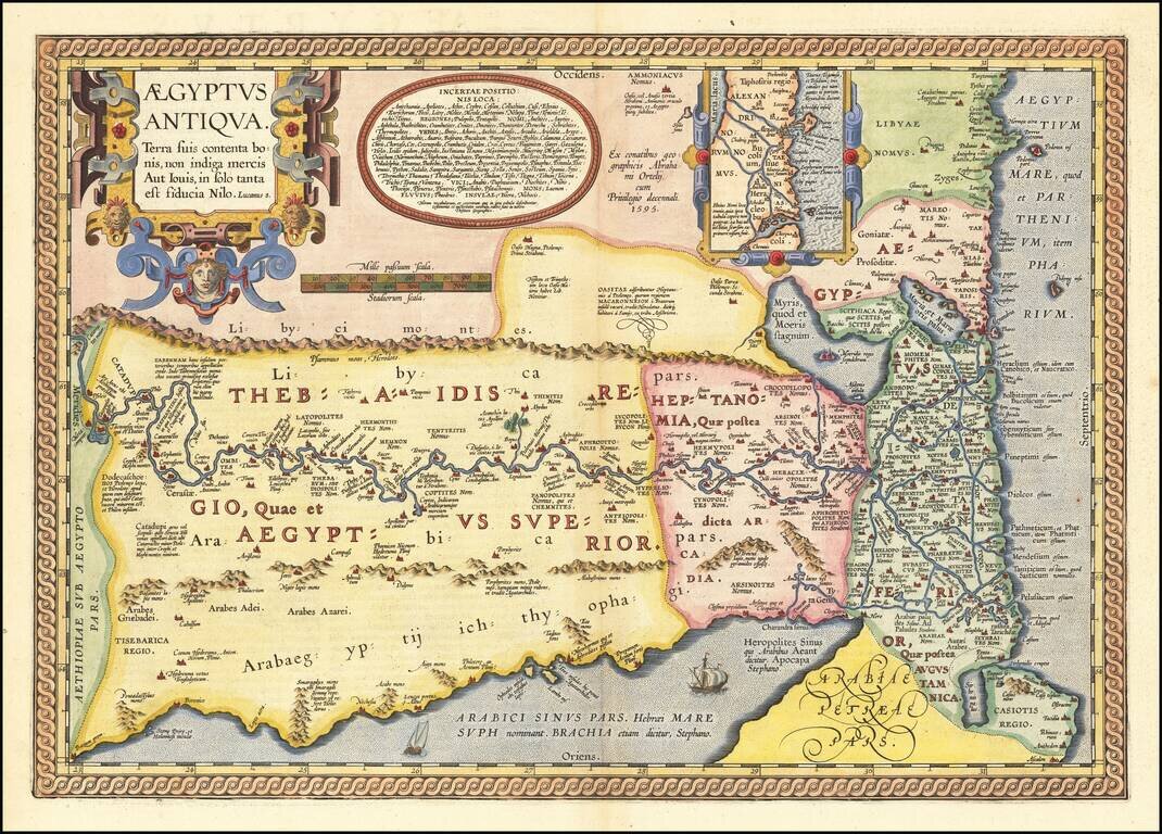
Fascinating Map of Ancient Egypt from Ortelius’ Parergon, The World’s First Historical Atlas Gorgeous example of Ortelius' second map of Egypt, which was issued only in late editions of his Parergon. Ortelius’ interest in ancient civilizations...
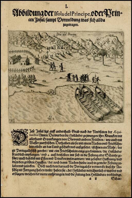
Early image of Sao Tome and Principe, off the coast of West Africa, from the De Bry edition of Olivier Van Noort's Description du Penible Voyage Faict entour de l'Univers ou Globe Terrestre, published by Cornelis Claes in 1602. Van Noort's map,...
![[ Pisces ]](/map/small/68533.jpg)
Striking full color example of Bayer's celestial chart of Pisces, with the stars heightened in gold. Bayer's Uranometria, is one of the most important celestial atlases of the 17th Century and the forerunner of all star atlases which contained 51 star...
![[ Canis Major ] (Stars Heightened in Gold)](/map/small/68771.jpg)
Striking full color example of Bayer's celestial chart of the constellation Canis Major, with the stars heightened in gold. The present example has no text on the verso. Bayer's Uranometria, is one of the most important celestial atlases of the 17th...
![[Piscis Austrinus] (Stars Heightened in Gold)](/map/small/68435.jpg)
A magnificent full-color example of Bayer's celestial chart of Piscis Austrinus, with the stars heightened in gold. Piscis Austrinus is the being that swallows the water poured by Aquarius and is an important constellation in several ancient...
![[ Aries ] (Stars Heightened in Gold)](/map/small/68475.jpg)
Striking full color example of Bayer's celestial chart of the constellation Aries, with the stars heightened in gold. The present example has no text on the verso. Bayer's Uranometria, is one of the most important celestial atlases of the 17th Century...