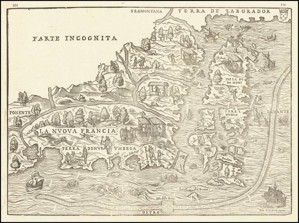
The First Printed Map of New England and New France A nice example of the first printed map devoted to New England and New France, showing the eastern seaboard from New York Bay to the Gulf of St. Lawrence. This map appeared in Ramusio's highly...
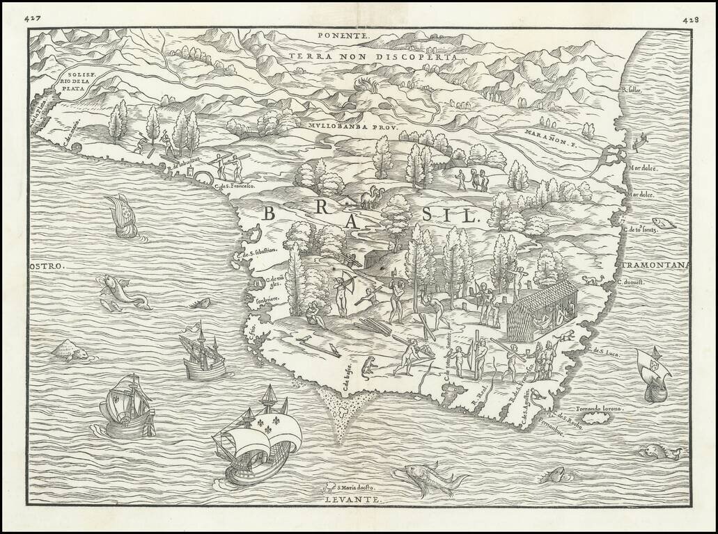
First state of Ramusio's map of Brazil is the earliest obtainable separately issued regional map of Brazil, from Gastaldi's Delle Navigazione e Viaggi, published in Venice in 1556. The map represents an extremely early and inaccurate depiction Brazil....
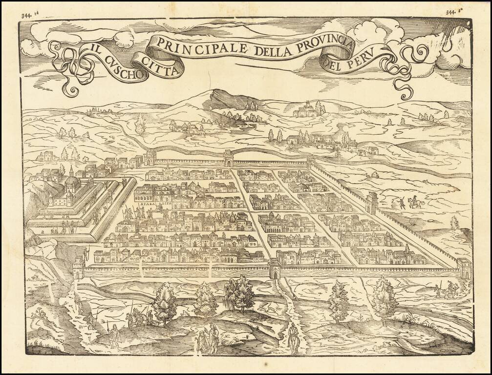
Fine example of this influential and decorative birdseye view of Cusco, from Ramusio's Raccolta di Navigationi et Viaggi., one of the most influential geographical works of the 16th Century. The view would later be copied by Munster and other 16th...
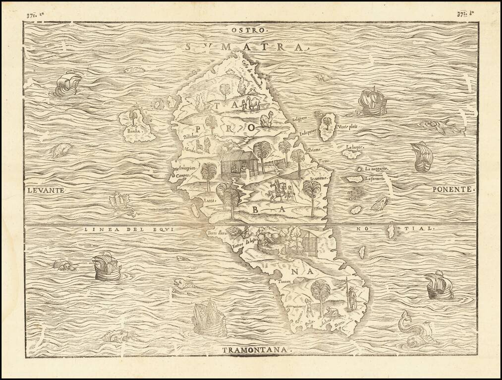
Fine Map of Sumatra, the First to be Based on Actual Observations Nice example of Giovanni Battista Ramusio's important early map of Sumatra, from his famed Navigationi et Viaggi. This is the first map focused solely on an Indonesian island to be...
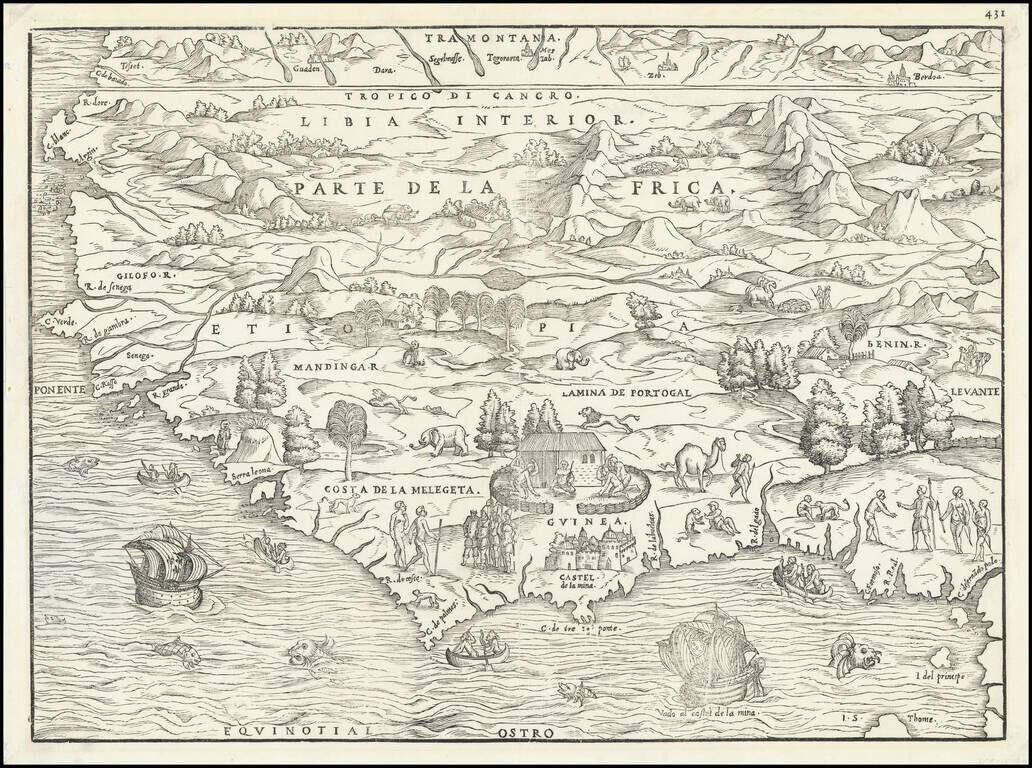
Striking Gastaldi Map of West Africa, Included in a Significant Travel Collection Finely-wrought early map of West Africa, compiled by Giacomo Gastaldi for Giovanni Battista Ramusio's Navigationi et Viaggi. This is an example of the first state,...