logo

1855. Vergleichendes Tableau der Lange der Strome und der Grosse der Seen der Erde in geograph. Meilen zu 15 am Grad.

  • Vergleichendes Tableau der Lange der Strome und der Grosse der Seen der Erde in geograph.  Meilen zu 15 am Grad.

Vergleichendes Tableau der Lange der Strome und der Grosse der Seen der Erde in geograph. Meilen zu 15 am Grad. information:

Year of creation: 
Resolution size (pixels): 
 16877x12901 px
Disk Size: 
 43.3717MiB
Number of pages: 
 1
Place: 
 Munich

Print information. Print size (Width x height in inches):
Printing at 72 dpi 
  234.4 х 179.18
Printing at 150 dpi 
 112.51 х 86.01
Printing at 300 dpi 
 56.26 х 43

An example of detailing the file of this map of in a printable high-resolution:

Click to open in high resolution (open in new tab).
Attention! this is just the central piece (central area 960x960 px) of the map file!
This is an example, so that you can see and study the level of detail of a given map. The entire Map will be fully available after payment!

Vergleichendes Tableau der Lange der Strome und der Grosse der Seen der Erde in geograph.  Meilen zu 15 am Grad.

A Mountains & Rivers Rarity

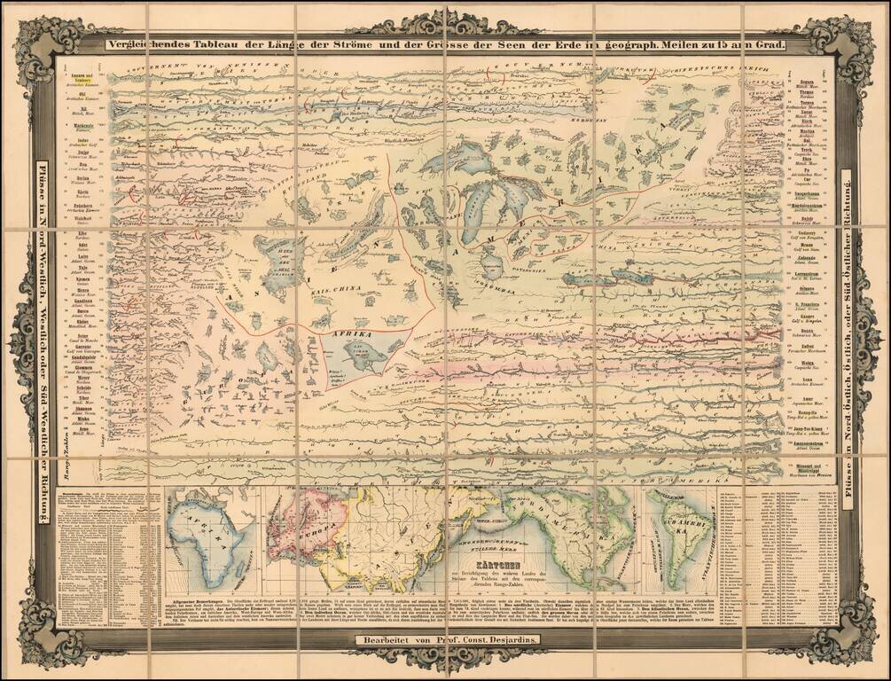
Rare separately issued chart showing the Rivers and Lakes of the World, published in Munich.

The lakes and rivers of the Eastern Hemisphere are shown on the left, with lakes and rivers of the Eastern Hemisphere on the right.

Includes several smaller maps entitled Kärtchen zur Berichtigung des wahren Laufes der Ströme des Tableau mit den correspondirenden Rangs-Zahlen at the bottom.

Professor Constantin Desjardins was the author of several atlases, including Physisch-statistisch und politischer Atlas von Europa and Geographisch-historischer Atlas von Europa.

Rarity

The map is very rare. We note several examples in German institutional collections and 1 example in the British Library, but no examples in the US, or offered in dealers catalogs or at auction.

This is the second example we have offered in the past 25 years.


Special conditions for students!

If you are a student, write to us in telegram: @antiquemaps and indicate what material you need and for what work you need a map in high detail. We are ready to provide material on special terms. For students only!

Item information:

Year of creation:
Size:
16877x12901 px
Disk:
43.3717MiB
Number of pages:
1
Place:
Munich
Author:
Constantin Desjardins.
$14.99

Related item