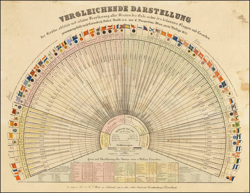
Early Global Statistics Data Visualization Chart. Rare German-language lithographed chart of the population ("Bevölkerung"), area ("Flächeninhalt"), and residents per square mile ("Einw. auft □ M."), along with the flags of many nations of the...
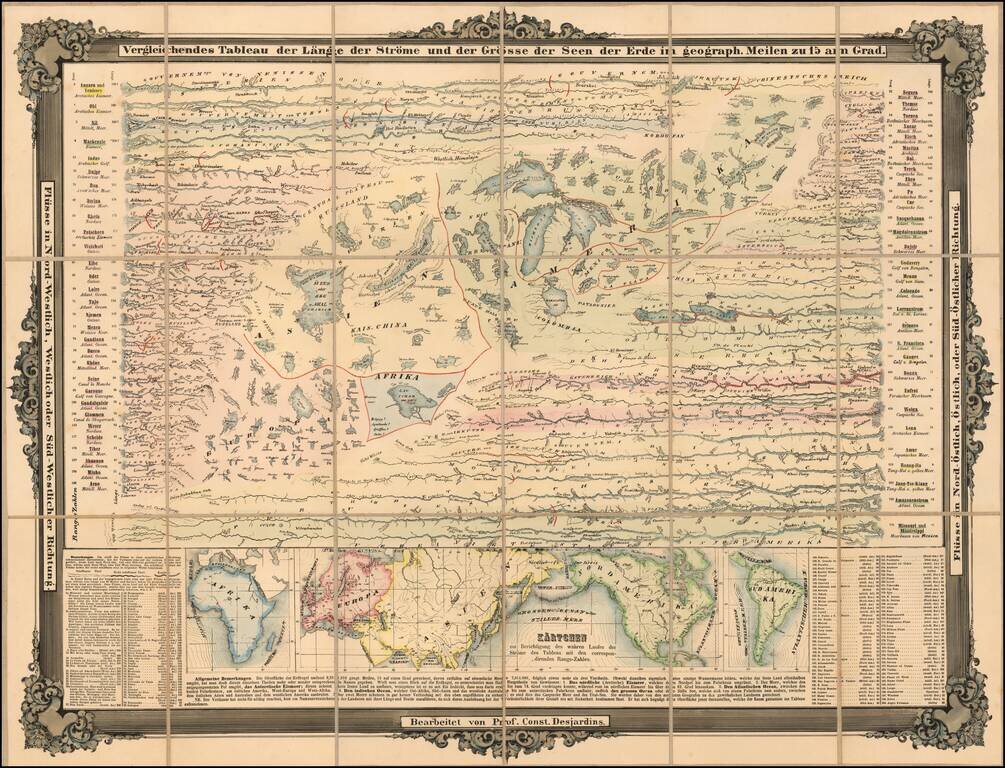
A Mountains & Rivers Rarity Rare separately issued chart showing the Rivers and Lakes of the World, published in Munich. The lakes and rivers of the Eastern Hemisphere are shown on the left, with lakes and rivers of the Eastern Hemisphere on the...