logo

1616. Typus Orbis Terrarum

  • Typus Orbis Terrarum

Map size in jpg-format: 3.77575MiB

Download "Typus Orbis Terrarum", in high resolution.

Typus Orbis Terrarum information:

Year of creation: 
Resolution size (pixels): 
 3886x2809 px
Disk Size: 
 3.77575MiB
Number of pages: 
 1
Place: 
 Amsterdam
Author: 

Print information. Print size (Width x height in inches):
Printing at 72 dpi 
  53.97 х 39.01
Printing at 150 dpi 
 25.91 х 18.73
Printing at 300 dpi 
 12.95 х 9.36

An example of detailing the file of this map of in a printable high-resolution:

Click to open in high resolution (open in new tab).
Attention! this is just the central piece (central area 960x960 px) of the map file!
This is an example, so that you can see and study the level of detail of a given map. The entire Map will be fully available after payment!

Typus Orbis Terrarum

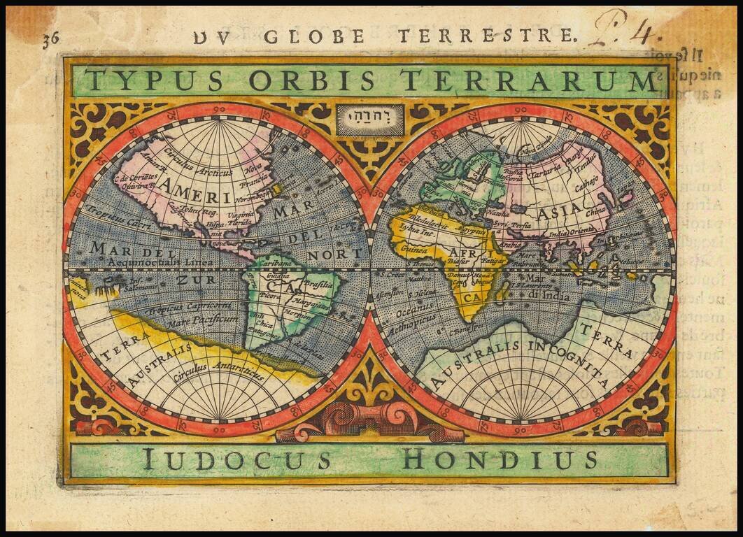
Decorative double hemisphere map of the World, based upon Mercator's map of 1569.

The map is by Jodocus Hondius Jr., who was then working with Bertius, following his father's death in 1612.

Shirley 291

Special conditions for students!

If you are a student, write to us in telegram: @antiquemaps and indicate what material you need and for what work you need a map in high detail. We are ready to provide material on special terms. For students only!

Item information:

Year of creation:
Size:
3886x2809 px
Disk:
3.77575MiB
Number of pages:
1
Place:
Amsterdam
Author:
Petrus Bertius.
$14.99

Related item