Barent Langenes was a Dutch publisher and engraver at the turn of the seventeenth century. He worked in Middleburg, Netherlands. He is best known for his publication of Petrus Bertius’ Caert-Thresoor in 1598. This pocket world atlas was small, printed in the vernacular, and was more affordable than folio-sized competitors, allowing more people to own and use atlases. The atlas was a commercial success and was printed twelve times in Dutch, French, Latin, and German editions between 1598 and 1650, although Langenes was most likely only involved in the first two Dutch editions (1598 and 1599).
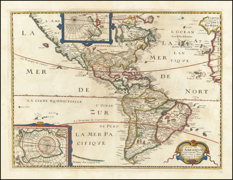
Rare separately published map of America, based upon Jodocus Hondius' map of 1618. The map is a reduced edition of the Bertius/ Tavnernier Map of 1627, without embellishments. A definite northwest coast of America is shown, unlike the Hondius...
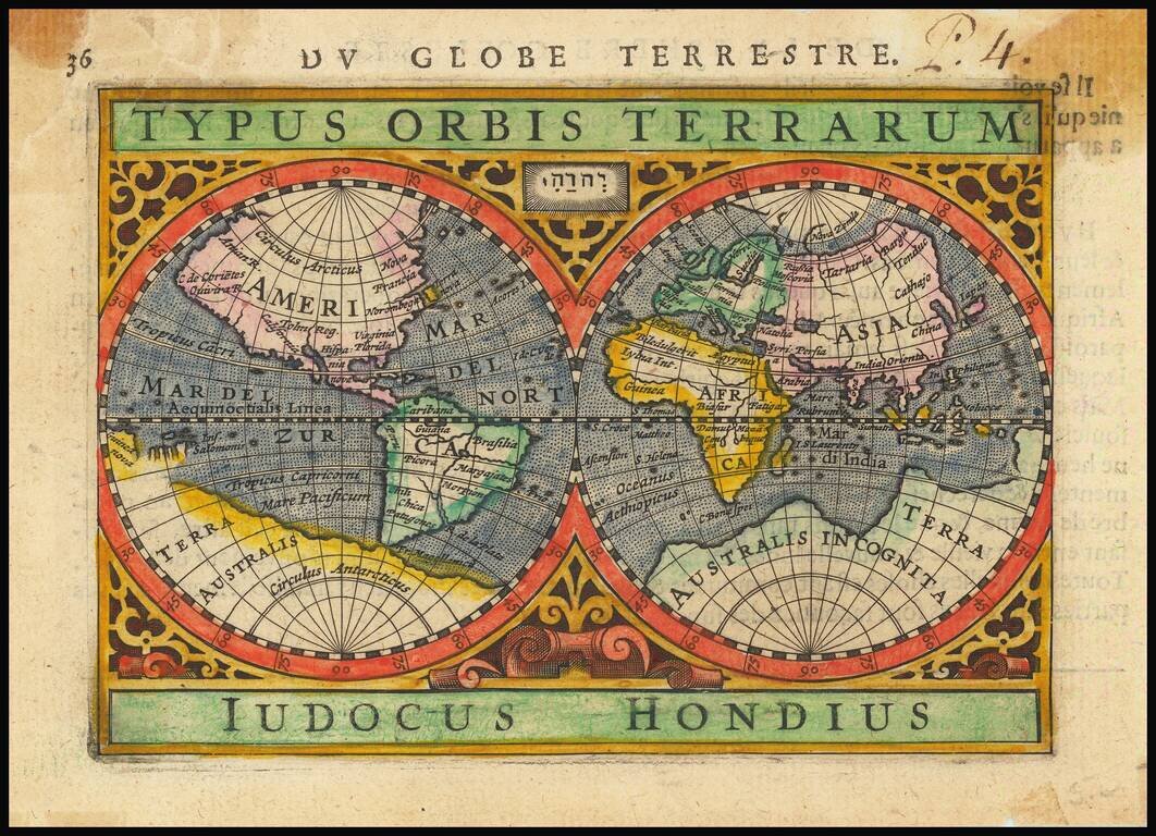
Decorative double hemisphere map of the World, based upon Mercator's map of 1569. The map is by Jodocus Hondius Jr., who was then working with Bertius, following his father's death in 1612.
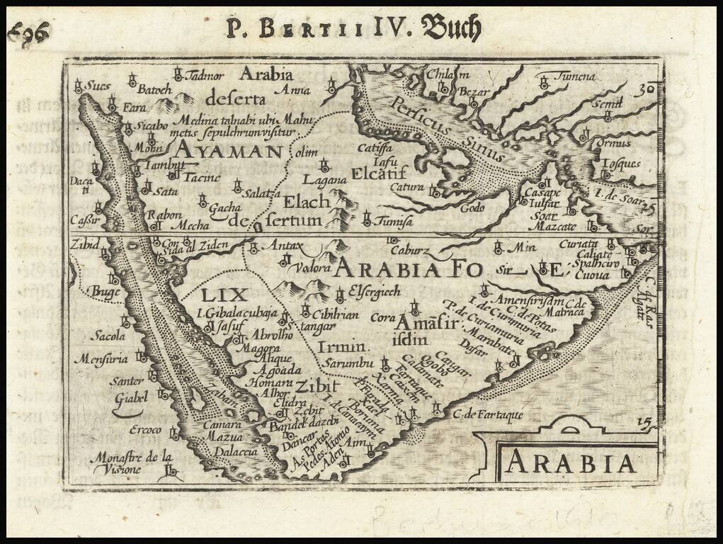
Nice example of this early state of Langenes / Bertius map of the Arabian Peninsula, which first appeared in the 1598 edition of Langenes's Caert-Thresoor, published in Middelburg. Langenes's map was first issued in his Caert-Thresoor and later...
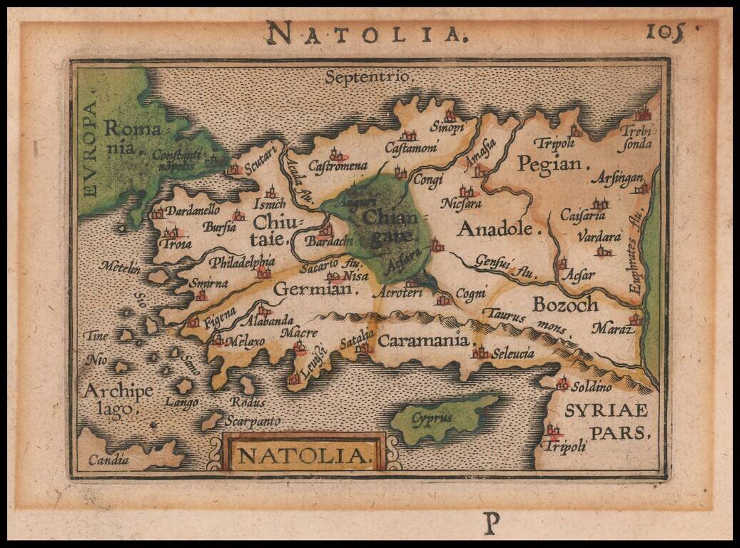
Nice example of this early state of Bertius's map of Asia Minor, which first appeared in an early edition of the Bertius Tabularum Geographicarum, published in Middelburg. The present map is one of the earliest obtainable maps of the region.
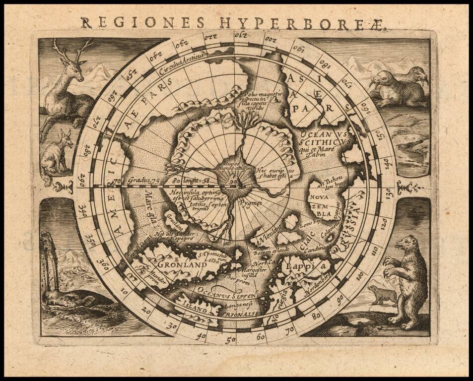
Fine example of Bertius' reduced size version of Gerhard Mercator's highly important and influential map of the North Pole, first published in 1595. Gerard Mercator was the first cartographer to create a polar projection of the earth. His map, the...