logo

1570. Transilvania

  • Transilvania

Map size in jpg-format: 32.2775MiB

Download "Transilvania", in high resolution.

Transilvania information:

Year of creation: 
Resolution size (pixels): 
 11886x8830 px
Disk Size: 
 32.2775MiB
Number of pages: 
 1
Place: 
 Antwerp
Author: 

Print information. Print size (Width x height in inches):
Printing at 72 dpi 
  165.08 х 122.64
Printing at 150 dpi 
 79.24 х 58.87
Printing at 300 dpi 
 39.62 х 29.43

An example of detailing the file of this map of in a printable high-resolution:

Click to open in high resolution (open in new tab).
Attention! this is just the central piece (central area 960x960 px) of the map file!
This is an example, so that you can see and study the level of detail of a given map. The entire Map will be fully available after payment!

Transilvania

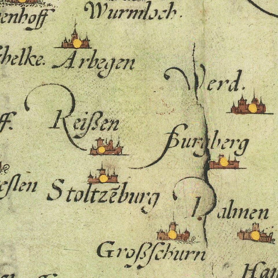
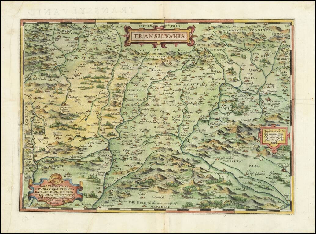
Nice example of Ortelius' map of Transylvania, from his Theatrum Orbis Terrarum, the first modern atlas.

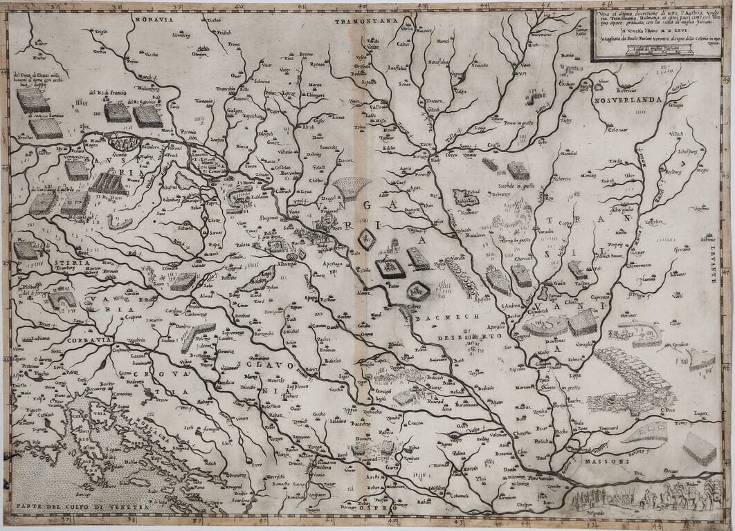
The map is drawn from a rare map of Hungary prepared by Sambucas in 1566, which is in turn based upon Honter's map of 1532.

Van Den Broecke 153.

Special conditions for students!

If you are a student, write to us in telegram: @antiquemaps and indicate what material you need and for what work you need a map in high detail. We are ready to provide material on special terms. For students only!

Item information:

Year of creation:
Size:
11886x8830 px
Disk:
32.2775MiB
Number of pages:
1
Place:
Antwerp
Author:
Abraham Ortelius.
$14.99

Related item