Robert Sayer (ca. 1724-1794) was a prominent London map publisher. Robert’s father was a lawyer, but his older brother married Mary Overton, the widow of prominent mapmaker Philip Overton and the proprietor of his shop after his death. Mary continued the business for roughly a year after her marriage and then, in early 1748, it passed to Robert. Robert became a freeman of the Stationers’ Company later that year; his first advertisement as an independent publisher was released in December.
Sayer benefited from Overton’s considerable stock, which included the plates of John Senex. In the 1750s, Sayer specialized in design books and topographical prints, as well as comic mezzotints. In 1753, he, along with John Roque, published a new edition of Thomas Read’s Small British Atlas, the first of several county atlases that Sayer would publish.
Sayer’s business continued to grow. In 1760 he moved further down Fleet Street to larger premises at 53 Fleet Street. In 1766, he acquired Thomas Jefferys’ stock when the latter went bankrupt. In 1774, he entered into a partnership with John Bennett, his former apprentice. The pair specialized in American atlases, based on the work of Jefferys. They also began publishing navigational charts in the 1780s and quickly became the largest supplier of British charts in the trade.
Bennett’s mental health declined, and the partnership ended in 1784. As Sayer aged, he relied on his employees Robert Laurie and James Whittle, who eventually succeeded him. He spent more and more time at his house in Richmond. In 1794, he died in Bath.
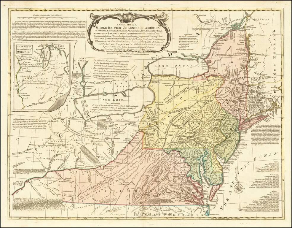
One of the Most Influential 18th Century Maps of America Fine example the Carrington Bowle's edition of Lewis Evans' seminal map of the British Colonies in North America. Along with the maps of Henry Popple and John Mitchell, Lewis Evans' map is...
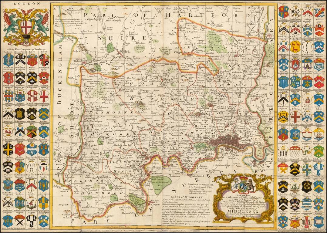
Fine large format map of the County of Middlesex, with London in the lower right corner. Includes 92 small coats of arms of the Free Companies in the county, and two larger decorative cartouches. A large and decorative 18th century map of Middlesex...
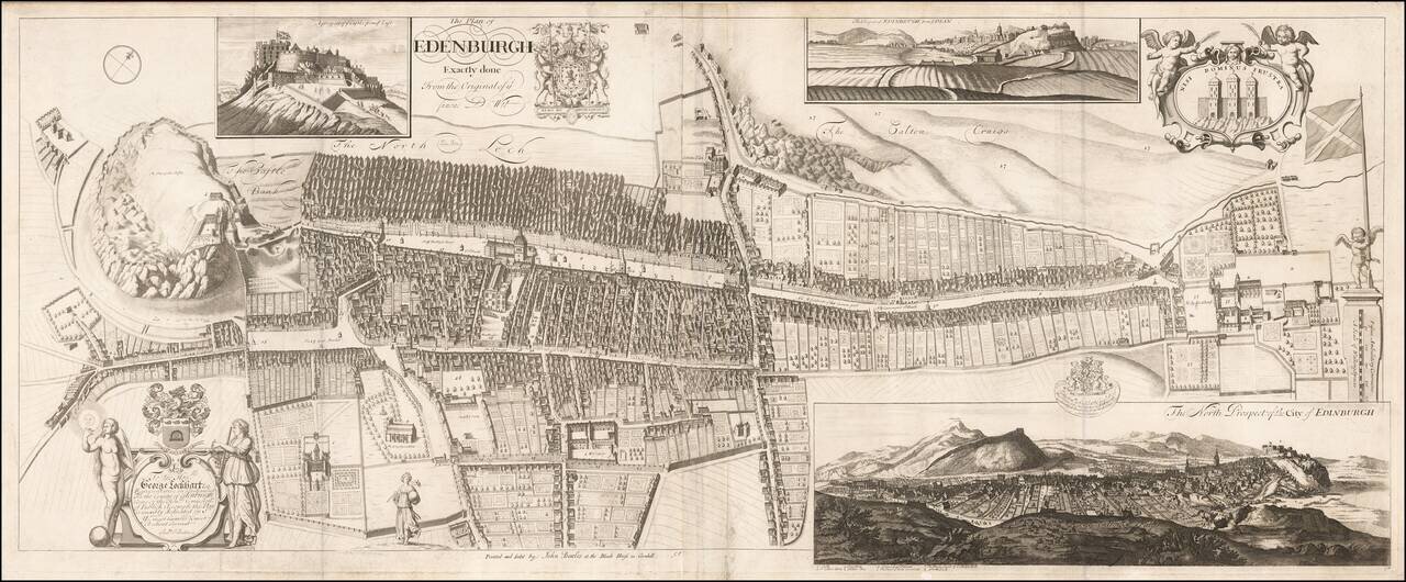
Rare Decorative Plan and View of Edinburgh Dedicated to George Lockhart esq. Rare town plan, bird's-eye view and prospect of Edinburgh, engraved by the Scots mapmaker Andrew Johnston, and first published in 1714. The map first appeared in the...