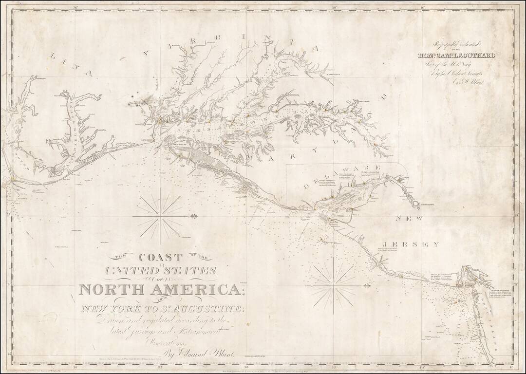
Nice example of Edmund Blunt's chart of the central portion of the coastline of the United States, from Cape Hatteras to Long Island. Blunt's chart was one of the most commercially successful and enduring American Sea charts issued in the first half...
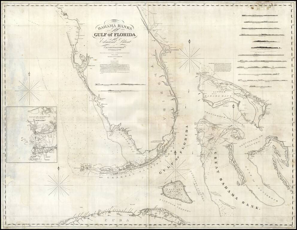
Rare early state of Blunt's sea chart of Florida and the Bahamas, first published in 1833. Nice coverage of the Bahama Islands. Has a small inset chart of Key West and twelve small recognition views of coastal approaches. The Coastline of Florida is...