Map size in jpg-format: 1.23235MiB
Click to open in high resolution (open in new tab).
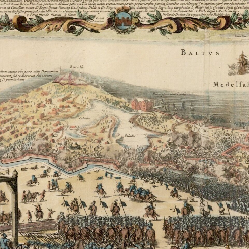
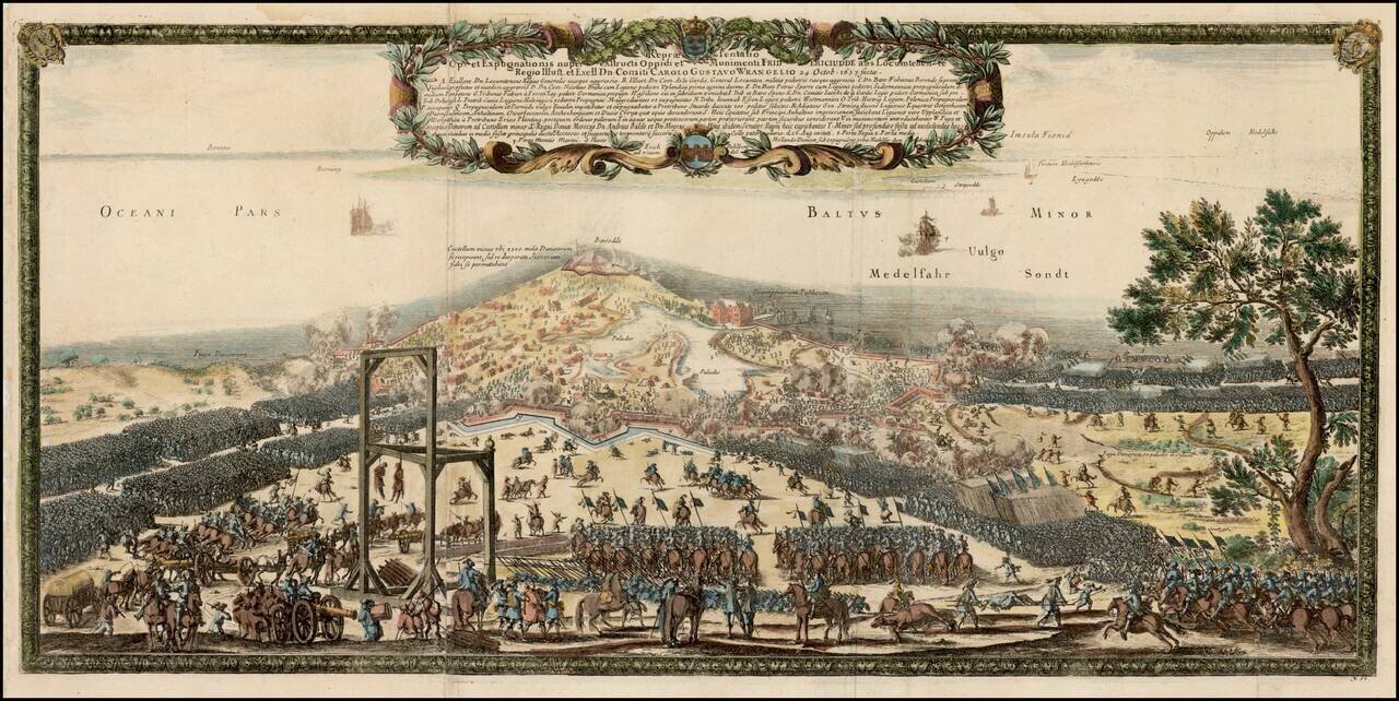
Highly detailed view of the Swedish invasion of Fredericia, by King Carl X Gustav, in August, 1657.
After the devastation caused by the Thirty Years' War in a largely unfortified Jutland, King Christian IV realized the necessity of building a strong fortress in Jutland, and decided that this project could be combined with his plans for building a large town in Jutland.
A fortified encampment was built on a point of land called Lyngs Odde, near the current location of Fredericia, with a rampart stretching to either side of the point, thus protecting the encampment from attacks. However, the fortifications were not perfect, and when Swedish Field Marshal Lennart Torstenson invaded Jutland, he was able to break through the ramparts. It was Frederick III, who was finally able to complete the plans for the fortification, also adding a flank fortification, on nearby Bers Odde, as suggested by Danish Imperial Marshal Anders Bille.
The armies of Carl X Gustav, attacked Fredericia on August 24, 1657. After failing to take Fredericia, the Swedes laid siege to the neighboring villages. On October 24, 1657, the Swedes again attacked Fredericia under the command of General Wrangel, this time taking Fredericia, which was occupied by Swedish forces for a year and a half.
If you are a student, write to us in telegram: @antiquemaps and indicate what material you need and for what work you need a map in high detail. We are ready to provide material on special terms. For students only!