Johann, or Johannes, Walch (1757-1816) was a painter and engraver. He was well-known for painting miniature portraits, having trained in Geneva, Venice, and Rome. Walch published several atlases and sheet maps. As with his atlases, many of Walch’s maps were reprinted after his death.
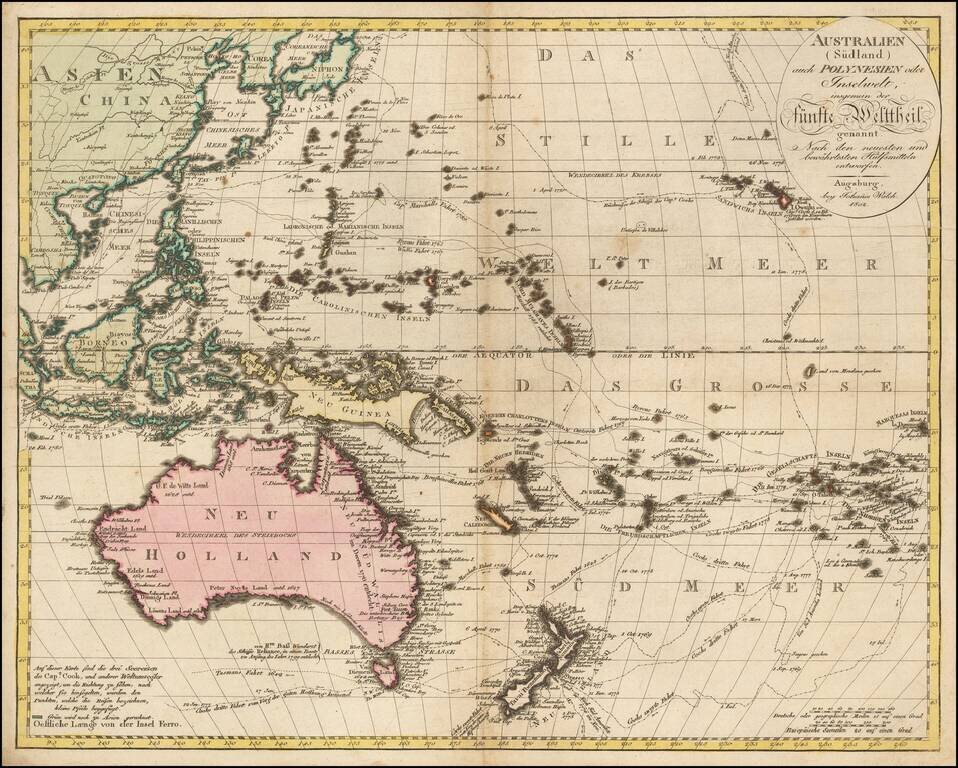
Exquisitely-Detailed Map of Australasia and the South Pacific -- Sea of Korea Fine example of Walch's map of the Western Pacific and Southeast Asia, first published in Augsburg in 1802. It celebrates the routes and encounters of the recent European...
![[Untitled Map of the Northern Hemisphere]](/map/small/18651.jpg)
Rare early map of the Northern Hemisphere, one of the earliest maps engraved by Walch, who would go on to have a successful career of more than 30 years as a mapmaker in Augsburg. Nice post-Cook detail, a very early use of information from Cook's...
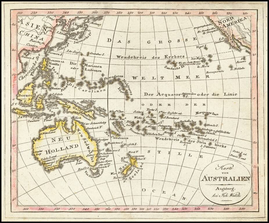
Interesting map of the Southern Part of the Pacific Ocean, published in Augsburg by Walch. Includes Hawaii and fascinating early configurations for Australia and New Zealand.
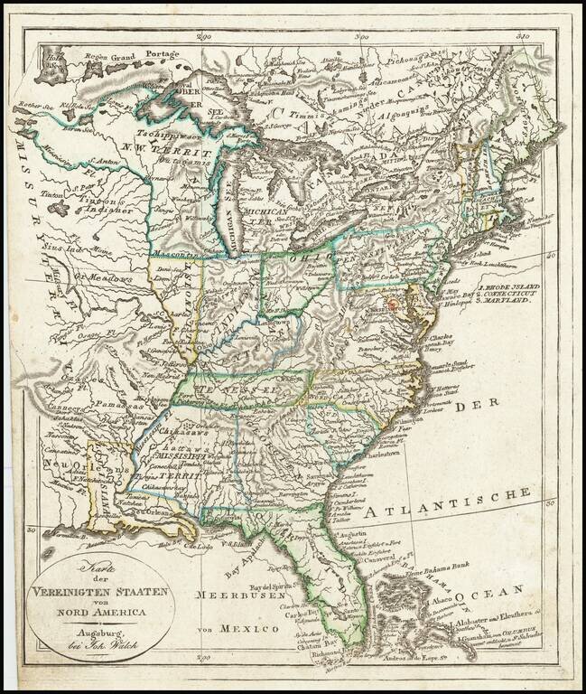
Mississippi Territory ! Rare early state of Walch's map of the United States, showing a number of early and transitional territorial configurations. This map vividly illustrates the fluid nature of American territorial boundaries between the Louisiana...
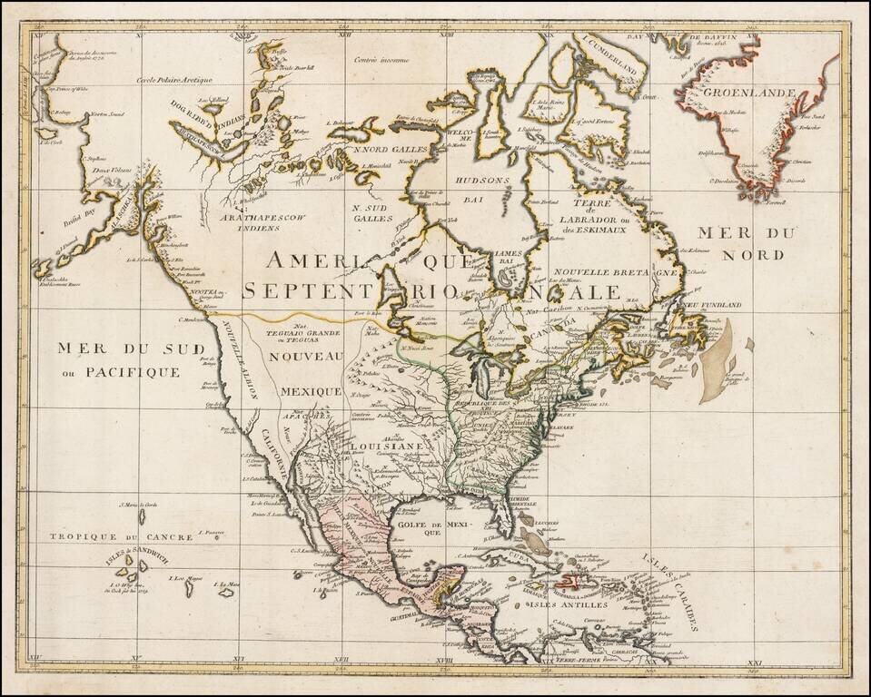
Very rare map of North America, published shortly after Cook's discovery of the Sandwich Islands (shown). Includes a marvelous treatment of the Upper Northwest, Canada and Alaska, noting the Dogged Ribbed Indians in Canada and the 2 Volcanos in Alaska.
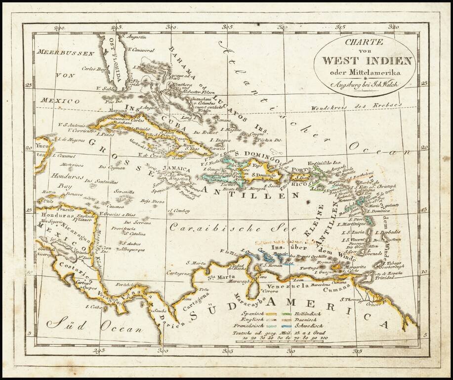
Interesting map of the West Indies, published in Augsburg by Walch. The map is colored by Colonies and includes some early annotations in a contemporary German hand.
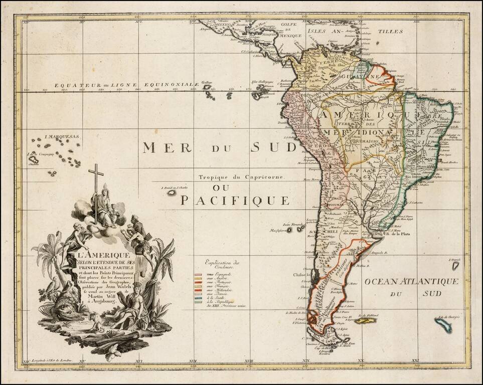
Very rare map of South America, published in Augsburg. Includes an elaborate cartouche, including a large allegator.
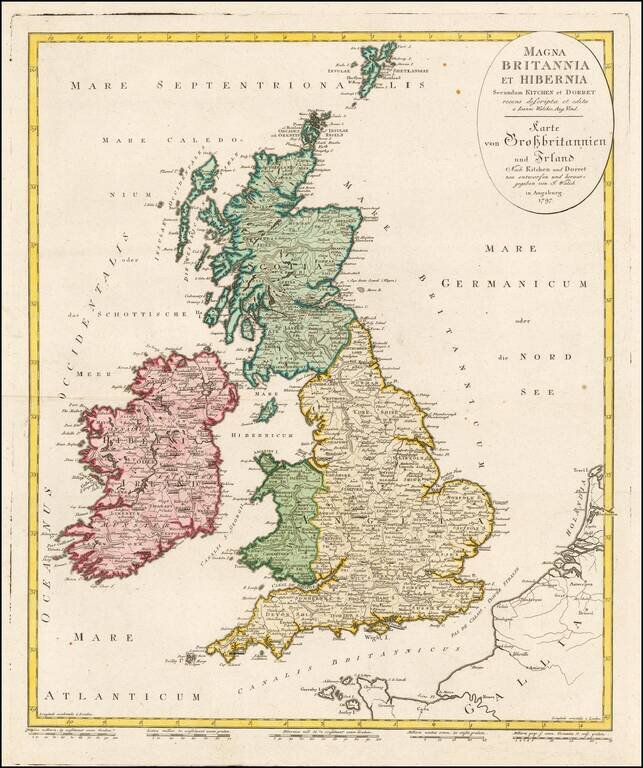
Scarce map of the British Isles, from a late 18th century large format German Atlas. Only the second time we have ever offered this map in over 20 years.
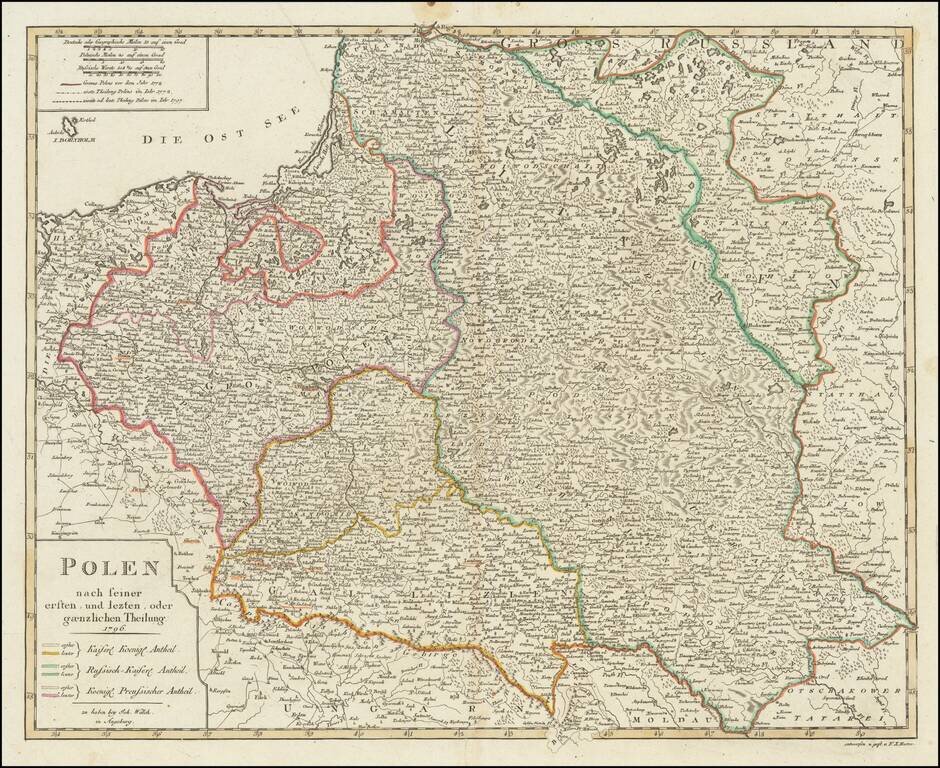
Detailed map of Poland, published in Augsburg by Johann Walch. The map shows Poland after the 3 dismemberments. The color coding shows the areas taken by the various European powers.
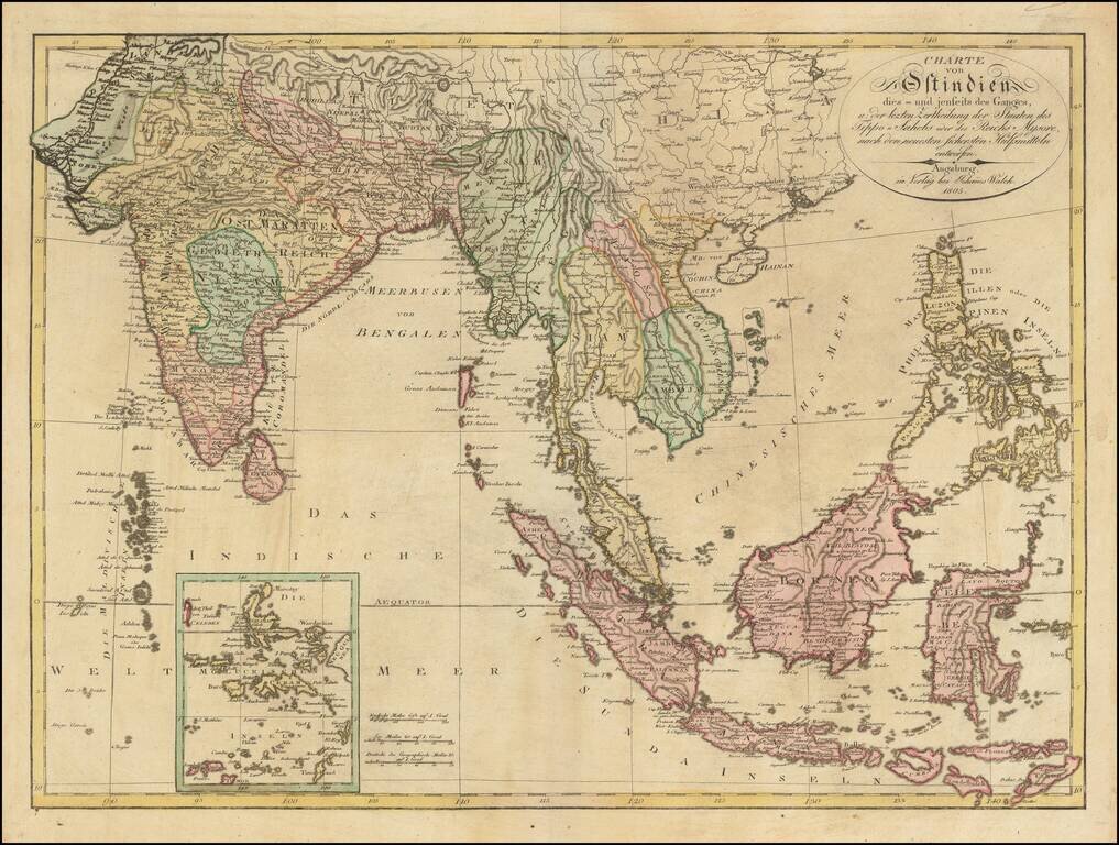
Scarce large format map of India, Southeast Asia and the Philippines, published in Augsburg by Johann Walch. The map gives a fine image of the Philippnes. Tonkin, Cochinchina (Vietnam), Laos, Siam (Thailand) and Camboja (Cambodia).