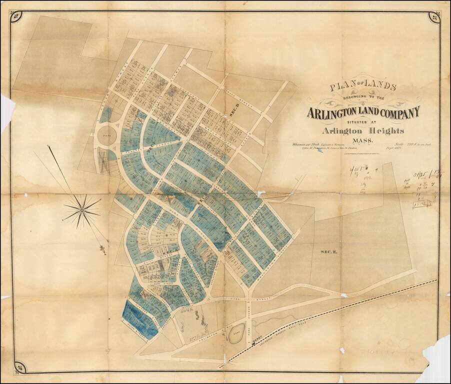
Rare early development map of Arlington Heights, Massachusetts. The map is oriented with Southwest at the top. The Park Circle Water Tower site is located. The Lexington Branch Railroad is shown looping around a Pond near the present site of the...
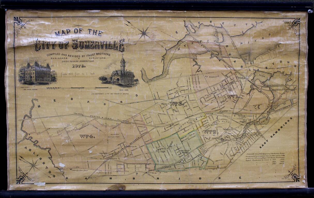
Wonderful separately issued map of Somerville, Massachusetts, in the Boston metropolitan area. Tufts College is shown on the border between Somerville and Medford. The Mystic Reservoir is named and illustrated. College Hill Station is labeled....