Pieter Goos (ca. 1616-1675) was a Dutch map and chart maker, whose father Abraham Goos (approx. 1590-1643) had already published numerous globes, land and sea maps together with Jodocus Hondius and Johannes Janssonius in Antwerp.
Pieter Goos gained recognition due to the publication of sea charts. He bought the copperplates of the famous guide book for sailors, De Lichtende Columne ofte Zeespiegel (Amsterdam 1644, 1649, 1650), from Anthonie Jacobsz. Goos published his own editions of this work in various languages, while adding his own maps. In 1666, he published his De Zee-Atlas ofte Water-Weereld, which is considered one of the best sea atlases of its time. Goos' sea charts came to dominate the Dutch market until the 1680s, when the Van Keulen family began to come to prominence.
![[Wall Map] West-Indische Paskaert waer in de graden der breedde over weder zyden vande middelyn wassende so vergrooten dat die geproportioneert syn tegen hunne nevenstaende graden de lengde.](/map/small/60169.jpg)
A Remarkable Dutch Sea Chart Used For Navigation Between Africa and America Rare Johannes Van Keulen issue of Pieter Goos's sea chart of the Atlantic Ocean, America and Africa, first published circa 1680. This chart was created for use at sea by...

"A scientific and artistic document of the first order" -- One of the most important sea charts of the 17th century. Exceptionally rare Johannes Loots issue of Guillaume Blaeu's landmark sea chart of the Atlantic Ocean, America and Africa, printed on...
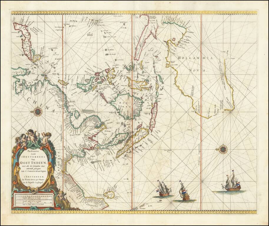
Nice old color example of Pieter Goos' sea chart of Australia, Southeast Asia, China, Japan, Korea and India. First published in Goos' Zee Atlas. The chart is the second of two charts encompassing the sea routes from Southern Africa to the Far East,...
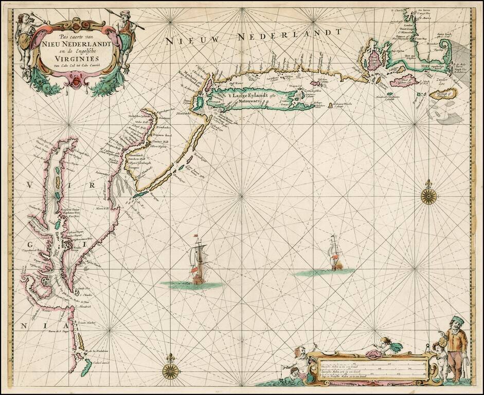
Fine wide margined example of one of the finest and most beautiful regional 17th-century charts of America, from De Zee Atlas ofter Water-Weereld, first published by Goos in 1666. The map illustrates the Atlantic coast of America from Cape Cod to Cape...

Scarce chart of the Caribbean, Florida, Gulf Coast and Southeastern part of North America, with inset of the north coast of Cuba. Goos based his general chart of the West Indies, Gulf Coast and Southeast on the manuscript maps of Hessel Gerritsz,...
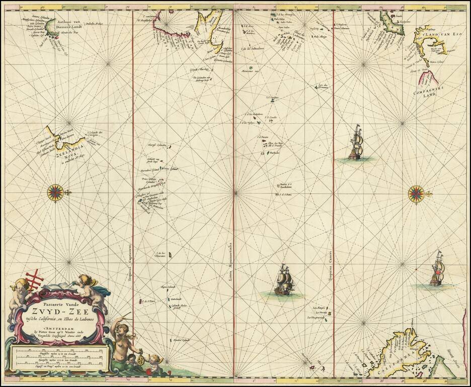
Rare Dutch Sea Chart of the Pacific Fine old color example of Pieter Goos' sea chart of the Pacific Ocean, extending from Australia, New Zealand and Japan to California. Oriented with west at the top, Goos's chart is among the earliest regional maps...
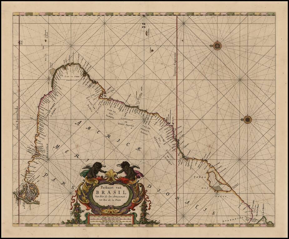
Gorgeous full color example of Goos's Sea Chart of the Coast of Brazil from the mouth of the Amazon to the Rio de la Plata, in full original color. Includes and elaborate title cartouche, compass roses, etc. The map appeared in Goos' De Zee Atlas ofte...
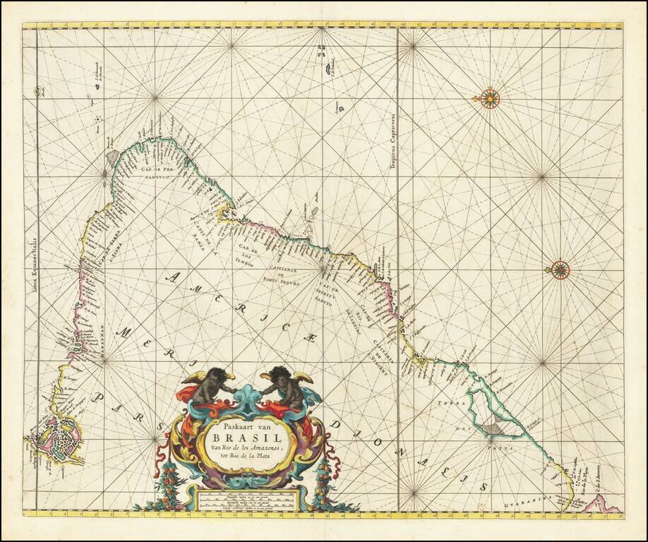
Gorgeous full color example of Goos's Sea Chart of the Coast of Brazil from the mouth of hte Amazon to the Rio de la Plata, in full original color. Includes and elaborate title cartouche, compass roses, etc. The map appeared in Goos' De Zee Atlas ofte...
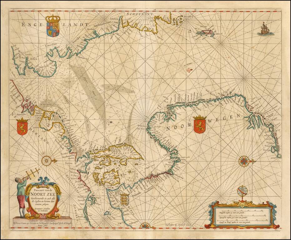
Nice example of Goos' Sea Chart of the Noort Zee, extending from the Mouth of the Thames and the English Channel and Calais and Dunkirk to Stetin and Christianopolen on the Baltic and Dronten and Schogen in Norway. The chart is oriented with north at...
![De Zee Custen van Ruslant, Laplant, Finmarcken, Spitsbergen en Nova Zemla [Heightened in Gold]](/map/small/54892.jpg)
Detailed sea chart of the coasts of Russia, Finland, and Spitsbegen in old color. Includes an inset map of "De Reviere Dwina opte Reviere van Archangel". The chart includes a detailed plan of the coastlines, soundings, anchorages, coastal details,...
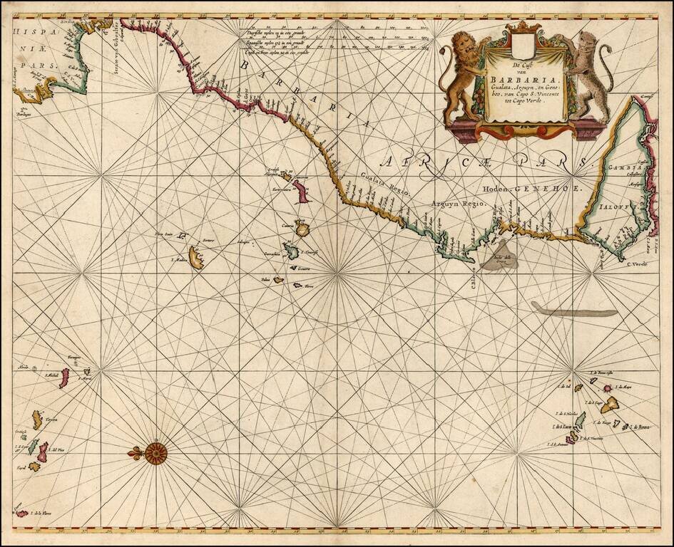
Detailed sea chart of the Iberian Peninsula and the Northwest Coast of Africa, extending to the Cape Verde Island and Gambia. Pieter Goos was one of the leading Dutch chart makers of the period.
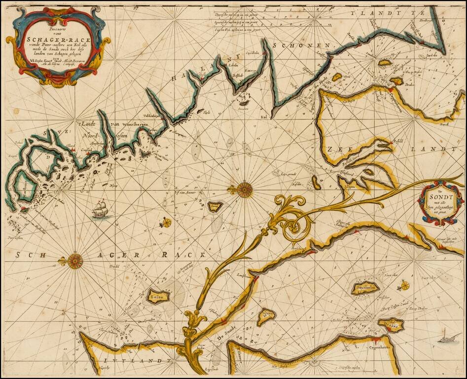
Rare variant of this striking sea chart of the strait between Sweden and Denmark, published by Goos. This east-oriented sea chart shows the waterway between Sweden and Denmark leading to the Baltic Sea. Skagerrak, Kattegat and Oere-Sund with...
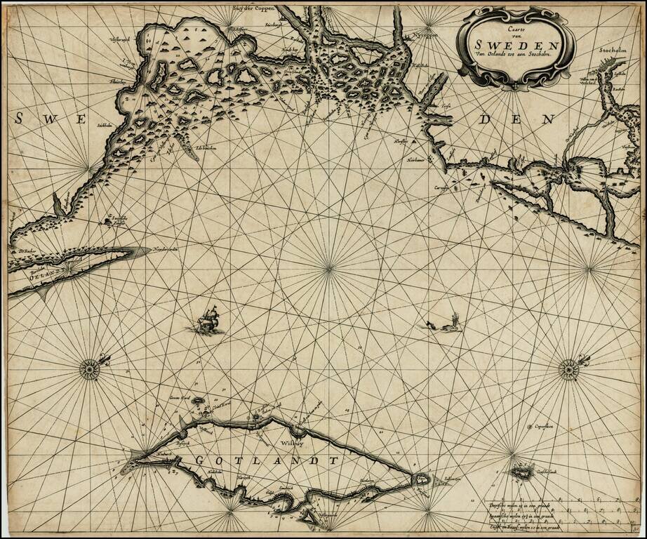
Dark impression of Goos' regional sea chart of Sweden, based upon an earlier chart by Jacobsz. The chart covers the coast of Sweden from Schenckenes and Oeland towards Stockholm, along with the island of Gotland. The chart includes the names of towns...
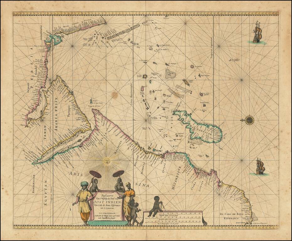
Charting the Western Indian Ocean Decorative sea chart of the Indian Ocean, orientated with the north to the left. The highly decorative chart shows the East African coast, Arabia, Madagascar and the islands of the Indian Ocean with the Seychelles...
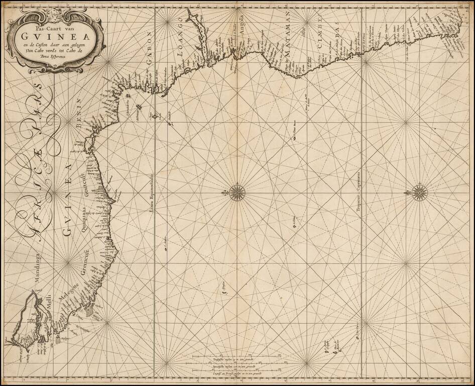
A rare sea chart from one of the great nautical atlases of the Dutch Golden Age of cartography: De Zee-Atlas Ofte Water-Weereld. The map captures the west African coast from the Gambia River in the north (here called R. Portugues) to roughly Cape St....