Map size in jpg-format: 14.8411MiB
Click to open in high resolution (open in new tab).
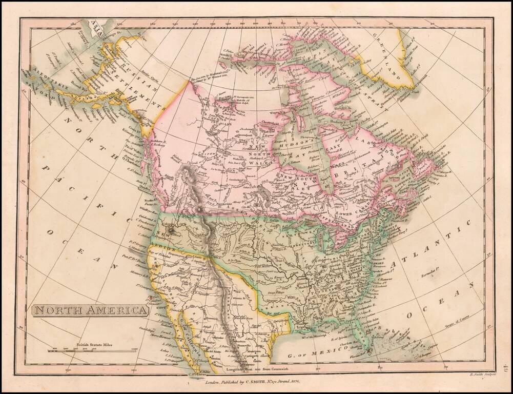
Post-Adams Onis Edition
Detailed map of North America, illustrating the boundaries of North America, shortly after the Adams Onis Treaty established the boundaries between Mexico and the United States.
The map illustrates features which give away its political view, most notably the boundary between Canada and the United States running below Puget Sound on the West Coast.
The mythical rivers in the west drain Lake Timpanagos and "Salt Lake" to Pacific Ocean, running just north of the equally mythical Rio de St. Felippe.
The single cordillera of the Rocky Mountains separates the regions explored by Lewis & Clark.
From Smith's General Atlas.
If you are a student, write to us in telegram: @antiquemaps and indicate what material you need and for what work you need a map in high detail. We are ready to provide material on special terms. For students only!


![[Signed Political Satire Artwork] Vietnam ... Vietnam ... Vietnam ...](/map/small/68726.jpg)