Map size in jpg-format: 36.0912MiB
Click to open in high resolution (open in new tab).
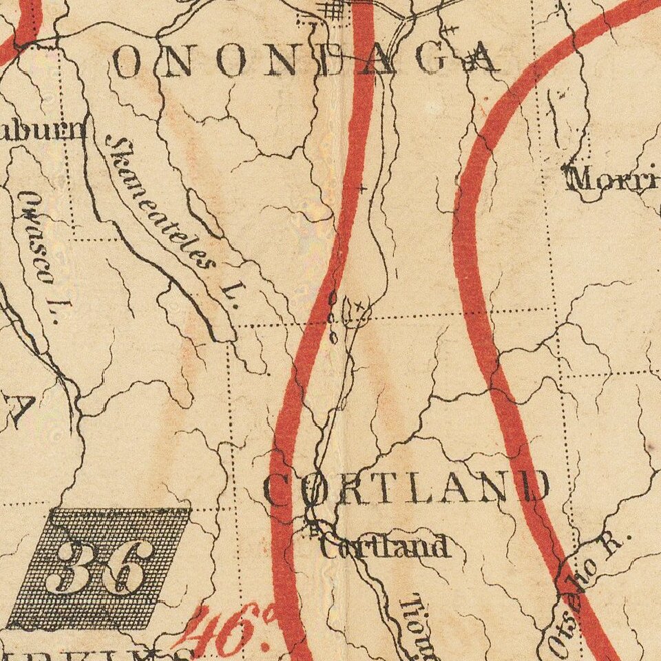
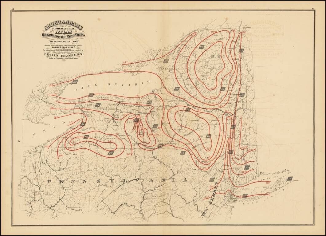
Antique printed color map of New York State, published in Asher & Adams' New Topographical Atlas and Gazetteer of New York.
The map shows the average mean temperature for the year bu isothermal lines (red) and the mean average rainfall in inches (shaded boxes).
Asher & Adams was a New York publishing firm known for their atlases. Notably, their maps were some of the first to prominently exhibit railroad lines, even if this meant a slight reduction in topographical detail. They specialized especially in state and county maps of the United States.
If you are a student, write to us in telegram: @antiquemaps and indicate what material you need and for what work you need a map in high detail. We are ready to provide material on special terms. For students only!

![[Site of A Presidential Assassination] Plan of the Pan American Exposition to be held at Buffalo, New York (May 1 - Nov. 1, 1901)](/map/small/69181.jpg)