Asher & Adams was a New York publishing firm known for their atlases. Notably, their maps were some of the first to prominently exhibit railroad lines, even if this meant a slight reduction in topographical detail. They specialized especially in state and county maps of the United States.
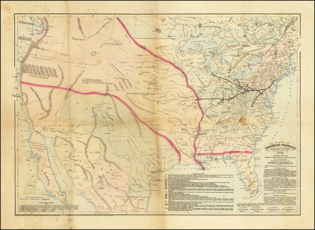
A Wonderful Centennial Map. The United States as it was known in 1776 - from the perspective of 1876. Very scarce hand-colored lithographed map of the United States, prepared by Asher & Adams for the Baltimore & Ohio Railroad, presumably for...
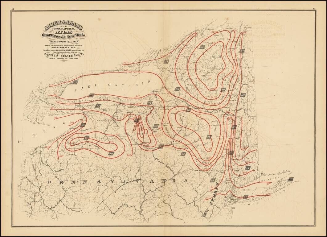
Antique printed color map of New York State, published in Asher & Adams' New Topographical Atlas and Gazetteer of New York. The map shows the average mean temperature for the year bu isothermal lines (red) and the mean average rainfall in inches...
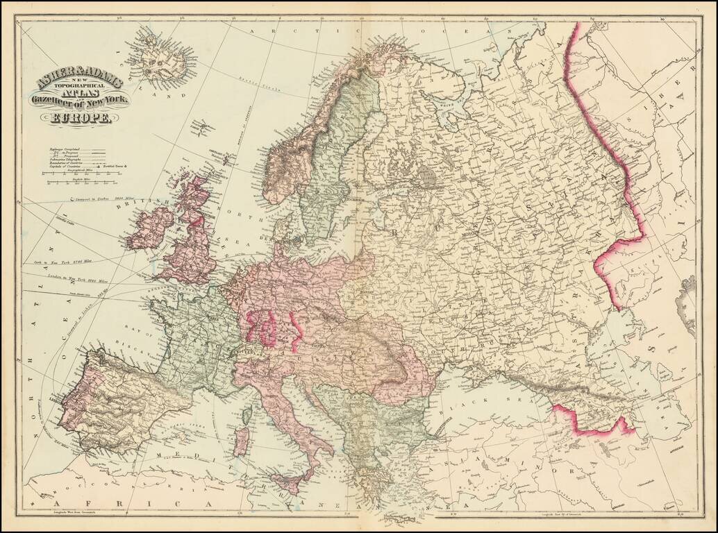
Fine large map of Europe, published by Asher & Adams. The map includes railroads and shipping routes, with distances to ports in North America and Europe.