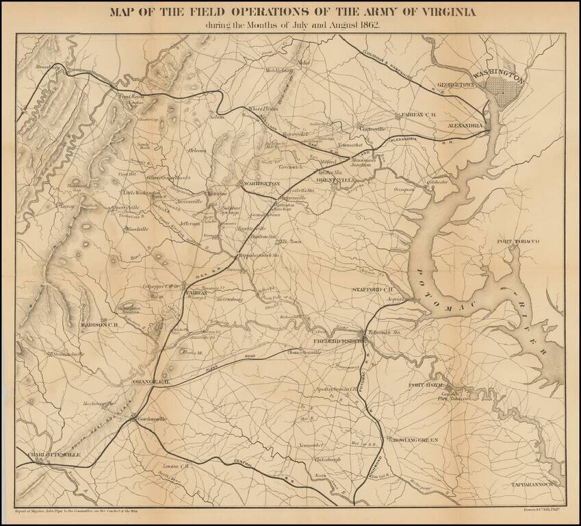
Detailed map of the Theater of War in Virginia. Washington D. C. is at the upper right. Charlottesville, Virginia is at the lower left. Shows roads, railroads, place names and terrain features. General Pope was the new commander of Federal forces in...
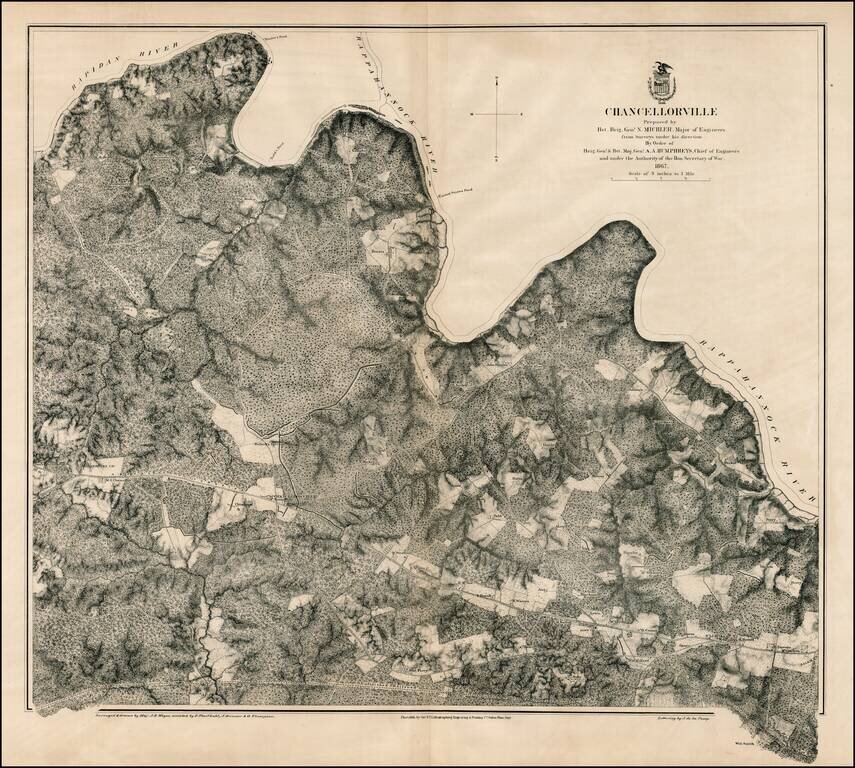
Scarce large format plan of the battle field and region around Chancellorville, showing the area south of the Rappahannock River. Shows fortifications. Highly detailed. What is most noteworthy about the map is the inclusion of dozens of land owners on...
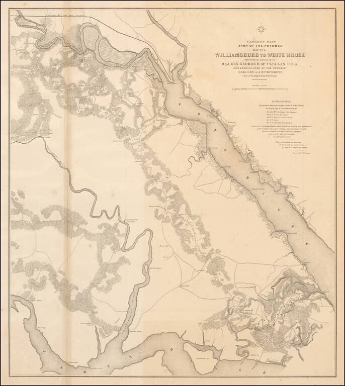
Large lithographed map of the area from Williamsburg, Virginia to "White House" on the Pamunkey River, prepared for McClellan and published in 1862. The map was one of a series of maps showing the theater of operations of the Army of the Potomac. The...
![[Atlanta Campaign] Map Illustrating the Military Operations in Front of Atlanta, Ga. From the Passage of Peach Tree Creek, July 19th 1864, to the Commencement of the Movement upon the Enemy's Lines of Communication, South of Atlanta, August 26th 1864 . .](/map/small/54700.jpg)
Remarkable map of the five miles around Atlanta, offered here in the so-called facsimile reproduction edition, published by the Graphic Company of New York. By far the most detailed map of the region around Atlanta to depict this fast growing southern...
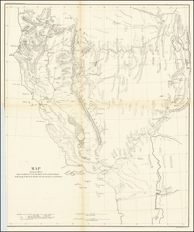
A Search For The Best Routes To The West. "[O]ne of the most interesting maps of the West" - Wheat 868 This is a scarce map which accompanied the Report of Capt. R. Ingalls on the March of L. Col. Steptoe from Ft. Leavenworth to California, in 1854...
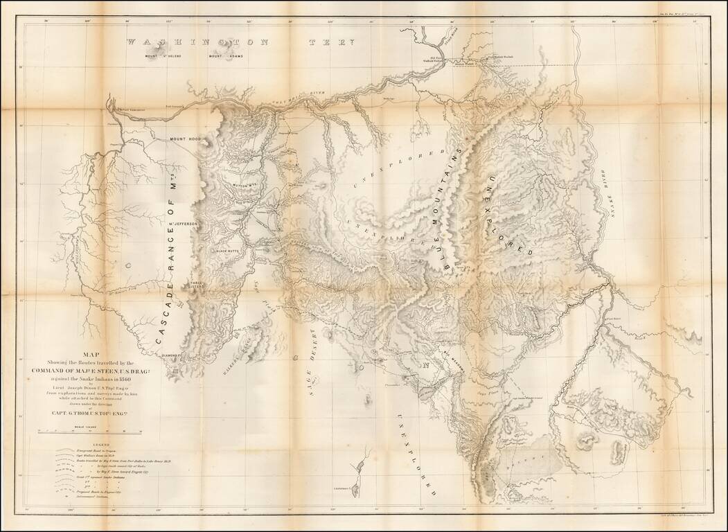
Important early map of Eastern Oregon, bounded by the Willamette, Columbia, and Snake Rivers. Major Enoch Steen, commander of the U.S. Dragoons, was sent to the area in 1860 to determine the feasibility of routes from the Willamette Valley to...
![[San Diego & San Diego Bay]](/map/small/45945.jpg)
Scarce map of the San Diego Bay & Vicinity, prepared during the time period when San Diego was actively soliciting the US Government to consider San Diego for future military installations. The names of many of the original landowner's of the...