Map size in jpg-format: 5.54717MiB
Click to open in high resolution (open in new tab).
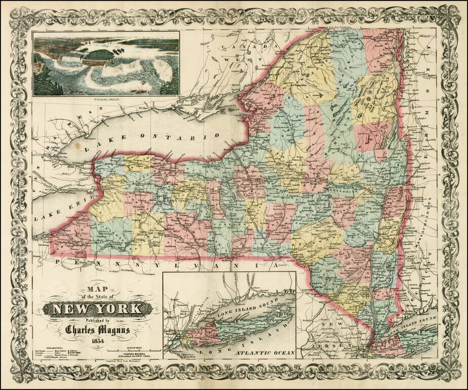
Scarce separately issued map of the state of New York, issued by Charles Magnus.
Magnus published birdseye views, letter sheets and separately issued maps during the Civil War. This map was apparently intended to be issued in pocket map format, but was never folded. The map is colored by counties and shows railroads, common roads, canals, towns, rivers, and a host of other information. Insets of Long Island and a large view of Niagara Falls.
If you are a student, write to us in telegram: @antiquemaps and indicate what material you need and for what work you need a map in high detail. We are ready to provide material on special terms. For students only!

![[Site of A Presidential Assassination] Plan of the Pan American Exposition to be held at Buffalo, New York (May 1 - Nov. 1, 1901)](/map/small/69181.jpg)