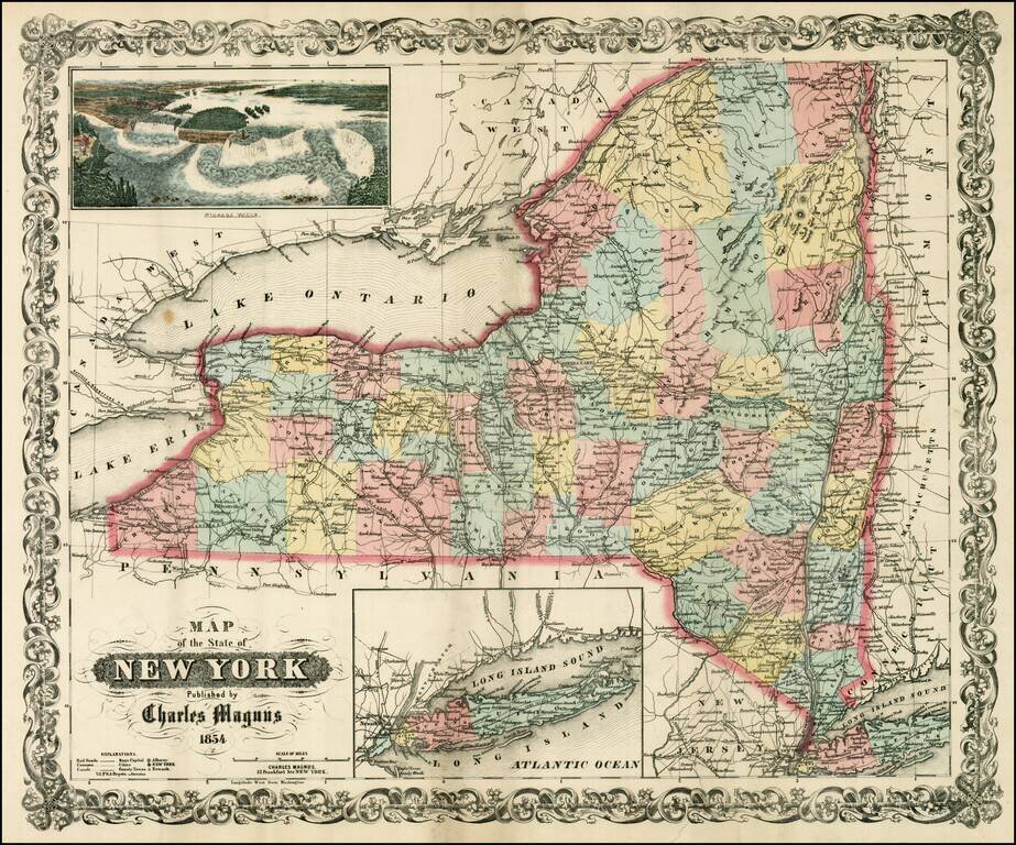
Scarce separately issued map of the state of New York, issued by Charles Magnus. Magnus published birdseye views, letter sheets and separately issued maps during the Civil War. This map was apparently intended to be issued in pocket map format, but...
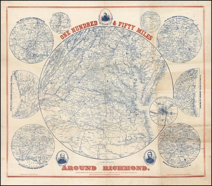
Scarce regional map of the area around Richmond, with 9 inset maps showing the 100 miles around Milledgeville, GA; 250 miles around Charleston, SC; 100 miles around Chattanooga, Tenn; Fortifications around Richmond; 200 miles around Montgomery, Ala,...