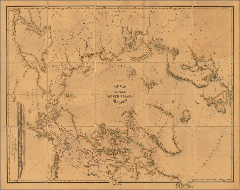
Interesting map of the North Polar regions.
The map provides a remarkable overview of Polar Exploration up to the mid-1870s. Approximately 70 explorers spanning four centuries are noted on the map, including the dates of voyages and coastlines...
antiquemaps.ru is sale. 12,000+ superb pieces of vintage collectible printable 300dpi maps - total 300GB high resolution rare and antique old map archive!
antiquemaps.ru website use cookies, local storage and other similar technologies. This is necessary to ensure the full functionality of our services. Using our services and sites after reading this notice means that you have given your consent to their use in your browser. Click "OK" to confirm your agreement