![[Cochise County, Arizona Territory - Northern Sonora] Ranches of the California and Mexico Land and Cattle Co. Arizpe District, State of Sonoma Mexico](/map/small/47308.jpg)
Hand Drawn Southern Pacific Railroad Company Map Locating The Cattle Ranches of the California and Mexico Land and Cattle Company -- Mexican Revolution -- Cananea Strike & Massacre Detailed manuscript map of part of Southern Arizona and Northern...
![Map Showing the Summer Resorts on the Pacific Coast, adjacent to the lines of the Central and Southern Railroads. [California Tourist. Yosemite, The Big-Tree Groves Geysers, Monterey and other Popular Summer Resorts of Californa]](/map/small/41461.jpg)
Detailed railroad map of the area around San Francisco Bay, extending to Virginia City, Nelson, Willows, Cloverdale, Clear Lake, Monterey, Madera, and Yosemite. The map shows the various railroad lines servicing the above listed destinations, via the...
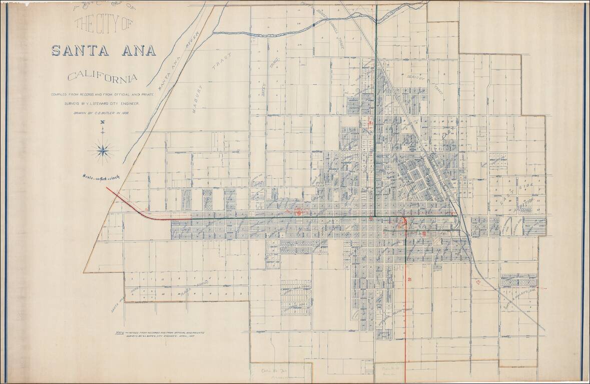
Excellent early map of Santa Ana, compiled by its City Engineer, W.L. Steward in 1906 and drawn by C.D. Butler, and later updated by G.L. Bates, the City Engineer in 1907. A reduced size edition of the map was printed by George L. Bates in Santa Ana,...
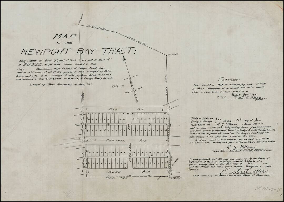
Detailed map of the "Newport Bay Tract," between Surf Avenue and Bay Avenue, centered on Coronado Street. Surf Avenue is now East Ocean Front. Central Avenue is now Balboa Boulevard. Bay Avenue is unchanged. Alvarado Street also appears. The land...
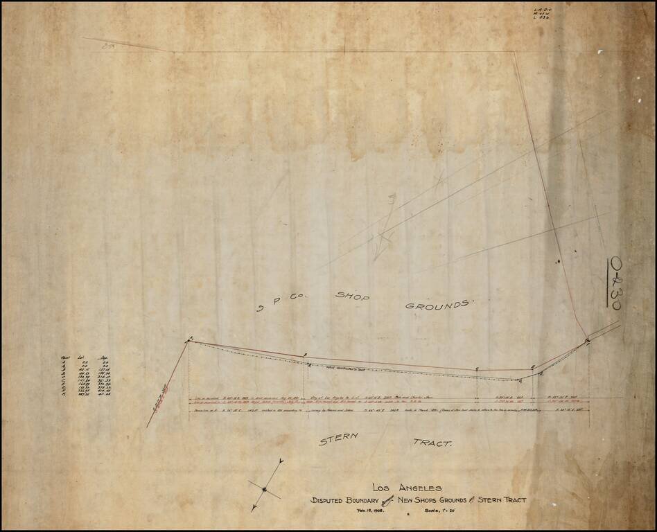
Southern Pacific Railroad Survey showing the boundary between the Stern Tract and the Southern Pacific Shop Ground, in Downtown Los Angeles. Includes the lines surveyed in August 1881, July 1899 and March 1891, the apparent basis for the dispute.