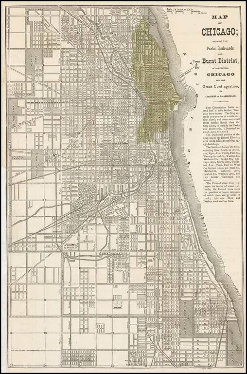
Early map of Chicago issued shortly after the 1871 Fire.
The darkened portion of the map shows the Burned District consisting of 2,124 acres and containing 17,450 buildings.
A scarce map -- this is the first example we have offered....
antiquemaps.ru is sale. 12,000+ superb pieces of vintage collectible printable 300dpi maps - total 300GB high resolution rare and antique old map archive!
antiquemaps.ru website use cookies, local storage and other similar technologies. This is necessary to ensure the full functionality of our services. Using our services and sites after reading this notice means that you have given your consent to their use in your browser. Click "OK" to confirm your agreement