![Map Of Route pursued by U.S. Troops from Fort Smith, Arkansas, To Santa Fe, New Mexico, via south side of Canadian River In the Year 1849 Whilst serving as an Escort to a party of California Emigrants. . . . [bound with:] Map, No 2... [and:] Map, No. 3...](/map/small/70778.jpg)
Along the Canadian River, through the Texas Panhandle, to Santa Fe, New Mexico. Fine four-sheet map of the overland exploration and survey map, undertaken by the United States Troops at the start of the Gold Rush. In 1849, shortly after gold was...
![[New Mexico Territory] Map of the Route pursued by US Troops under the command of Bvt. Lieut. Col. Jno. M. Washington, Governor of New Mexico, in an expedition against the Navajos Indians. . . .1849](/map/small/49761.jpg)
Important early map of parts of New Mexico and Arizona, prepared during the survey explorations and military campaigns in New Mexico and West Texas in 1849. Prepared by Topographical Engineer James H. Simpson and the artist Edward Kern, the map...
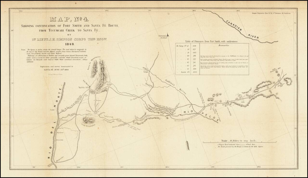
Detailed map of a portion of New Mexico Territory, showing the area east of the Rio Grande to the Canadian River. The map focuses on the roads and rivers in the region and the details surveyed by the exploration party led by James Simpson. Major...