logo

1822. Map and Description of the Principal Mountains &c. Throughout The World

  • Map and Description of the Principal Mountains &c. Throughout The World

Map and Description of the Principal Mountains &c. Throughout The World information:

Year of creation: 
Resolution size (pixels): 
 6666x5391 px
Disk Size: 
 7.20177MiB
Number of pages: 
 1
Place: 
 Philadelphia
Author: 
 Carey Lea

Print information. Print size (Width x height in inches):
Printing at 72 dpi 
  92.58 х 74.88
Printing at 150 dpi 
 44.44 х 35.94
Printing at 300 dpi 
 22.22 х 17.97

An example of detailing the file of this map of in a printable high-resolution:

Click to open in high resolution (open in new tab).
Attention! this is just the central piece (central area 960x960 px) of the map file!
This is an example, so that you can see and study the level of detail of a given map. The entire Map will be fully available after payment!

Map and Description of the Principal Mountains &c. Throughout The World

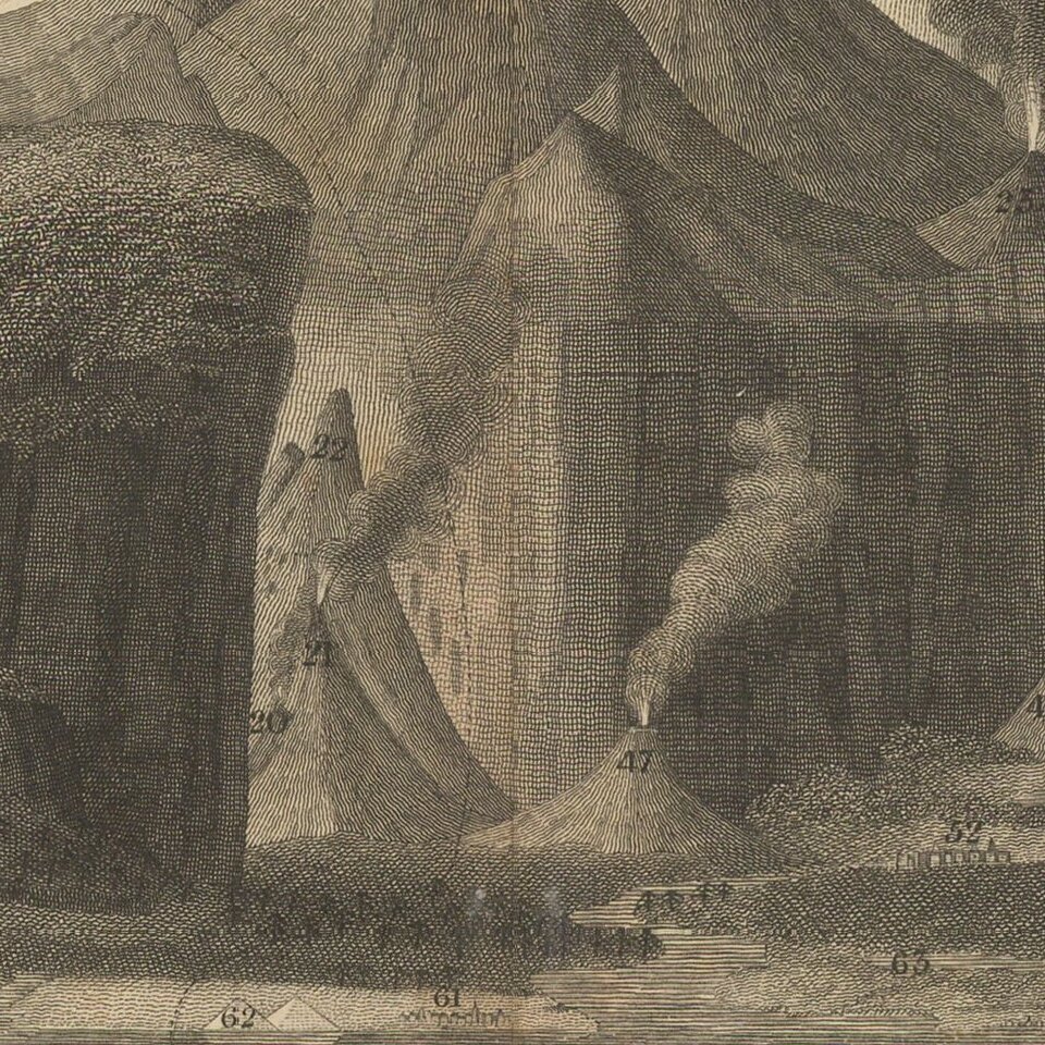
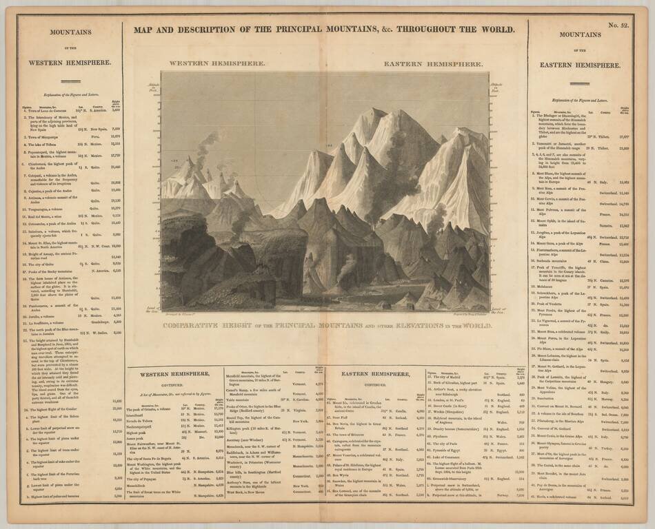
Scarce comparative mountains chart, from Carey & Lea's American Atlas.

This is likely the earliest Mountains chart to appear in an American Atlas. Includes over 100 mountains and elevations, including some volcanoes.


Special conditions for students!

If you are a student, write to us in telegram: @antiquemaps and indicate what material you need and for what work you need a map in high detail. We are ready to provide material on special terms. For students only!

Item information:

Year of creation:
Size:
6666x5391 px
Disk:
7.20177MiB
Number of pages:
1
Place:
Philadelphia
Author:
Carey. Lea.
$14.99

Related item