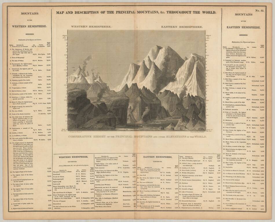
Scarce comparative mountains chart, from Carey & Lea's American Atlas.
This is likely the earliest Mountains chart to appear in an American Atlas. Includes over 100 mountains and elevations, including some volcanoes.
antiquemaps.ru is sale. 12,000+ superb pieces of vintage collectible printable 300dpi maps - total 300GB high resolution rare and antique old map archive!
antiquemaps.ru website use cookies, local storage and other similar technologies. This is necessary to ensure the full functionality of our services. Using our services and sites after reading this notice means that you have given your consent to their use in your browser. Click "OK" to confirm your agreement