Map size in jpg-format: 60.9438MiB
Click to open in high resolution (open in new tab).
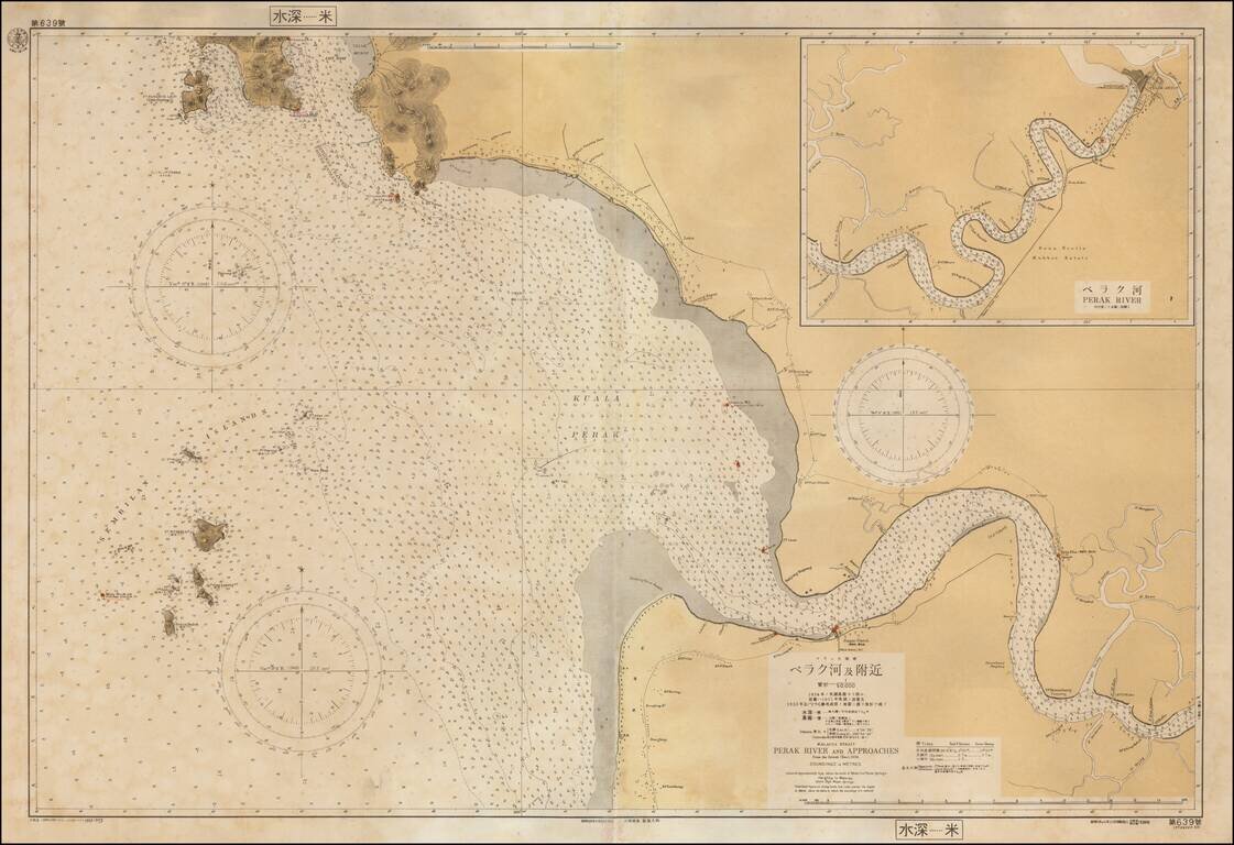
Rare separately issued sea chart of a part of the west coast of Malaysia, published in Japan by the Maritime Safety Agency of Japan, shortly after the Second World War.
The map extends from Pangkor Island to the mouth of the Perak River and then up river to Teluk Intan.
The map indicates that it is drawn from an 1935 British Admiralty Chart.
A very unusual chart -- the first we have ever seen.
If you are a student, write to us in telegram: @antiquemaps and indicate what material you need and for what work you need a map in high detail. We are ready to provide material on special terms. For students only!
![[Signed Political Satire Artwork] Vietnam ... Vietnam ... Vietnam ...](/map/small/68726.jpg)
![[Martin Behaim Globe / Book] Pars Globi terrestris Ao. 1492 a Martino Behaim Equite Lusitano Norimbergae confecti Delineavit Christoph. Theoph de Murr 1778 (bound with:) Diplomatische Geschichte des Portugesischen berühmten Ritters Martin Behaims](/map/small/68828.jpg)
![Il Disegno Della Terza Parte Dell' Asia [Gastaldi's Wall Map of SE Asia with extra panels!]](/map/small/30554hbp.jpg)