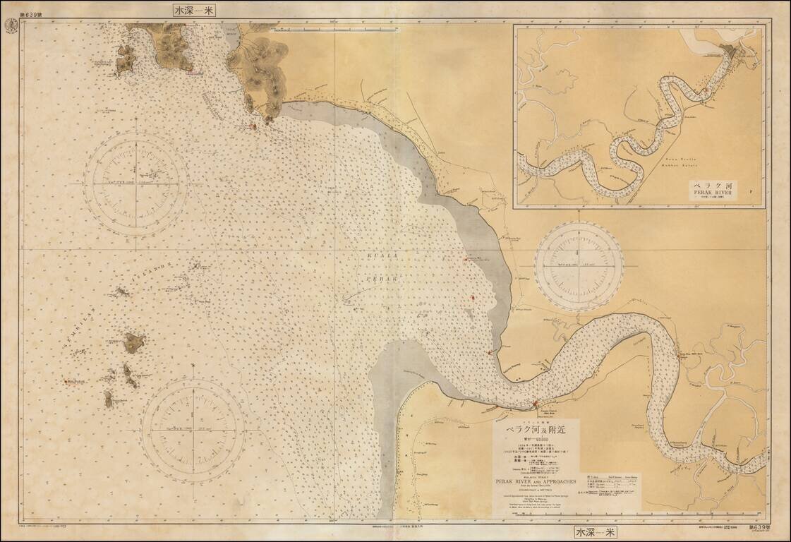
Rare separately issued sea chart of a part of the west coast of Malaysia, published in Japan by the Maritime Safety Agency of Japan, shortly after the Second World War. The map extends from Pangkor Island to the mouth of the Perak River and then up...
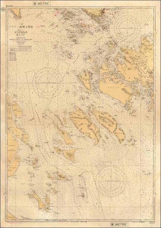
Rare separately issued sea chart of a part of the areas between Singapore Island and the coast of Sumatra, published by the Maritime Safety Agency of Japan shortly after the end of the Second World War. Major islands shown including Batam, Bulan,...